MyTopo
Classic USGS Hazelton Peak Wyoming 7.5'x7.5' Topo Map
Regular price
$16.95
Regular price
Sale price
$16.95
Unit price
per
Couldn't load pickup availability
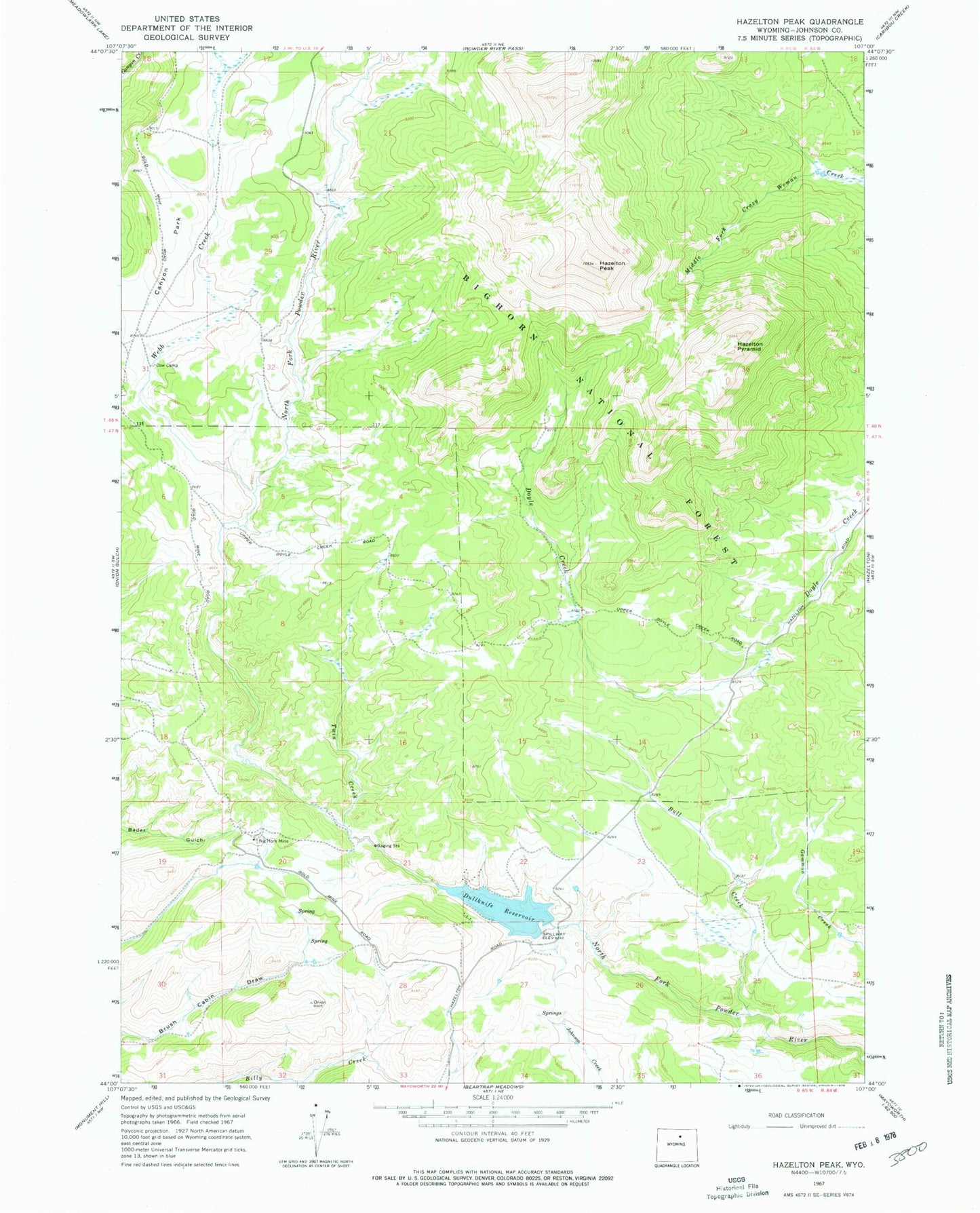
Historical USGS topographic quad map of Hazelton Peak in the state of Wyoming. Map scale may vary for some years, but is generally around 1:24,000. Print size is approximately 24" x 27"
This quadrangle is in the following counties: Johnson.
The map contains contour lines, roads, rivers, towns, and lakes. Printed on high-quality waterproof paper with UV fade-resistant inks, and shipped rolled.
Contains the following named places: Big Horn Mine, Bull Creek, Canyon Park, Dull Knife Dam, Dullknife Reservoir, Hazelton Peak, Hazelton Pyramid, Powder River Mine, Taylor Prospect Mine, Twin Creek, Webb Creek