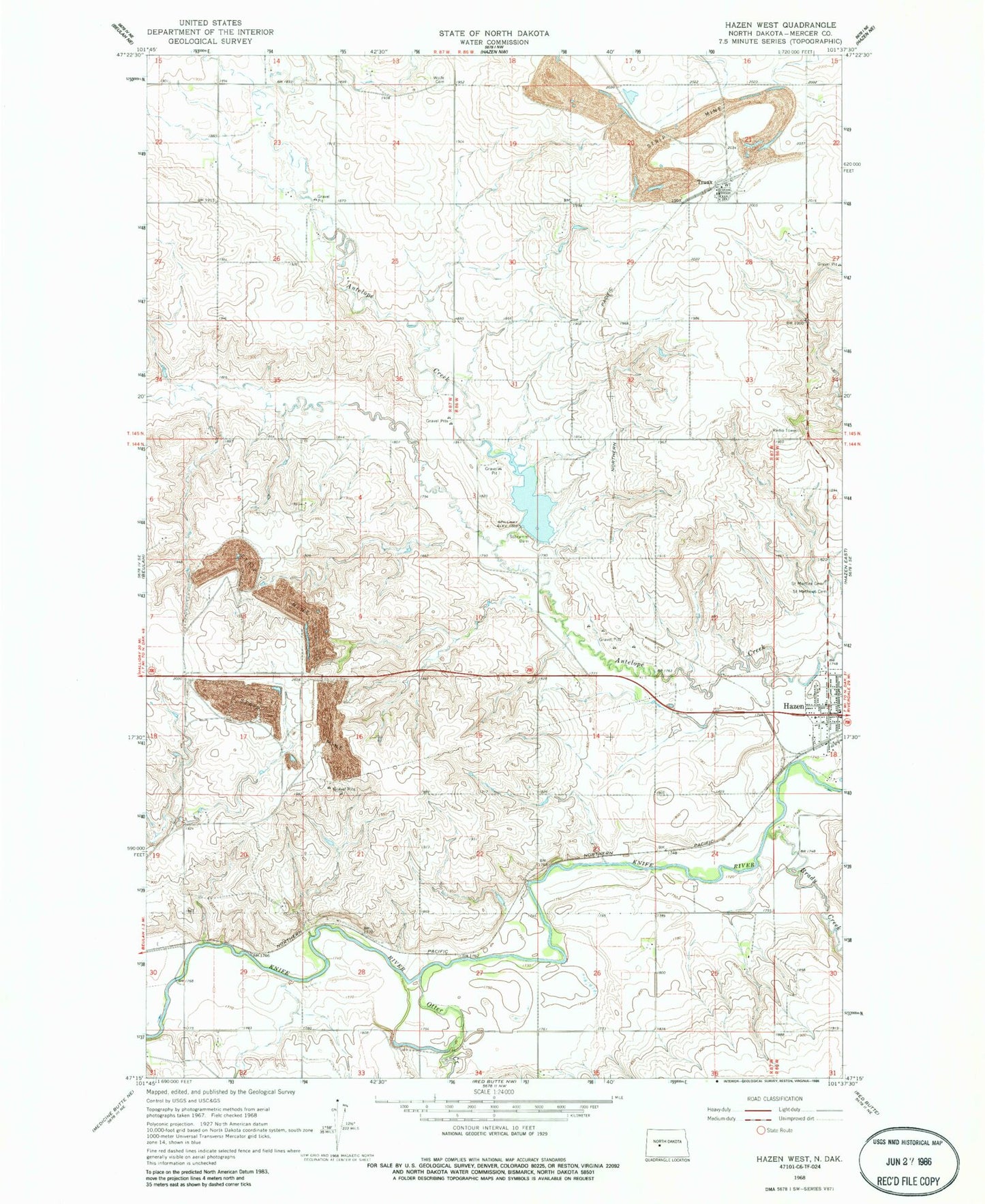
MyTopo
Classic USGS Hazen West North Dakota 7.5'x7.5' Topo Map
Regular price
$16.95
Regular price
Sale price
$16.95
Unit price
per
Couldn't load pickup availability
Historical USGS topographic quad map of Hazen West in the state of North Dakota. Map scale may vary for some years, but is generally around 1:24,000. Print size is approximately 24" x 27"
This quadrangle is in the following counties: Mercer.
The map contains contour lines, roads, rivers, towns, and lakes. Printed on high-quality waterproof paper with UV fade-resistant inks, and shipped rolled.
Contains the following named places: Brady Creek, City of Hazen, Hazen Cemetery, Mercer County Regional Landfill, Otter Creek, Peace Lutheran Cemetery, Saint Martins Cemetery, Saint Matthews Cemetery, Schramm Dam, Truax, West Branch Antelope Creek, Wolfe Cemetery