MyTopo
Classic USGS Hazen Arkansas 7.5'x7.5' Topo Map
Couldn't load pickup availability
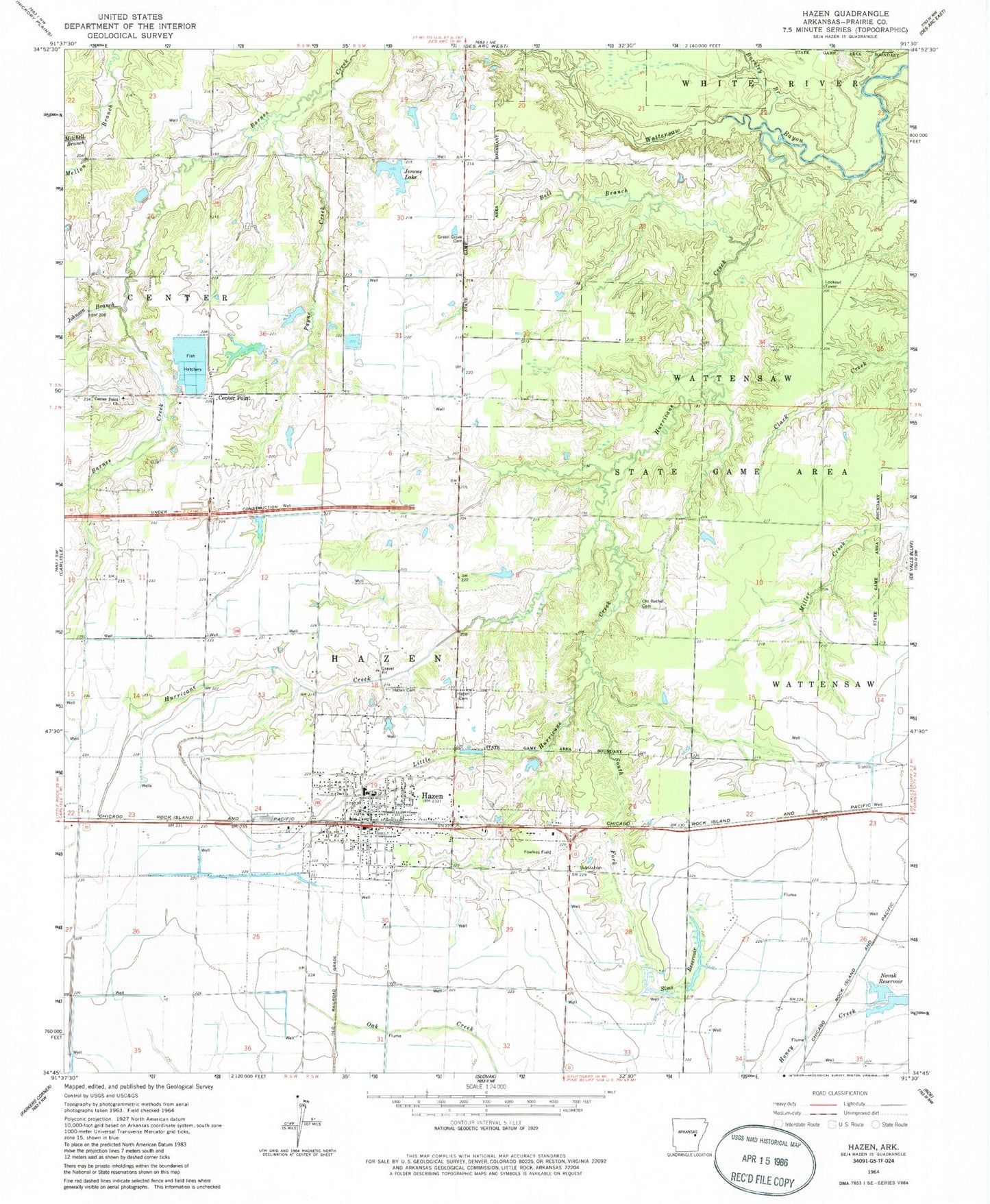
Historical USGS topographic quad map of Hazen in the state of Arkansas. Map scale may vary for some years, but is generally around 1:24,000. Print size is approximately 24" x 27"
This quadrangle is in the following counties: Prairie.
The map contains contour lines, roads, rivers, towns, and lakes. Printed on high-quality waterproof paper with UV fade-resistant inks, and shipped rolled.
Contains the following named places: Arkansas Noname 127 Dam, Barkley Branch, Bell Branch, Center Point, Center Point Church, Center Point School, City of Hazen, Crowley Lake, Crowley Lake Dam, Floyds Reservoir, Fowlkes Field, Green Grove Cemetery, Green Grove Church, Greenwalt Company Airport, Hazen, Hazen Cemetery, Hazen Elementary School, Hazen Heliport, Hazen High School, Hazen Police Department, Hazen Post Office, Hazen Volunteer Fire Department, Hurricane Creek, Jerome Lake, Jerome Lake Dam, Johnson Branch, Little Hurricane Creek, Mitchell Branch, Novak Reservoir, Old Bethel Cemetery, Payne Creek, Pinch Church, Pinch School, Pleasant Point Church, Pleasant Point School, Prairie County, Rogers Chapel, Rogers School, Sims Reservoir, South Fork Little Hurricane Creek, Southern Paramedic Service Hazen, Tarnceville, Thomas, Township of Hazen, Wattensaw State Game Area, ZIP Code: 72064