MyTopo
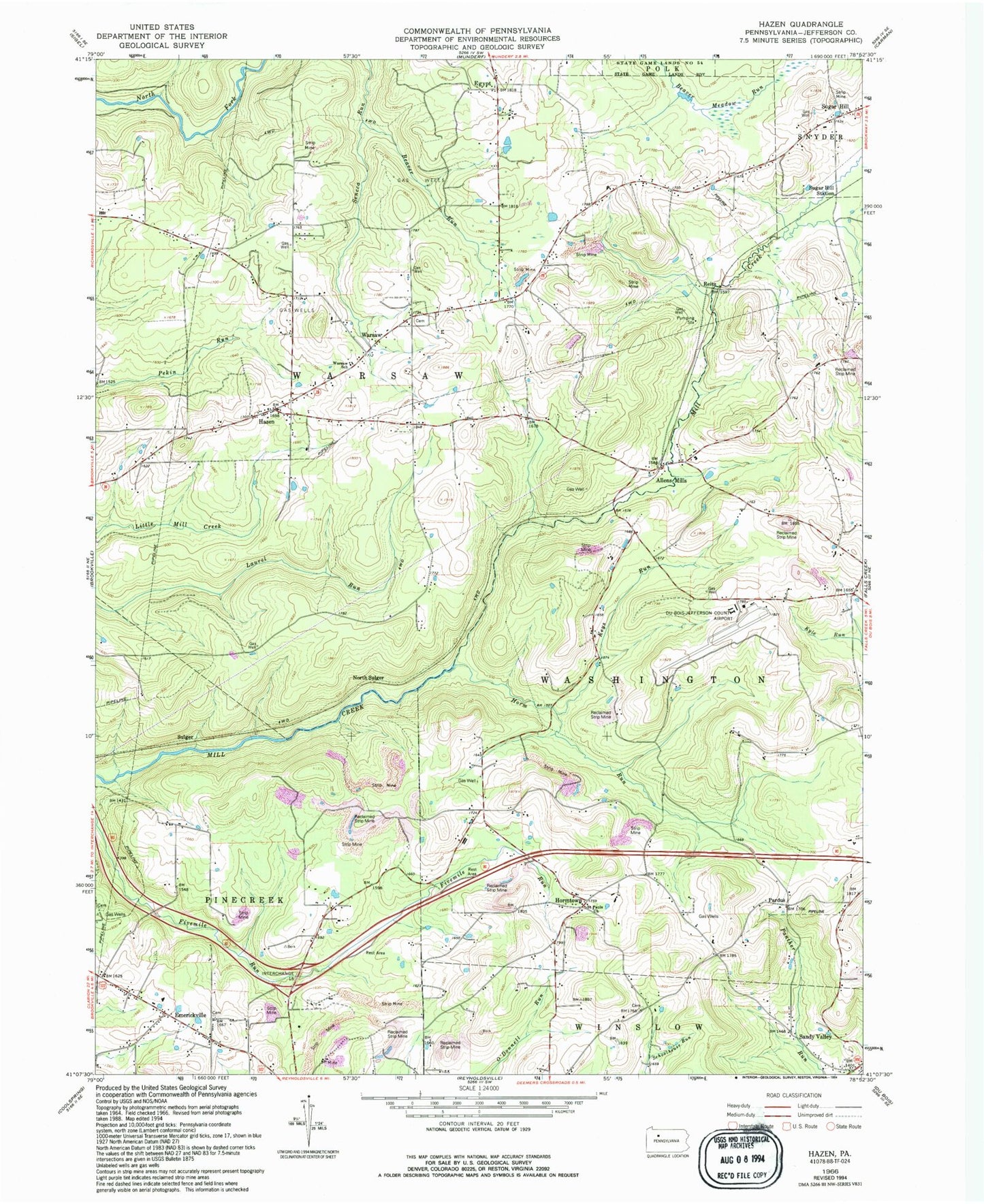
Classic USGS Hazen Pennsylvania 7.5'x7.5' Topo Map
Couldn't load pickup availability
Historical USGS topographic quad map of Hazen in the state of Pennsylvania. Map scale may vary for some years, but is generally around 1:24,000. Print size is approximately 24" x 27"
This quadrangle is in the following counties: Jefferson.
The map contains contour lines, roads, rivers, towns, and lakes. Printed on high-quality waterproof paper with UV fade-resistant inks, and shipped rolled.
Contains the following named places: Allen School, Allen Station, Allens Mills, Beaver Run, Bower School, Britten School, Church of God Cemetery, Dubois Regional Airport, Egypt, Emerickville, Emerickville Lutheran Cemetery, Epworth Cemetery, Hazen, Hazen Amish Community Cemetery, Horm Run, Horm Run School, Hormtown, Jefferson County, Keys Run, Mason School, McAninch School, McIntosh School, Mile Hill School, Morrison School, North Sulger, Pardus, Raught School, Reitz, Saint Pauls Church, Sandy Valley, Sandy Valley Post Office, Smith Cemetery, Snyder School, Sugar Hill, Sugar Hill Station, Sulger, Temple Cemetery, Township of Warsaw, Warsaw, Warsaw School, Warsaw Township Volunteer Fire Company Station 15, Wray School