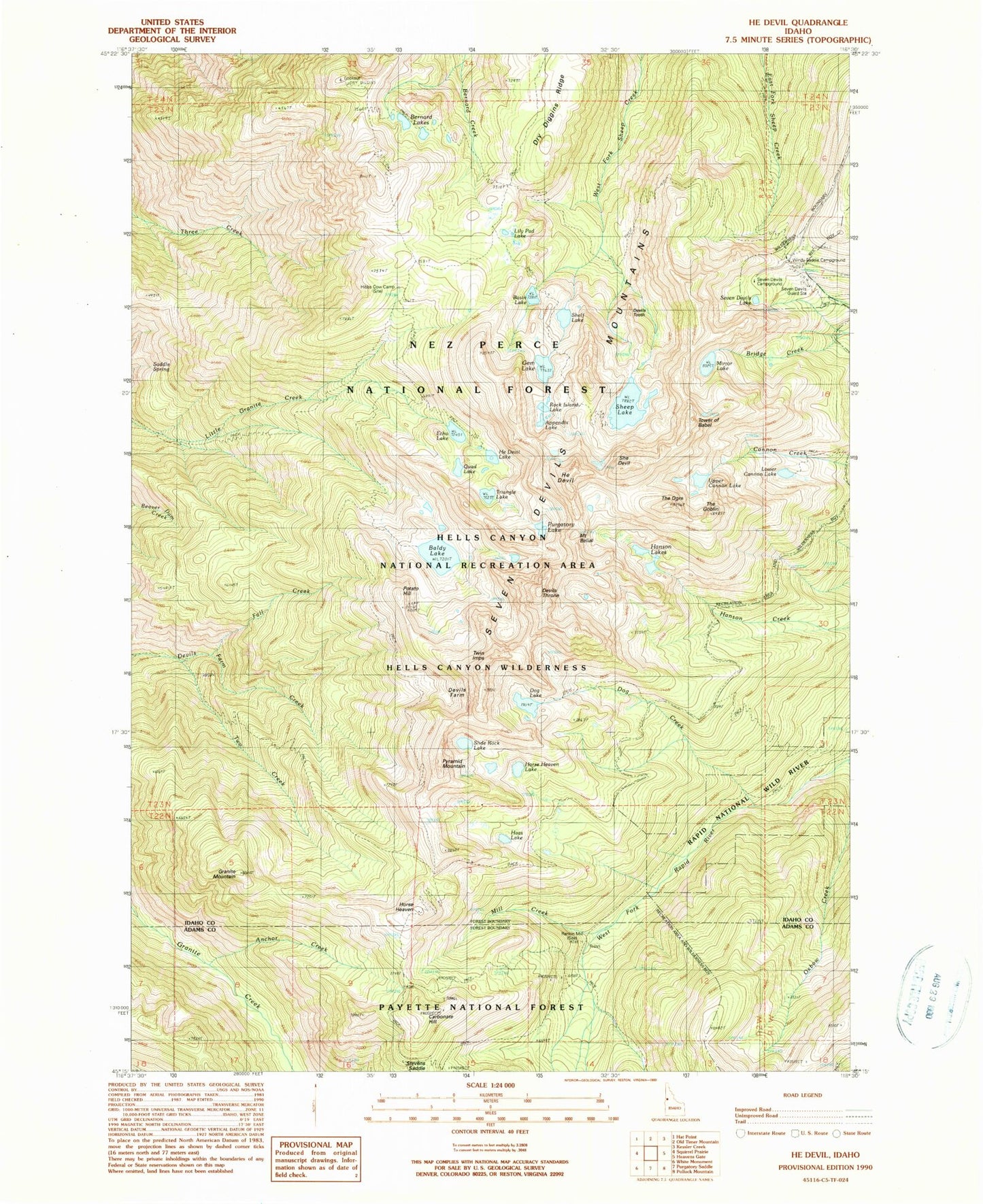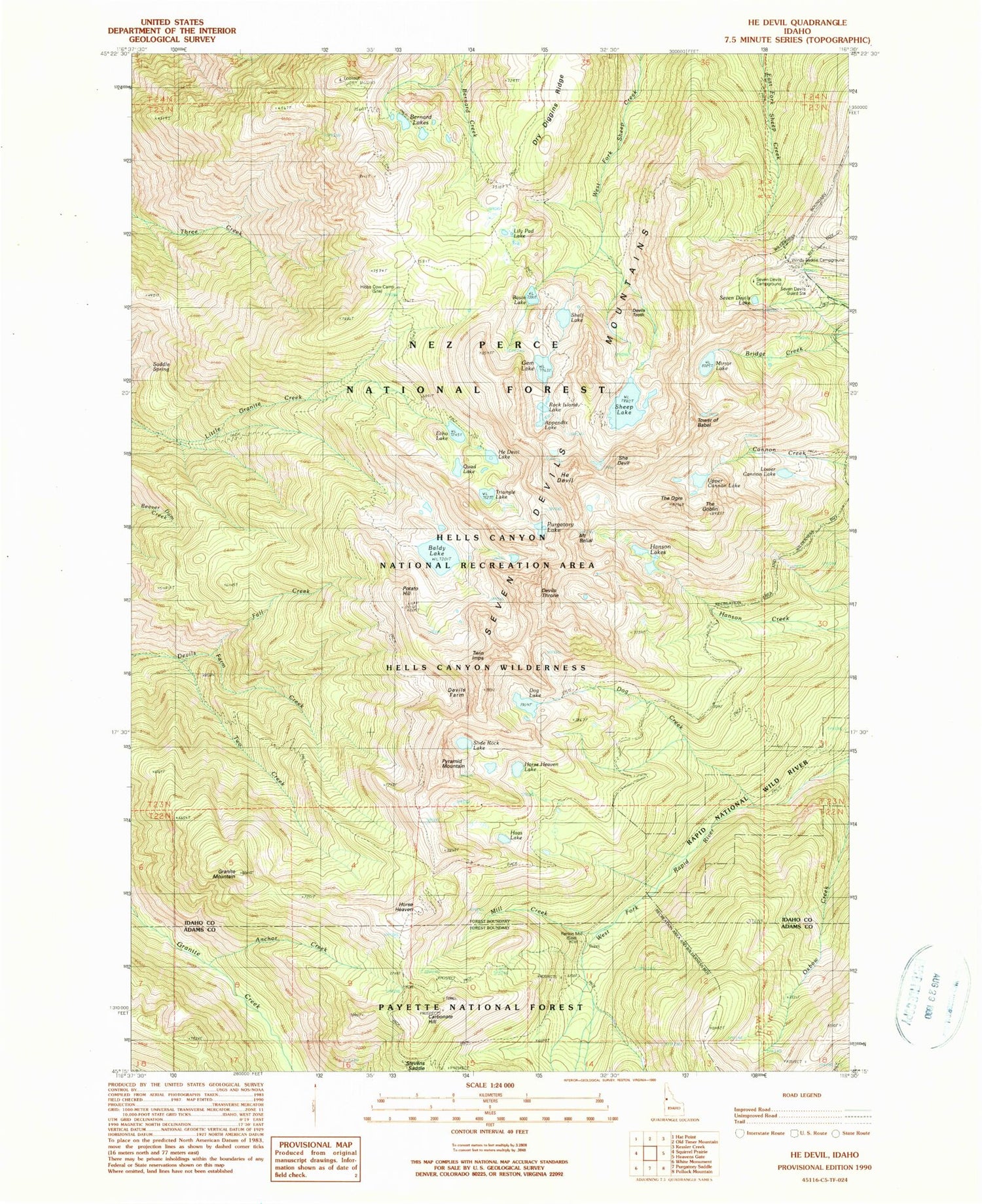
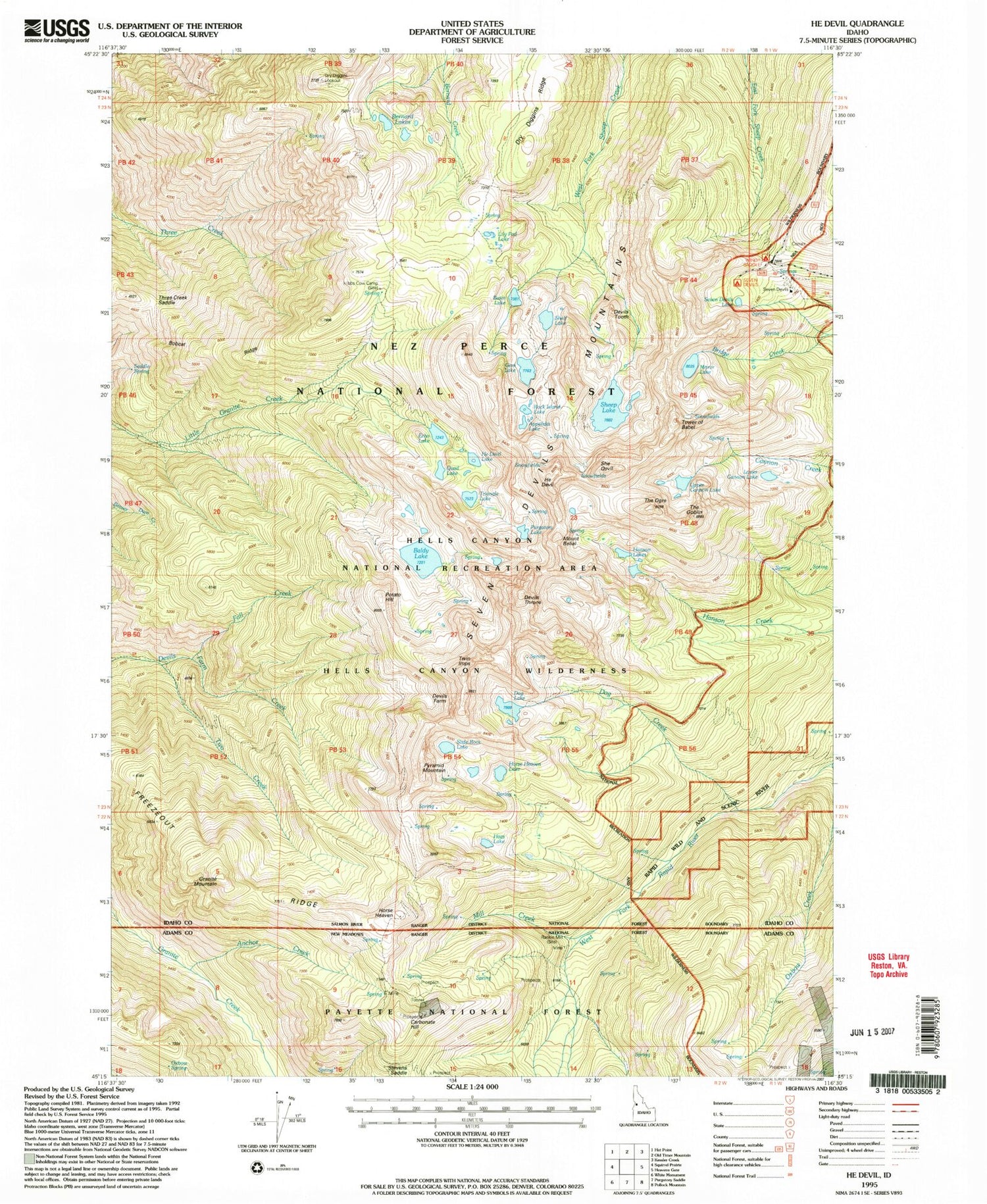
MyTopo
USGS Classic He Devil Idaho 7.5'x7.5' Topo Map
Couldn't load pickup availability
Historical USGS topographic quad map of He Devil in the state of Idaho. Scale: 1:24000. Print size: 24" x 27"
This quadrangle is in the following counties: Adams, Idaho.
The map contains contour lines, roads, rivers, towns, lakes, and grids including latitude / longitude and UTM / MGRS. Printed on high-quality waterproof paper with UV fade-resistant inks.
Contains the following named places: Horse Heaven, Seven Devils Campground, Windy Saddle Campground, Anchor Creek, Appendix Lake, Baldy Lake, Basin Lake, Carbonate Hill, Devils Farm, Dog Creek, Dog Lake, Dry Diggins Lookout, Dry Diggins Ridge, Echo Lake, Fall Creek, Gem Lake, Granite Mountain, Haas Lake, Hanson Lakes, He Devil, He Devil Lake, Heavens Gate Trail (historical), Hibbs Cow Camp, Horse Heaven Lake, Lily Pad Lake, Mill Creek, Mirror Lake, Old Boise Trail, Oxbow Creek, Oxbow Spring, Potato Hill, Quad Lake, Rock Island Lake, Saddle Spring, Seven Devils Lake, Seven Devils Mountains, Sheep Lake, Shelf Lake, Slide Rock Lake, Stevens Saddle, Triangle Lake, Two Creek, Tower of Babel, Devils Tooth, Rankin Mill, Seven Devils Guard Station, Pyramid Mountain, She Devil, Twin Imps, The Goblin, Devils Throne, Mount Belial, Purgatory Lake, Lower Cannon Lake, Upper Cannon Lake, Seven Devils Recreation Site, The Ogre, Bobcat Ridge, Freezeout Ridge