MyTopo
Classic USGS Head Spur Utah 7.5'x7.5' Topo Map
Regular price
$16.95
Regular price
Sale price
$16.95
Unit price
per
Couldn't load pickup availability
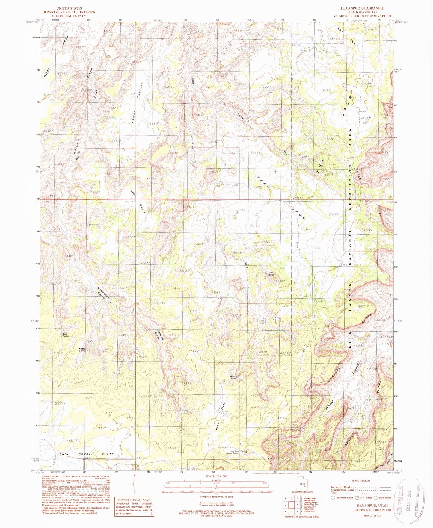
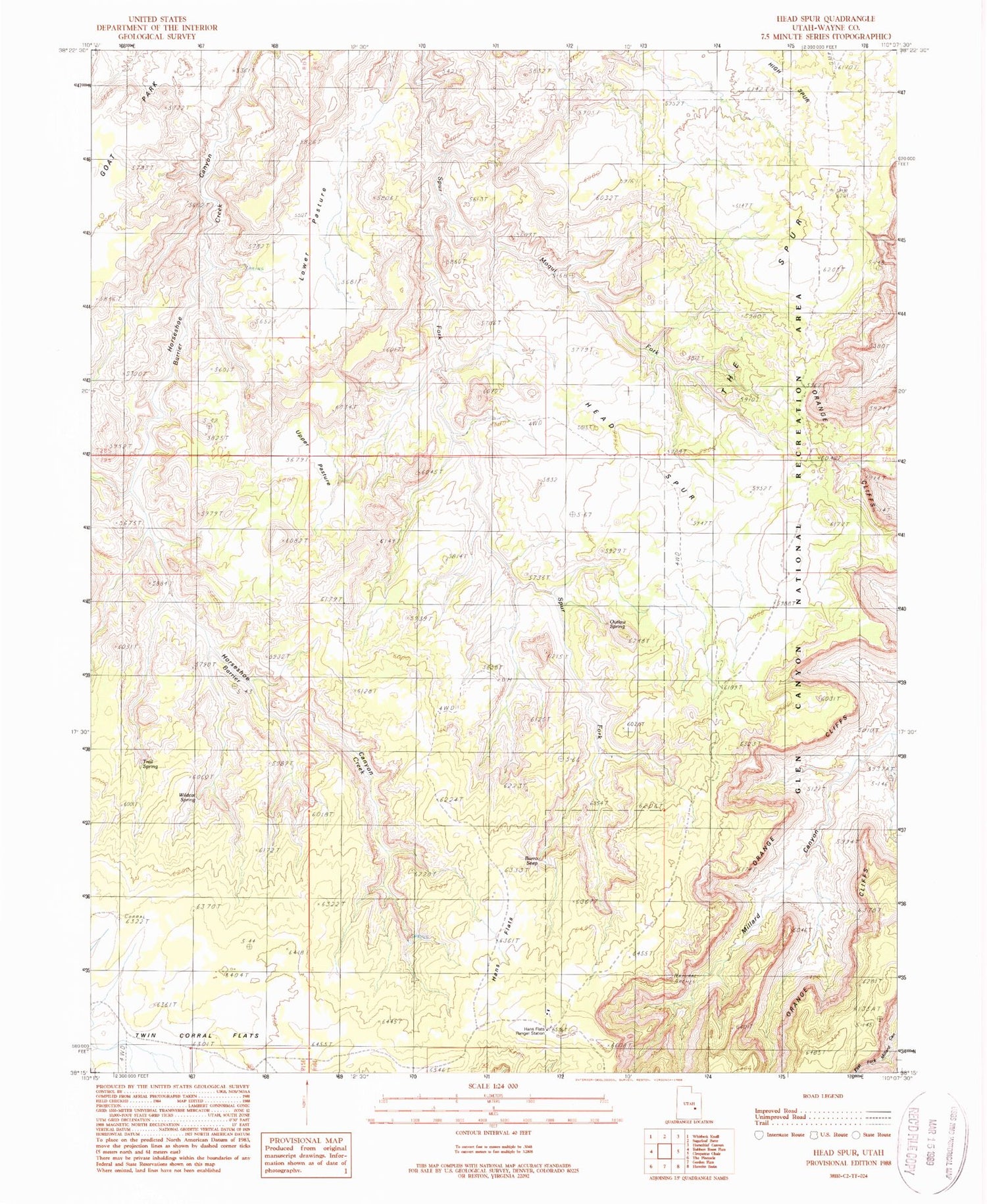
Historical USGS topographic quad map of Head Spur in the state of Utah. Typical map scale is 1:24,000, but may vary for certain years, if available. Print size: 24" x 27"
This quadrangle is in the following counties: Wayne.
The map contains contour lines, roads, rivers, towns, and lakes. Printed on high-quality waterproof paper with UV fade-resistant inks, and shipped rolled.
Contains the following named places: Burro Seep, Hans Flats, Head Spur, High Spur, Lower Pasture, Moqui Fork, Orange Cliffs, Outlaw Spring, The Spur, Trail Spring, Upper Pasture, Wildcat Spring, Natural Arch, Hans Flats Ranger Station, Millard Canyon Overlook