MyTopo
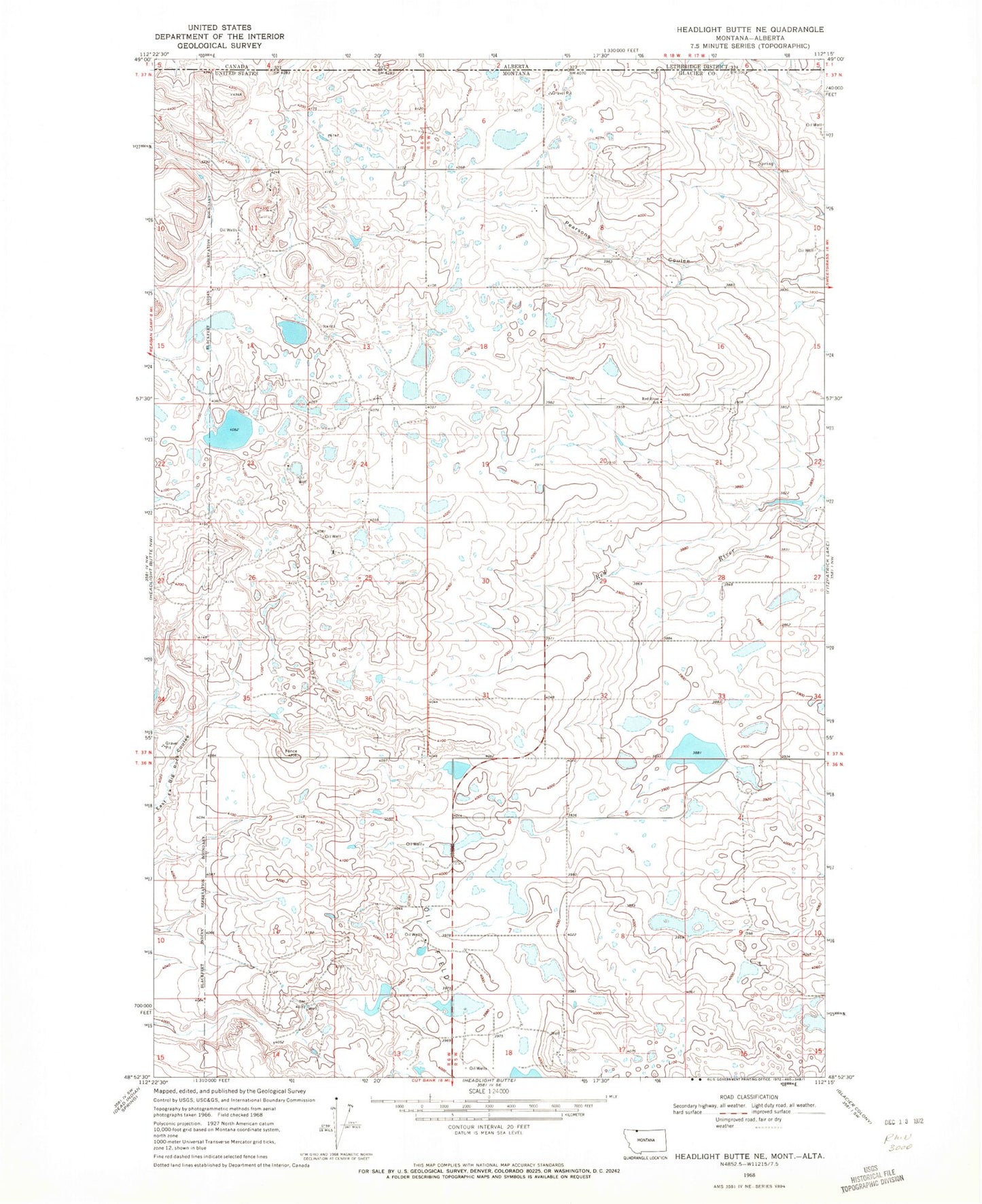
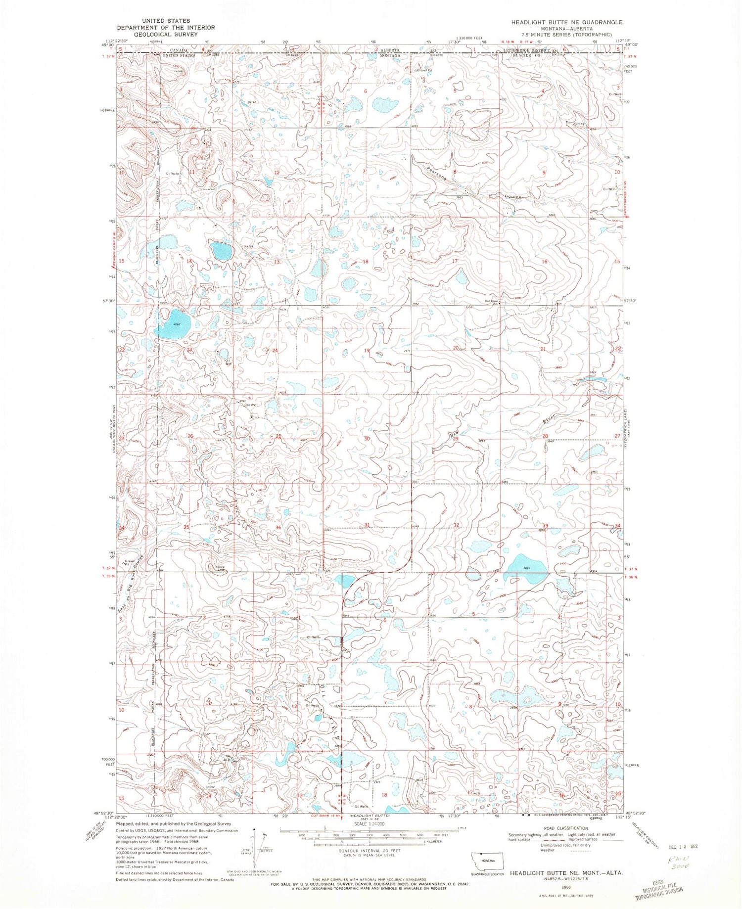
Classic USGS Headlight Butte NE Montana 7.5'x7.5' Topo Map
Couldn't load pickup availability
Historical USGS topographic quad map of Headlight Butte NE in the state of Montana. Map scale may vary for some years, but is generally around 1:24,000. Print size is approximately 24" x 27"
This quadrangle is in the following counties: Glacier.
The map contains contour lines, roads, rivers, towns, and lakes. Printed on high-quality waterproof paper with UV fade-resistant inks, and shipped rolled.
Contains the following named places: 36N05W04AB__01 Well, 36N05W04DB__01 Well, 36N05W09BC__01 Well, 36N05W17BA__01 Well, 36N06W02DA__01 Well, 36N06W12AC__01 Well, 36N06W12BC__01 Well, 36N06W13AA__01 Well, 36N06W14BA__01 Well, 37N05W06CB__01 Well, 37N05W07AD__01 Well, 37N05W08DD__01 Well, 37N05W19DA__01 Well, 37N05W20DC__01 Well, 37N05W21AB__01 Well, 37N05W29DD__01 Well, 37N05W30DD__01 Well, 37N06W01CB__01 Well, 37N06W03DA__01 Well, 37N06W24AB__01 Well, 37N06W24CD__01 Well, 37N06W24CD__02 Well, 37N06W26AC__01 Well, 37N06W35CB__01 Well, 37N06W36DD__01 Well, Korner, Korner Post Office, Lukins Lake, Red River School, Tsadi Dam, Upsilon Dam, Vasboe Dam