MyTopo
Classic USGS Heafer Arkansas 7.5'x7.5' Topo Map
Couldn't load pickup availability
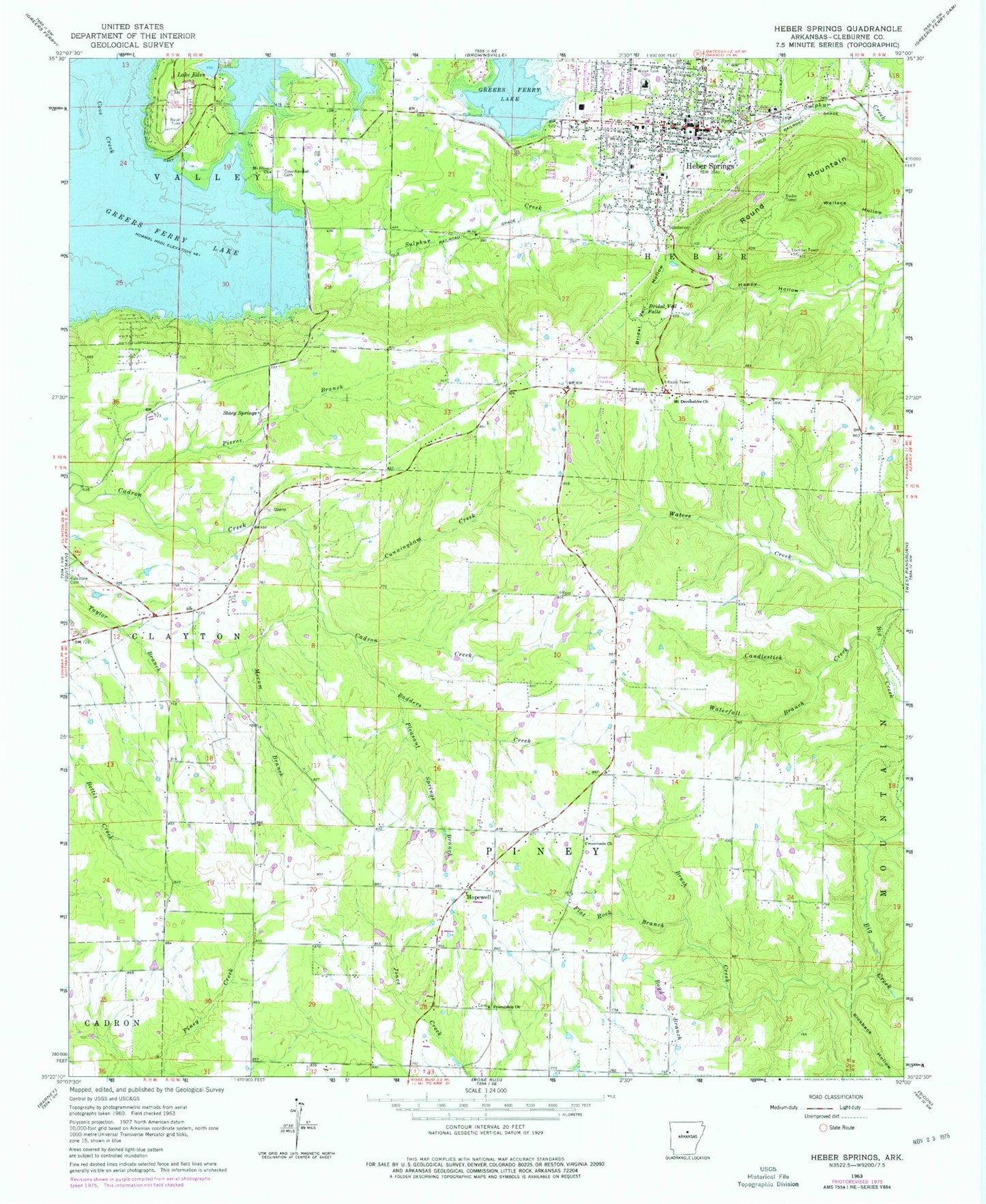
Historical USGS topographic quad map of Heafer in the state of Arkansas. Map scale may vary for some years, but is generally around 1:24,000. Print size is approximately 24" x 27"
This quadrangle is in the following counties: Crittenden.
The map contains contour lines, roads, rivers, towns, and lakes. Printed on high-quality waterproof paper with UV fade-resistant inks, and shipped rolled.
Contains the following named places: Abston Wynne School, Bell School, Benwood Lake, Billow Cemetery, Booker, Booker Cemetery, Booker School, Brown Cemetery, Butler Church, Carruth School, Cruse Cemetery, Deer Bayou, Ditch Number 1, Ditch Number 10, Ditch Number 11, Ditch Number 2, Ditch Number 21, Ditch Number 32, Ditch Number 4, Ditch Number 6, Ditch Number 7, Ditch Number 8, East Black Oak, Galilee Church, Heafer, Heafer East Black Oak Volunteer Fire Department, Lencross Church, Macedonia Church, Mount Vernon Church, New Bethel Church, New Bethlehem Church, New Bethlehem School, New Mount Pisgah Church, Patterson School, Philadelphia Church, Saint Pauls Cemetery, Saint Pauls Church, Township of Wappanocca, Turrell Post Office, Turrell Volunteer Fire Department, United States Fish and Wildlife Wapanocca National Wildlife Refuge Park Security, Walnut Grove Cemetery, Walnut Grove Church