MyTopo
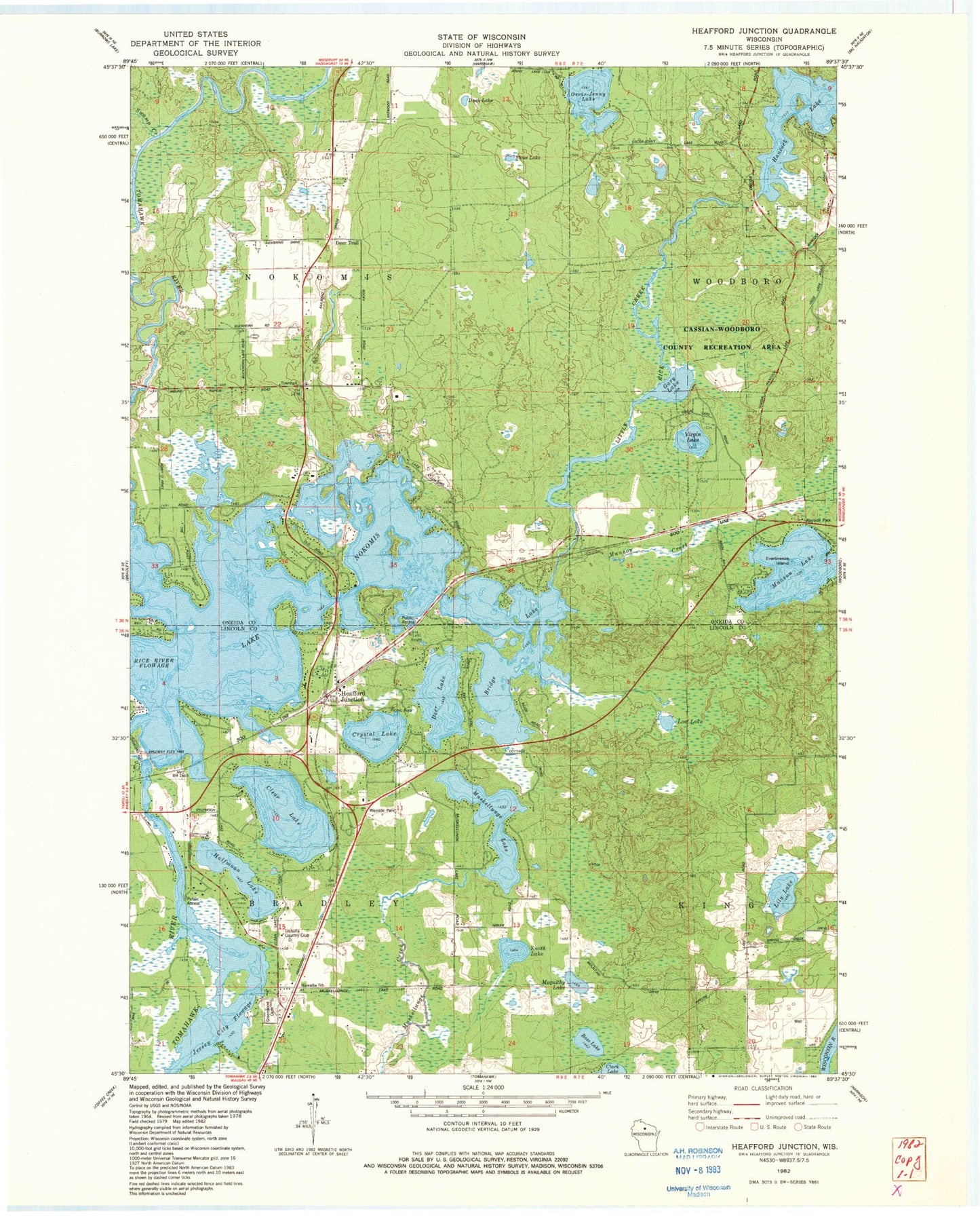
Classic USGS Heafford Junction Wisconsin 7.5'x7.5' Topo Map
Couldn't load pickup availability
Historical USGS topographic quad map of Heafford Junction in the state of Wisconsin. Typical map scale is 1:24,000, but may vary for certain years, if available. Print size: 24" x 27"
This quadrangle is in the following counties: Lincoln, Oneida.
The map contains contour lines, roads, rivers, towns, and lakes. Printed on high-quality waterproof paper with UV fade-resistant inks, and shipped rolled.
Contains the following named places: Bass Lake, Bridge Lake, Crystal Lake, Deer Lake, Deer Trail, Duck Lake, Everbreeze Island, Gary Lake, Greenwood Cemetery, Heafford Junction, Hiawatha School, Jersey City Flowage, Lily Lake, Lost Lake, Manson Lake, Mequithy Lake, Muskellunge Lake, Nokomis School (historical), Lake Nokomis, Oscar-Jenny Lake, Rice Creek, Smith Lake, Stone Lake, Swamp Creek, Virgin Lake, Clear Lake, Halfmoon Lake, Hancock Lake, Town of Nokomis, Hancock Lake Dam, Hancock Lake 22, Rice 1907C335 Dam, Inshalla Country Club, Manson Creek, Nokomis Townhall, Lily Lake School (historical), Manson (historical), Pinewood School (historical), Turner Airport, Nokomis Volunteer Fire Department Station 2, Nokomis Volunteer Fire Department