
MyTopo
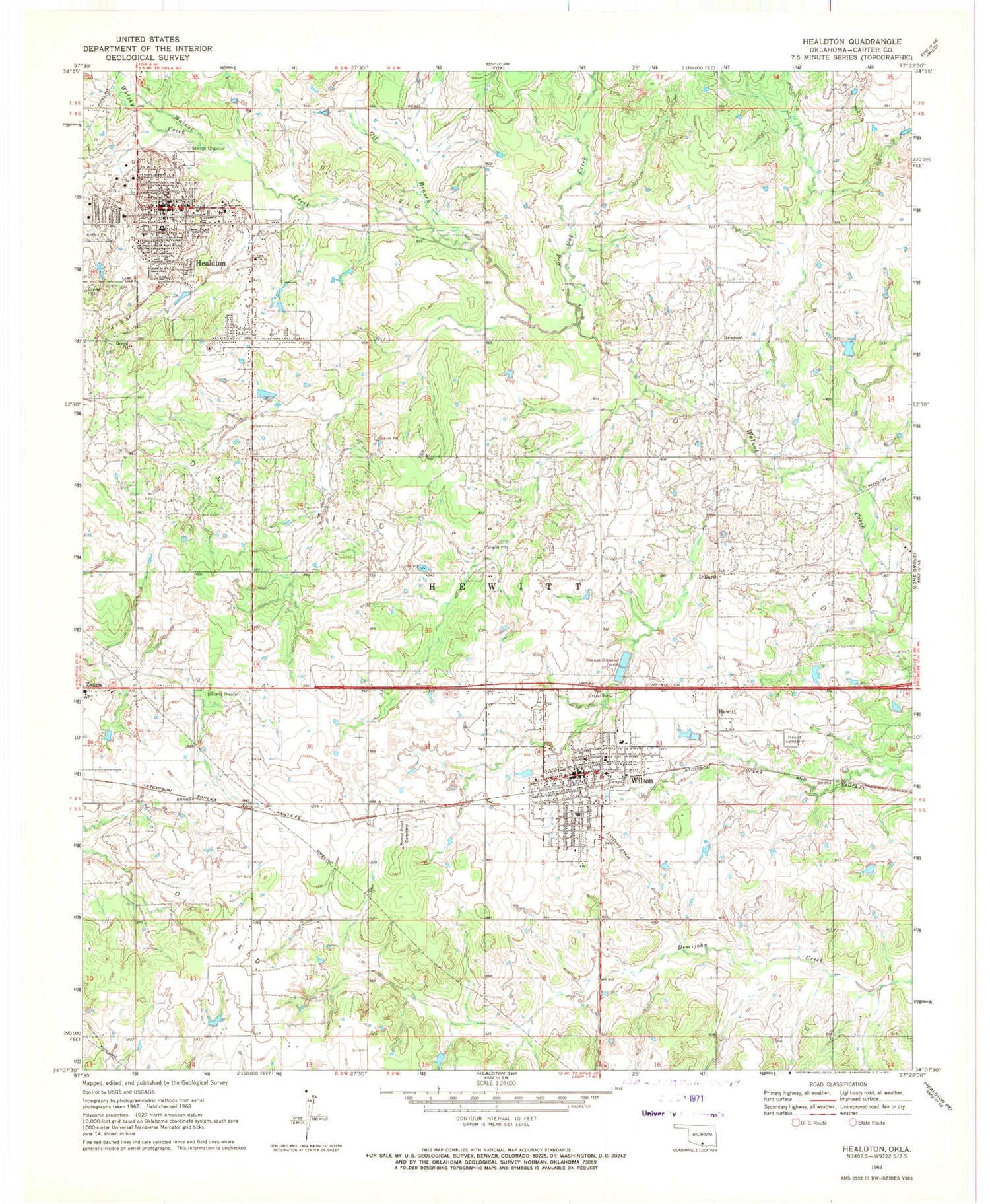
Classic USGS Healdton Oklahoma 7.5'x7.5' Topo Map
Couldn't load pickup availability
Historical USGS topographic quad map of Healdton in the state of Oklahoma. Map scale may vary for some years, but is generally around 1:24,000. Print size is approximately 24" x 27"
This quadrangle is in the following counties: Carter.
The map contains contour lines, roads, rivers, towns, and lakes. Printed on high-quality waterproof paper with UV fade-resistant inks, and shipped rolled.
Contains the following named places: Anthis Park, Bailey Cemetery, Bethel Baptist Church, Bomar Point Cemetery, Carter County Sheriff's Office, Church of Christ, City of Healdton, City of Wilson, Cockwell Airport, Dillard, Dillard Volunteer Fire Department, First Baptist Church, First Baptist Church-Healdton, First United Methodist Church, Healdton, Healdton Assembly of God Church, Healdton Elementary School, Healdton Fire Department Storage, Healdton High School, Healdton Lake, Healdton Middle School, Healdton Municipal Hospital, Healdton Police Department, Healdton Post Office, Healdton Volunteer Fire Department, Hewitt, Hewitt Cemetery, Jehovah Witnesses Church, Mount Olive Cemetery, Oil Branch, Red Oak Creek, Rexroat, Southern Oklahoma Ambulance Service, Township of Hewitt, Upper Bayou Site 10 Dam, Upper Bayou Site 10 Reservoir, Upper Bayou Site 17 Dam, Upper Bayou Site 17 Reservoir, Upper Bayou Site 18 Dam, Upper Bayou Site 18 Reservoir, Upper Bayou Site 8 Dam, Upper Bayou Site 8 Reservoir, Whisky Creek, Wilson, Wilson Division, Wilson Elementary School, Wilson Fire Department, Wilson High School, Wilson Police Department, Wilson Post Office, Zaneis


