MyTopo
Classic USGS Heath Springs South Carolina 7.5'x7.5' Topo Map
Couldn't load pickup availability
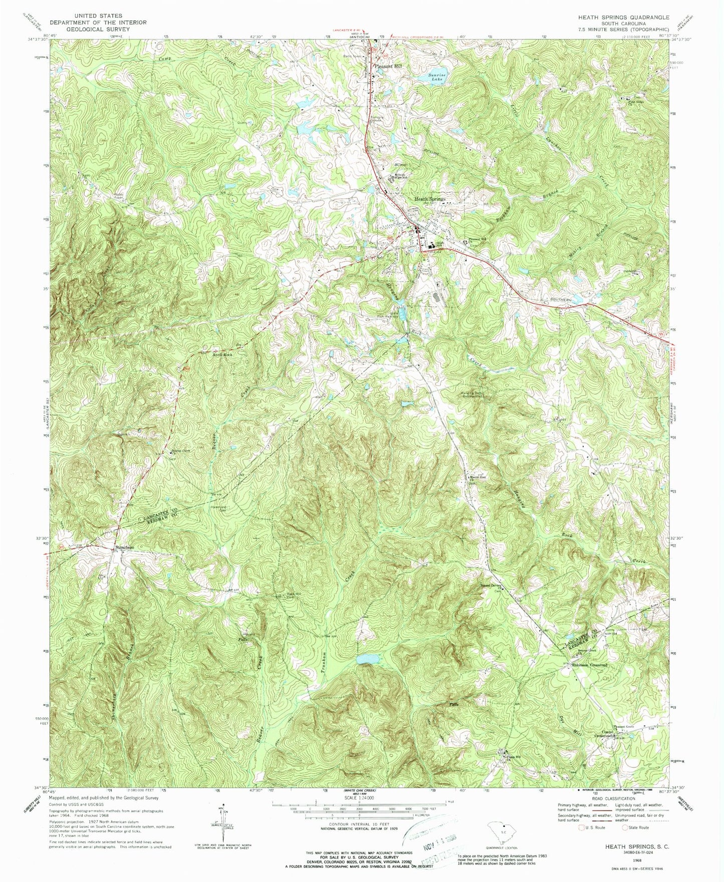
Historical USGS topographic quad map of Heath Springs in the state of South Carolina. Map scale may vary for some years, but is generally around 1:24,000. Print size is approximately 24" x 27"
This quadrangle is in the following counties: Kershaw, Lancaster.
The map contains contour lines, roads, rivers, towns, and lakes. Printed on high-quality waterproof paper with UV fade-resistant inks, and shipped rolled.
Contains the following named places: Anvil Rock, Beaver Creek Cemetery, Beaver Creek Church, Beckham Branch, Brewer Gully, Brewers Pond Dam D-1752, Bridges Pond Dam D-1773, Cedar Falls, Coats Crossroad, Dye Mill Branch, Flint Ridge Church, Flint Ridge School, Hammond Cemetery, Hanging Rock, Hanging Rock Battleground, Heath Springs, Heath Springs Baptist Church, Heath Springs City Hall, Heath Springs Division, Heath Springs Fire Department Station 9, Heath Springs High School, Heath Springs Post Office, Hillside High School, Honkers Lake Dam D-3183, Little Lynches Creek, Mobley Branch, Mobley Cemetery, Mount Zion Church, Oak Ridge School, Oakhurst, Oakhurst Church, Oakhurst School, Pleasant Grove Church, Pleasant Grove School, Pleasant Hill, Pleasant Hill Church, Pleasant Hill Fire Department Station 13, Pool J, Pool J Dam D-3182, Robinson Crossroad, Rock Hill Cemetery, Rock Hill Church, Salem United Methodist Church, Second Calvary Church, South Carolina Noname 29002 D-1774 Dam, Springs-Stevens State Fish Hatchery, Stoneboro, Stoneboro School, Sunrise Lake, Thorn Hill Church, Town of Heath Springs, Tranham Creek, ZIP Code: 29058