

MyTopo
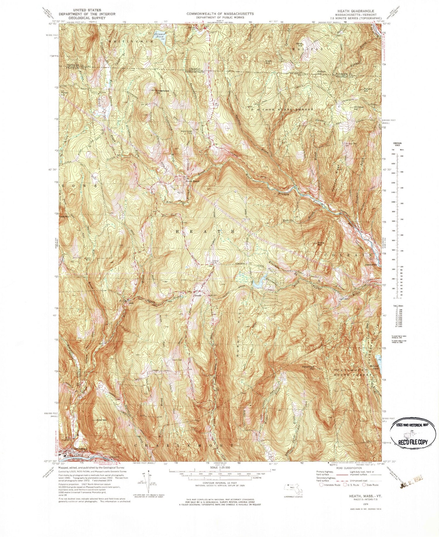
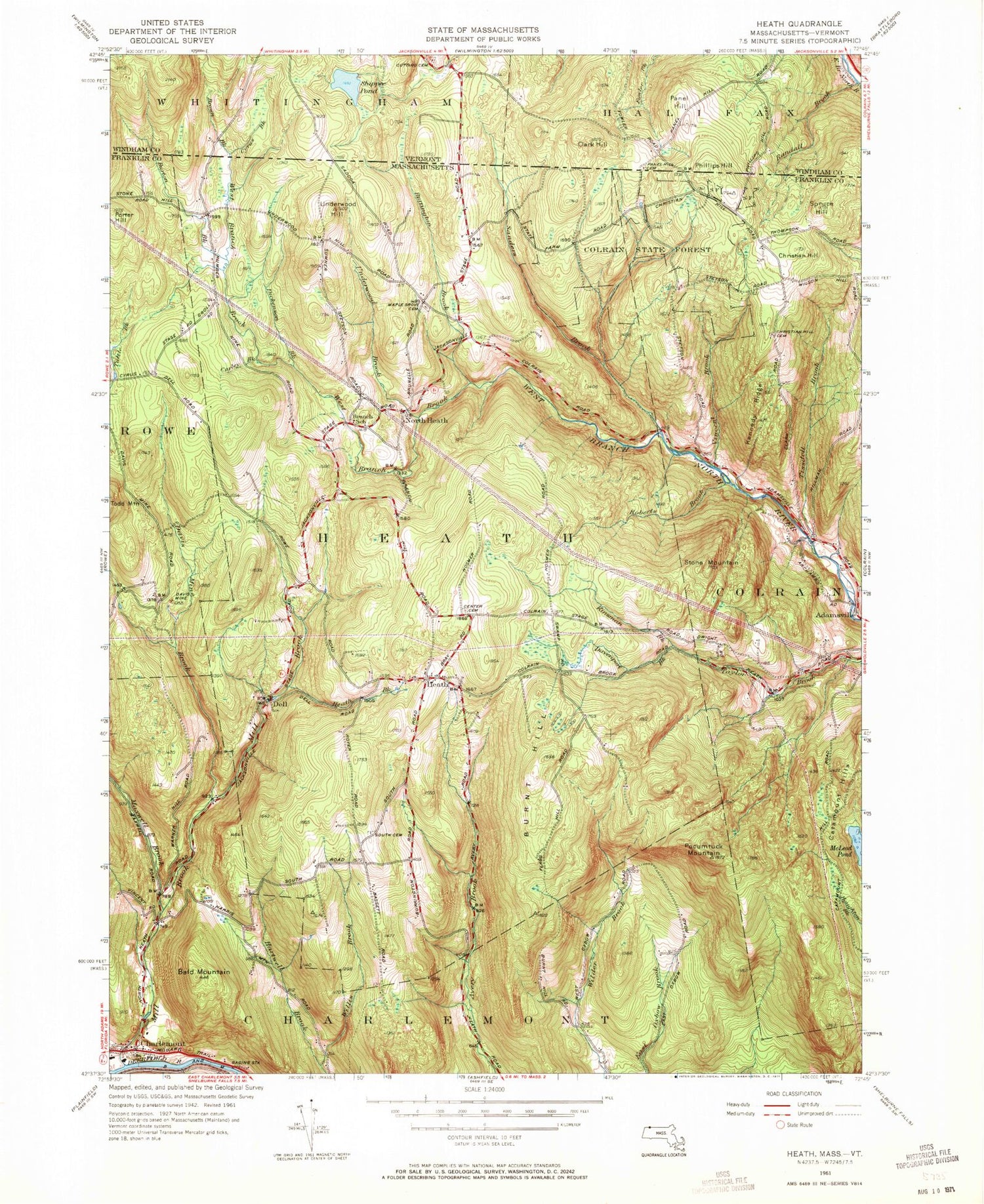
Classic USGS Heath Massachusetts 7.5'x7.5' Topo Map
Couldn't load pickup availability
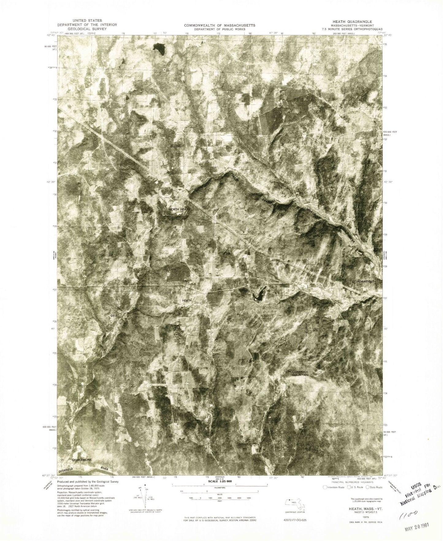
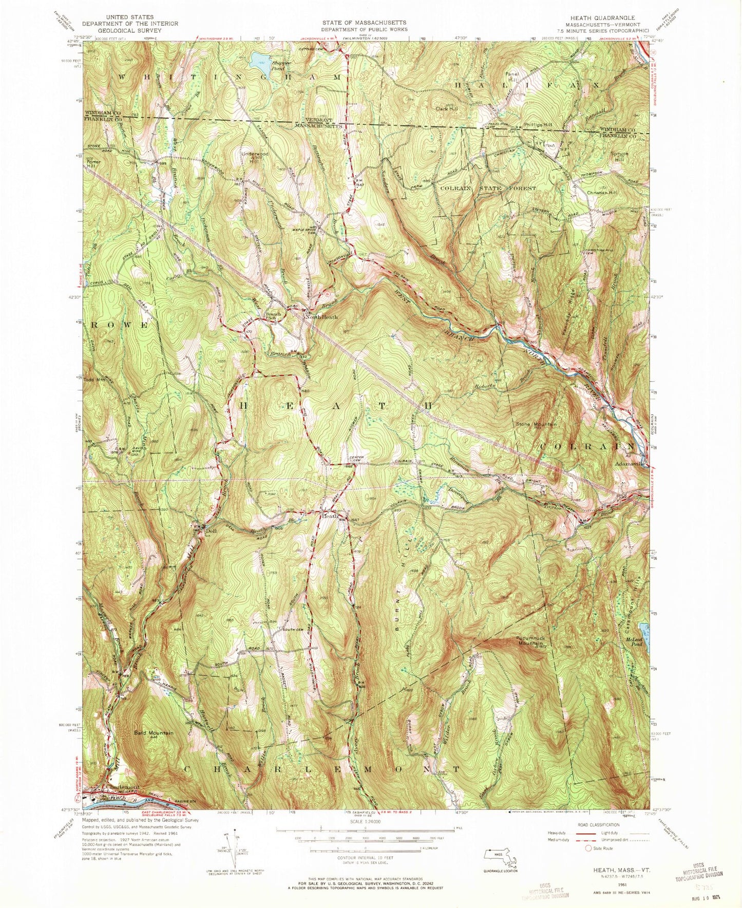
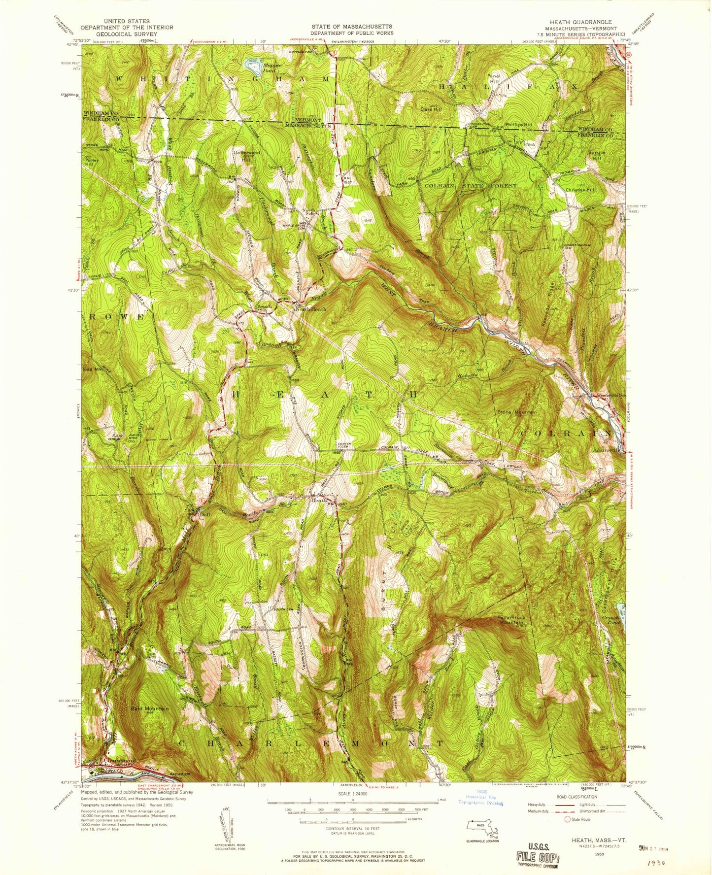
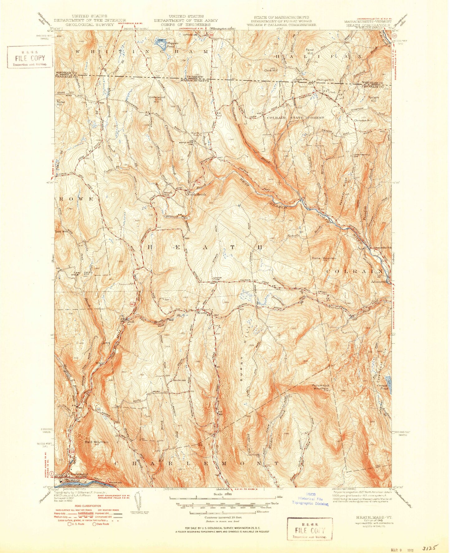
Historical USGS topographic quad map of Heath in the states of Massachusetts, Vermont. Typical map scale is 1:24,000, but may vary for certain years, if available. Print size: 24" x 27"
This quadrangle is in the following counties: Franklin, Windham.
The map contains contour lines, roads, rivers, towns, and lakes. Printed on high-quality waterproof paper with UV fade-resistant inks, and shipped rolled.
Contains the following named places: H O Cook State Forest, Maple Grove Cemetery, Catamount State Forest, Cristian Hill Cemetery, Sanderson Academy, Bissell Covered Bridge, South Cemetery, Mill Brook Reservoir, Mohawk Beach Estates Dam, Center Cemetery, Davis Mine, Davenport Brook Reservoir, J A Wells Upper Dam, Bald Mountain, Burnt Hill, Burrington Brook, Burton Brook, Carley Brook, Charlemont, Creamery Brook, Davenport Brook, Davis Mine Brook, Dell, Dickenson Brook, Heath, Heath Brook, Kennedy Ridge, Kinsman Brook, Maxwell Brook, Mill Brook, North Heath, Phillips Hill, Pocumtuck Mountain, Porter Hill, Roberts Brook, Sanders Brook, Spruce Hill, Stone Mountain, Tissdell Brook, Underwood Brook, Underwood Hill, Vincent Brook, Wheatherby Brook, Willis Brook, Christian Hill, Town of Heath, Fort Shirley (historical), Davis Post Office (historical), West Branch Brook, Town of Charlemont, Hawlemont Regional Elementary School, Heath Post Office, Heath Fire Department, Charlemont Fire Department, Village Cemetery, Heath Police Department, Brown Brook, Burton Brook, Clark Hill, Cutting Cemetery, Cyrus Brook, Panel Hill, Panel Hill Cemetery, Randall Brook, Shippee Pond, Shippee Pond Dam, H O Cook State Forest, Maple Grove Cemetery, Catamount State Forest, Cristian Hill Cemetery, Sanderson Academy, Bissell Covered Bridge, South Cemetery, Mill Brook Reservoir, Mohawk Beach Estates Dam, Center Cemetery, Davis Mine, Davenport Brook Reservoir, J A Wells Upper Dam, Bald Mountain, Burnt Hill, Burrington Brook, Burton Brook, Carley Brook, Charlemont, Creamery Brook, Davenport Brook, Davis Mine Brook, Dell, Dickenson Brook, Heath, Heath Brook, Kennedy Ridge, Kinsman Brook, Maxwell Brook, Mill Brook, North Heath, Phillips Hill, Pocumtuck Mountain, Porter Hill, Roberts Brook, Sanders Brook, Spruce Hill, Stone Mountain, Tissdell Brook, Underwood Brook, Underwood Hill, Vincent Brook, Wheatherby Brook, Willis Brook, Christian Hill, Town of Heath, Fort Shirley (historical), Davis Post Office (historical), West Branch Brook, Town of Charlemont, Hawlemont Regional Elementary School, Heath Post Office, Heath Fire Department, Charlemont Fire Department, Village Cemetery, Heath Police Department, Brown Brook, Burton Brook, Clark Hill, Cutting Cemetery, Cyrus Brook, Panel Hill, Panel Hill Cemetery, Randall Brook, Shippee Pond, Shippee Pond Dam, H O Cook State Forest, Maple Grove Cemetery, Catamount State Forest, Cristian Hill Cemetery, Sanderson Academy, Bissell Covered Bridge, South Cemetery, Mill Brook Reservoir, Mohawk Beach Estates Dam, Center Cemetery, Davis Mine, Davenport Brook Reservoir, J A Wells Upper Dam, Bald Mountain, Burnt Hill, Burrington Brook, Burton Brook, Carley Brook, Charlemont, Creamery Brook, Davenport Brook, Davis Mine Brook, Dell, Dickenson Brook, Heath, Heath Brook, Kennedy Ridge, Kinsman Brook, Maxwell Brook, Mill Brook, North Heath, Phillips Hill, Pocumtuck Mountain, Porter Hill, Roberts Brook, Sanders Brook, Spruce Hill, Stone Mountain, Tissdell Brook, Underwood Brook, Underwood Hill, Vincent Brook, Wheatherby Brook, Willis Brook, Christian Hill, Town of Heath, Fort Shirley (historical), Davis Post Office (historical), West Branch Brook, Town of Charlemont, Hawlemont Regional Elementary School, Heath Post Office, Heath Fire Department, Charlemont Fire Department, Village Cemetery, Heath Police Department, Brown Brook, Burton Brook, Clark Hill, Cutting Cemetery, Cyrus Brook, Panel Hill, Panel Hill Cemetery, Randall Brook, Shippee Pond, Shippee Pond Dam, H O Cook State Forest, Maple Grove Cemetery, Catamount State Forest, Cristian Hill Cemetery, Sanderson Academy, Bissell Covered Bridge, South Cemetery, Mill Brook Reservoir, Mohawk Beach Estates Dam, Center Cemetery, Davis Mine, Davenport Brook Reservoir, J A Wells Upper Dam, Bald Mountain, Burnt Hill, Burrington Brook, Burton Brook, Carley Brook, Charlemont, Creamery Brook, Davenport Brook, Davis Mine Brook, Dell, Dickenson Brook, Heath, Heath Brook, Kennedy Ridge, Kinsman Brook, Maxwell Brook, Mill Brook, North Heath, Phillips Hill, Pocumtuck Mountain, Porter Hill, Roberts Brook, Sanders Brook, Spruce Hill, Stone Mountain