
MyTopo
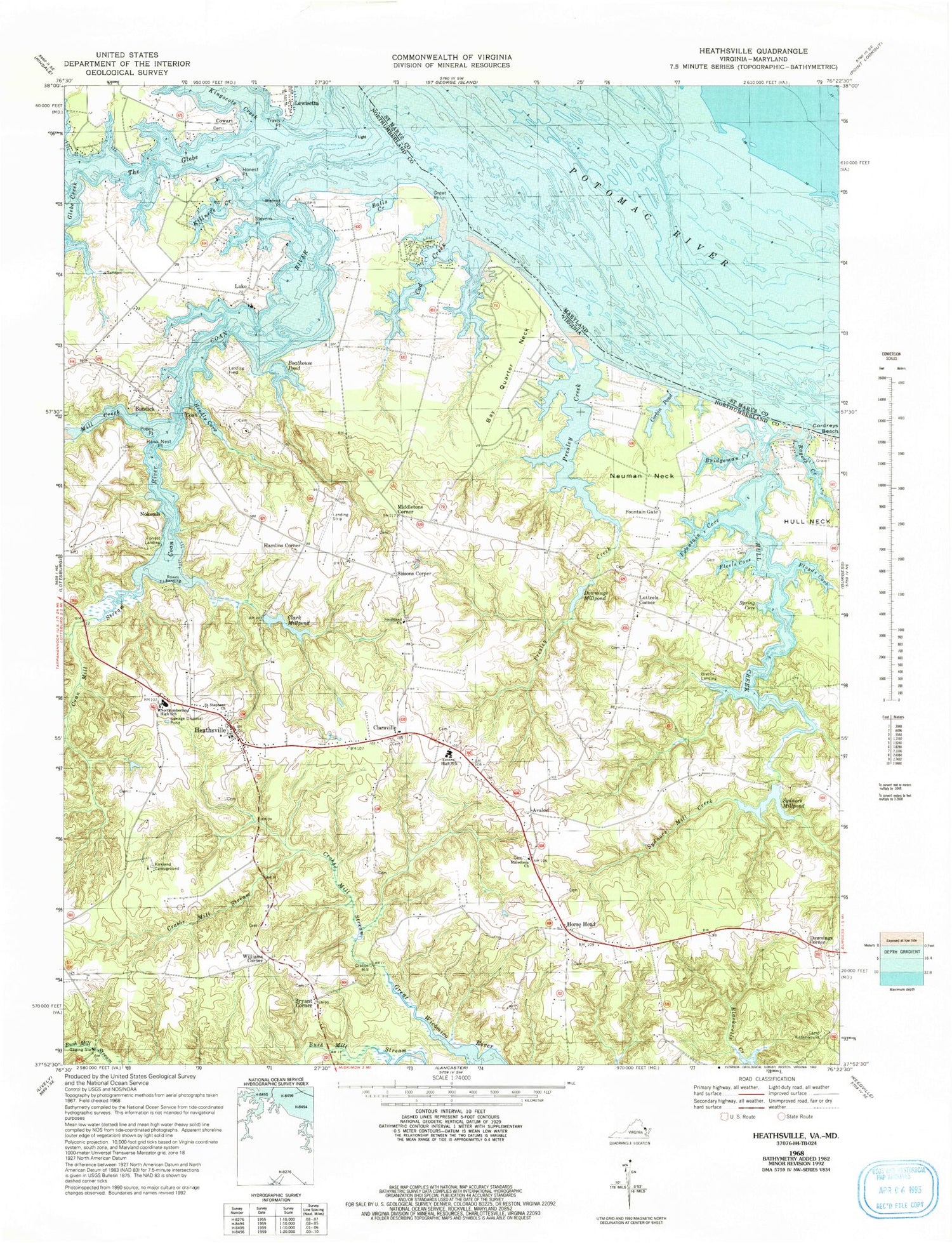
Classic USGS Heathsville Virginia 7.5'x7.5' Topo Map
Couldn't load pickup availability
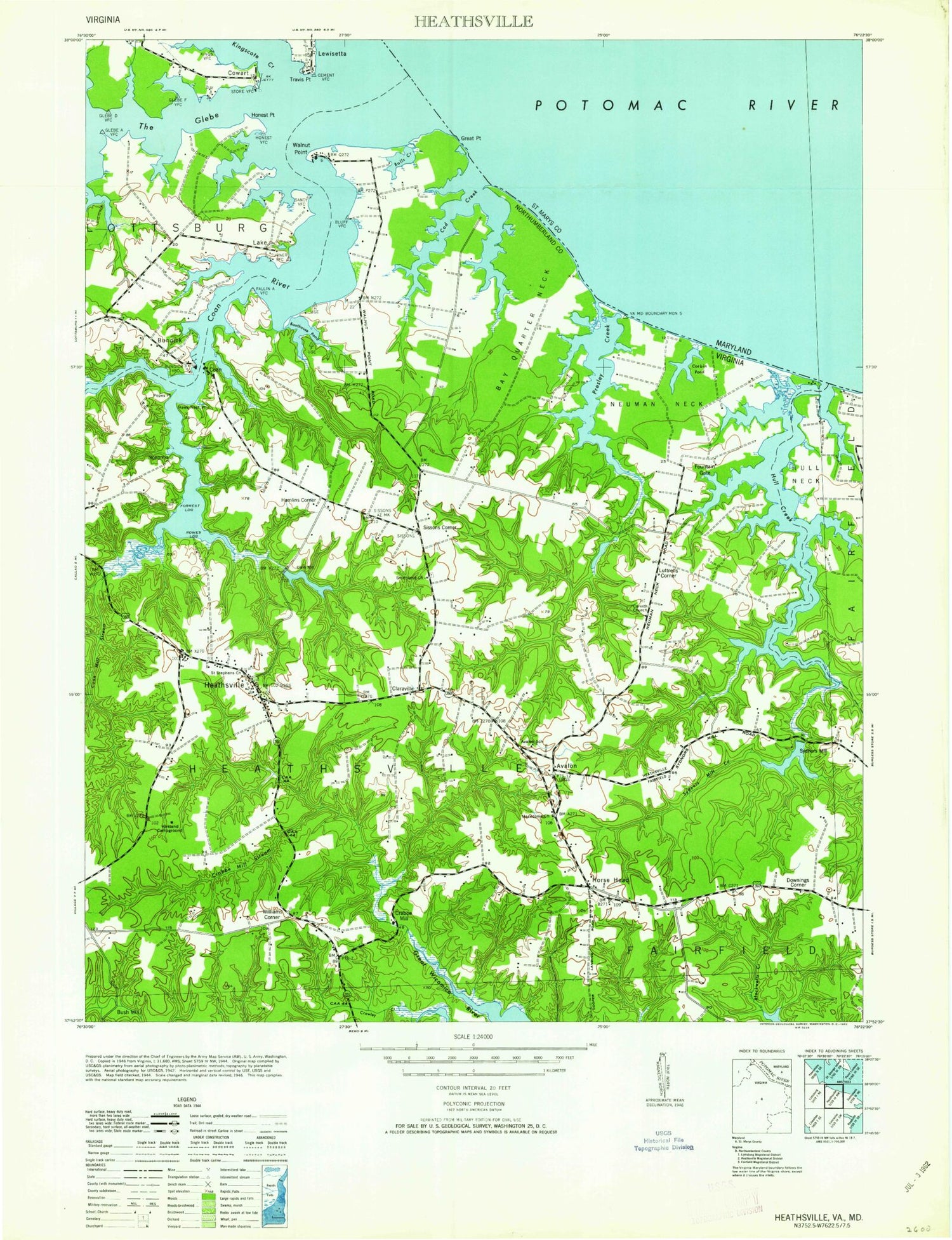
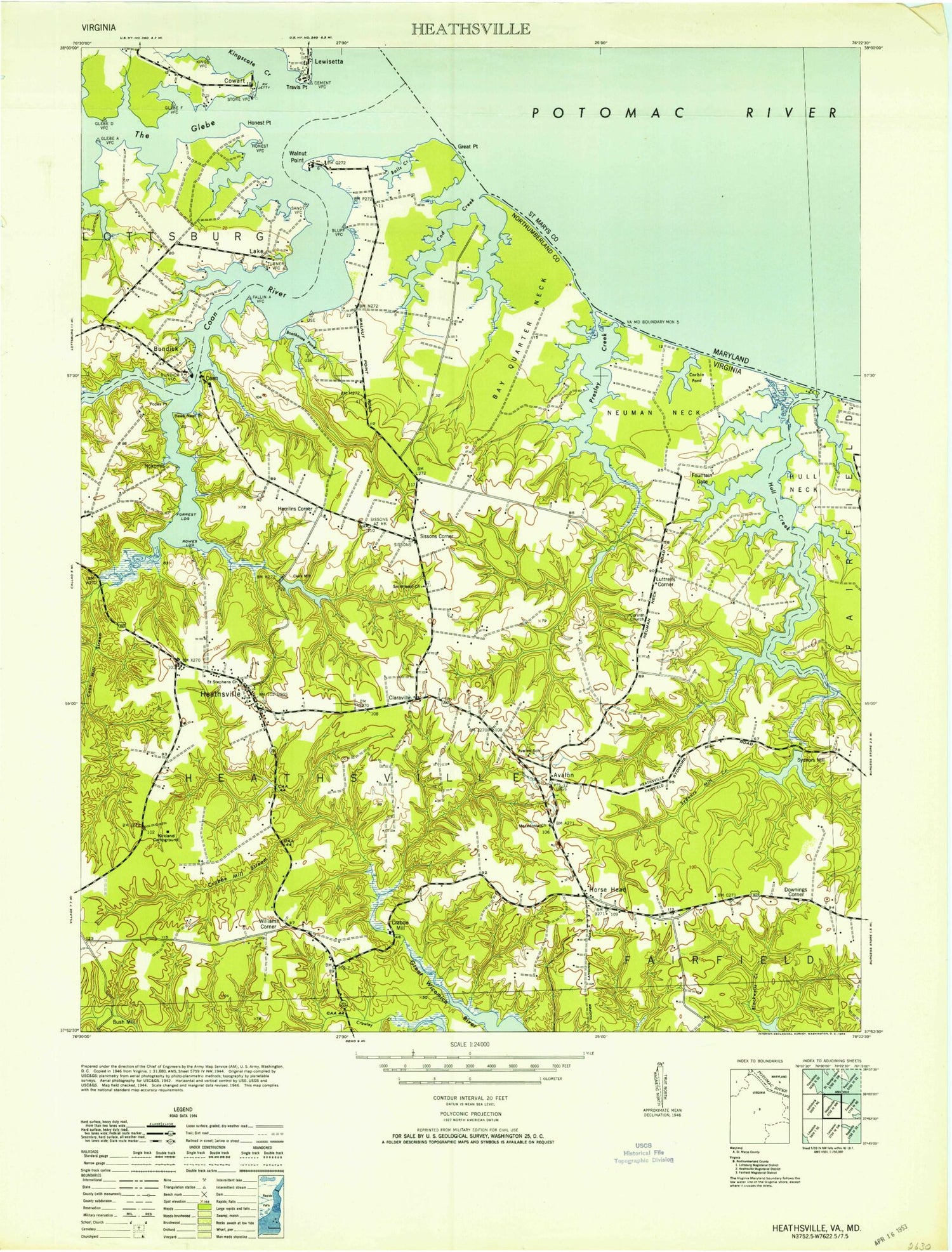
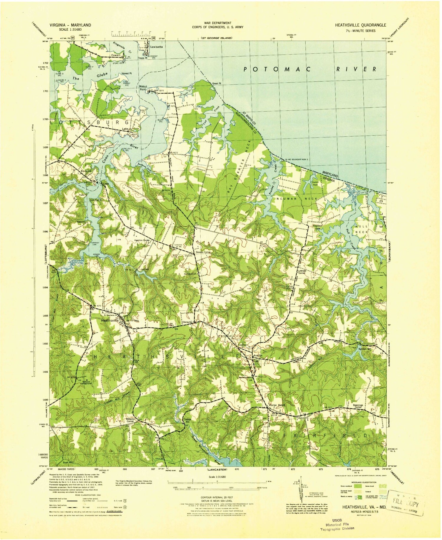
Historical USGS topographic quad map of Heathsville in the state of Virginia. Map scale may vary for some years, but is generally around 1:24,000. Print size is approximately 24" x 27"
This quadrangle is in the following counties: Northumberland, St. Mary's.
The map contains contour lines, roads, rivers, towns, and lakes. Printed on high-quality waterproof paper with UV fade-resistant inks, and shipped rolled.
Contains the following named places: Avalon, Avalon School, Bay Quarter Neck, Boathouse Pond, Brents Landing, Bridgeman Creek, Bryant Corner, Bryants Corner, Bundick, Bush Mill, Central High School, Claraville, Clark Millpond, Clarkes Milldam, Clarks Mill, Coan, Coan Hall School, Coan Mill Stream, Coan River, Coan River Marina, Coan-Bundicks Ferry, Cod Creek, Corbin Pond, Corinth Church, Corinth School, Cowart, Cowarts Point, Crabbe Mill, Crabbe Mill Stream, District 2, Downings Corner, Downings Mill, Downings Millpond, Fleets Cove, Floyds Cove, Forrest Landing, Fountain Cove, Fountain Gate, Glebe Creek, Hamlins Corner, Hawk Nest Point, Headly Cove, Heathsville, Heathsville Airport, Heathsville Census Designated Place, Heathsville Post Office, Highland Point, Honest Point, Horse Head, Horse Head School, Hull Creek, Killneck Creek, Kingscote Creek, Kirkland Campground, Lake, Lewisetta, Lewisetta Marina, Luttrels Corner, Macedonia Church, Martins Corner School, Mid - County Volunteer Rescue Squad, Mid County Rescue Squad, Middletons Corner, Mill Creek, Neuman Neck, Nokomis, Northumberland County Sheriff's Office, Northumberland Elementary School, Northumberland High School, Northumberland Middle School, Northumberland Public Library, Oakland School, Popes Point, Poplar Farm School, Presley Creek, Pumpkin Hill, Roger Point, Rogers Creek, Rowes Landing, Saint Stephen's Anglican Church, Sissons Corner, Sissons School, Smithland Church, Spring Cove, Stevens Point, Stubbins School, Sydnors Mill, Sydnors Mill Creek, Sydnors Millpond, Sydnors Millpond Dam, The Glebe, Virginia Marine Police - Northern Area Office, Walnut Point, Williams Corner, ZIP Code: 22473


