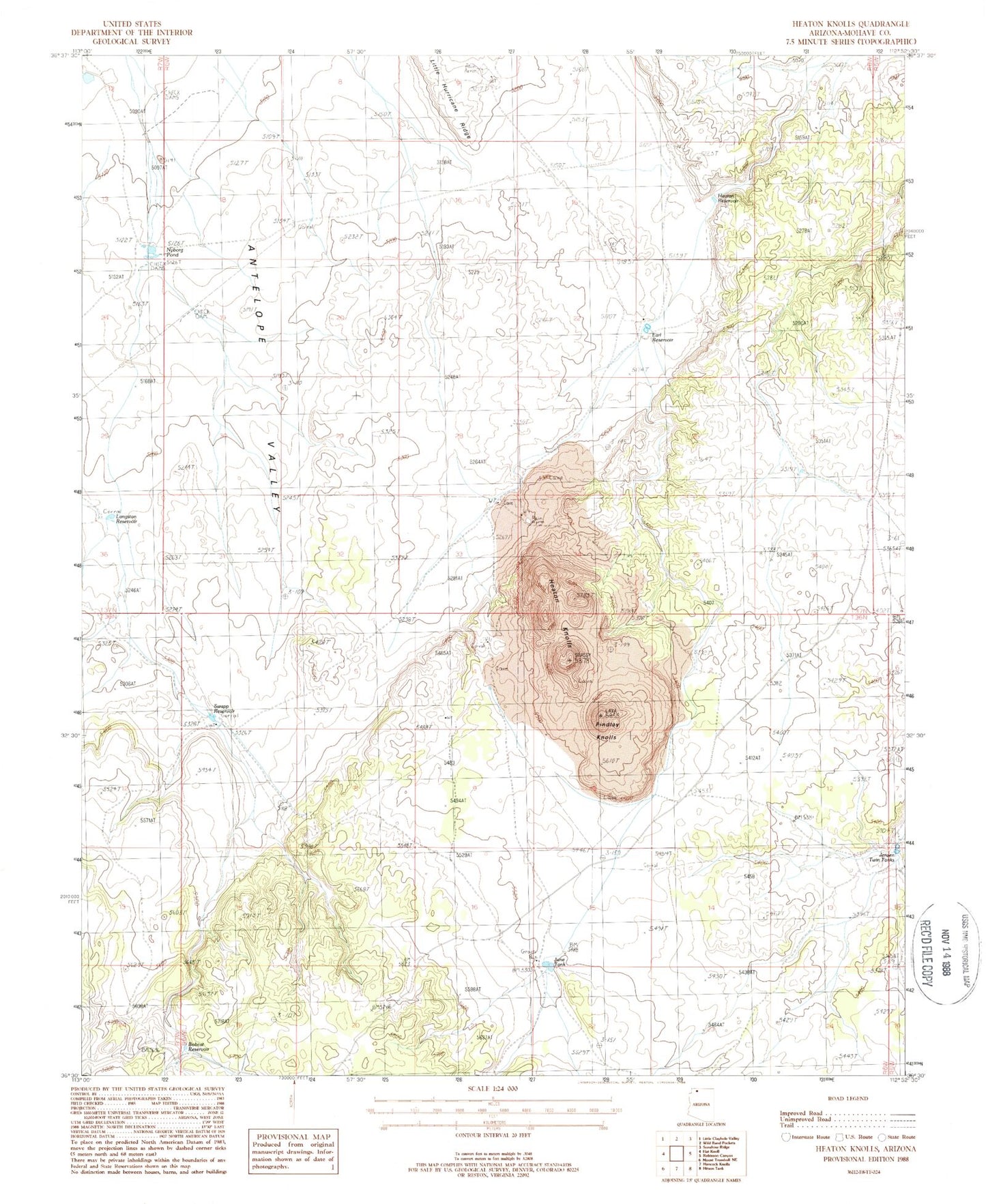
MyTopo
Classic USGS Heaton Knolls Arizona 7.5'x7.5' Topo Map
Regular price
$16.95
Regular price
Sale price
$16.95
Unit price
per
Couldn't load pickup availability
Historical USGS topographic quad map of Heaton Knolls in the state of Arizona. Map scale may vary for some years, but is generally around 1:24,000. Print size is approximately 24" x 27"
This quadrangle is in the following counties: Mohave.
The map contains contour lines, roads, rivers, towns, and lakes. Printed on high-quality waterproof paper with UV fade-resistant inks, and shipped rolled.
Contains the following named places: Antelope Detention Dam, Antelope Valley Detention Dam, Bobcat Reservoir, Earl Reservoir, Findlay Knolls, Heaton Knolls, Heaton Knolls Catchment, Heaton Reservoir, June Tank, Langston Reservoir, Little Hurricane Ridge, Nyborg Pond, Red Blanket Ranch, Swapp Reservoir, Twin Tanks