MyTopo
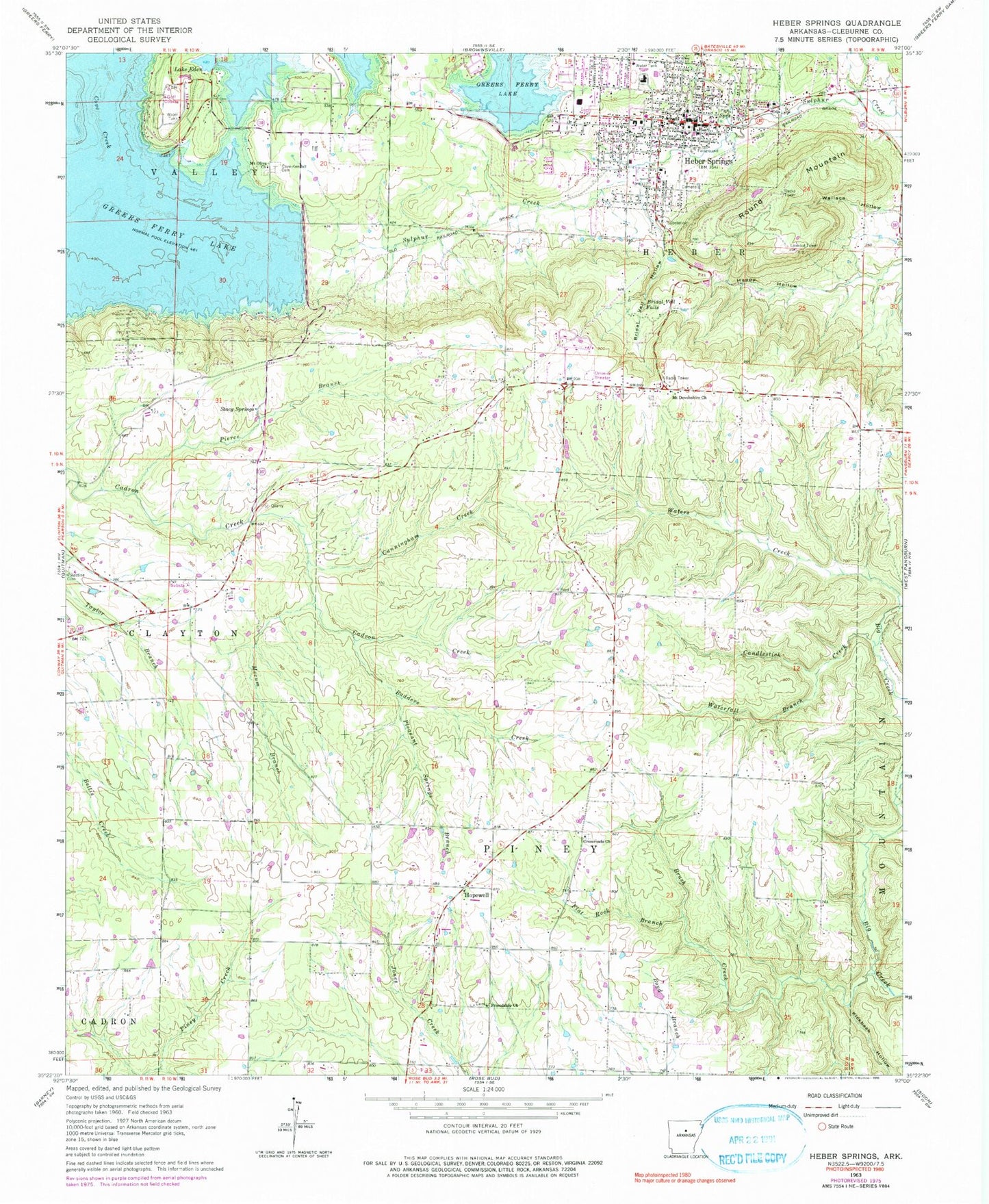
Classic USGS Heber Springs Arkansas 7.5'x7.5' Topo Map
Couldn't load pickup availability
Historical USGS topographic quad map of Heber Springs in the state of Arkansas. Map scale may vary for some years, but is generally around 1:24,000. Print size is approximately 24" x 27"
This quadrangle is in the following counties: Cleburne.
The map contains contour lines, roads, rivers, towns, and lakes. Printed on high-quality waterproof paper with UV fade-resistant inks, and shipped rolled.
Contains the following named places: Badders Creek, Bridal Veil Falls, Bridal Veil Hollow, Brush Creek, Candlestick Creek, Central Methodist Church, Church of God, City of Heber Springs, Cleburne County Courthouse, Cleburne County Sheriff's Office, Cove Creek Volunteer Fire Department Station 3, Cove-Kendall Cemetery, Crossroads Church, Cunningham Creek, Driftwood Shores, Eden Isle Lake Dam, Estelle Hospital, First Assembly of God Church, First Baptist Church, First Presbyterian Church, Flat Rock Branch, Friendship Freewill Baptist Church, Happy Hollow, Heber Springs, Heber Springs Elementary School, Heber Springs Fire Department, Heber Springs High School, Heber Springs Middle School, Heber Springs Police Department, Hopewell, Hopewell Primitive Baptist Church, Hopewell Volunteer Fire Department, KAWW-AM (Heber Springs), KAWW-FM (Heber Springs), Kickback Hollow, Lake Eden, Mecum Branch, Mount Devonshire Church, Mount Devonshire School, Mount Olive Missionary Baptist Church, Northstar Emergency Medical Service - Heber Springs Station, Palestine Cemetery, Parish Lake, Parish Lake Dam, Pierce Branch, Pleasant Springs Branch, Round Mountain, Seven Natural Springs, Sexton Creek, South Shore Park, Spring Park, Stacy Springs, Township of Heber, Township of Piney, Township of Valley, Wallace Hollow, Waterfall Branch, Waters Creek