
MyTopo
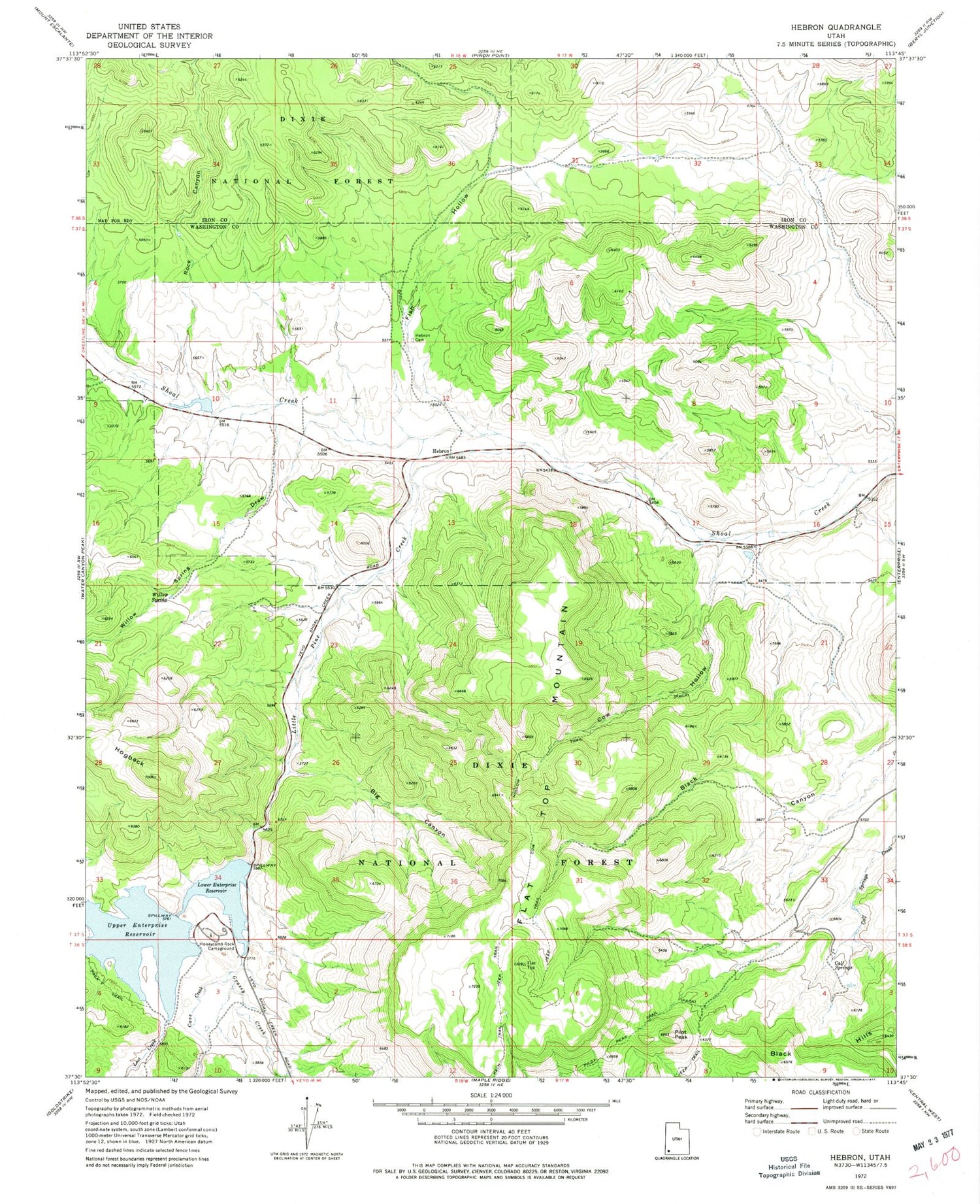
Classic USGS Hebron Utah 7.5'x7.5' Topo Map
Couldn't load pickup availability
Historical USGS topographic quad map of Hebron in the state of Utah. Map scale may vary for some years, but is generally around 1:24,000. Print size is approximately 24" x 27"
This quadrangle is in the following counties: Iron, Washington.
The map contains contour lines, roads, rivers, towns, and lakes. Printed on high-quality waterproof paper with UV fade-resistant inks, and shipped rolled.
Contains the following named places: Big Canyon, Calf Springs, Cave Canyon, Cave Creek, Cow Creek, Cow Hollow, Enterprise Reservoir Campground, Fish Hollow, Flat Top Mountain, Grassy Creek, Hebron, Hebron Cemetery, Hebron Historical Site, Hogback, Hollow Trail, Honeycomb Rock Campground, Honeycomb Rocks, Little Pine Creek, Lost Creek, Lower Enterprise Dam, Lower Enterprise Reservoir, Pilot Peak, Pilot Peak Trail, Rock Canyon, Upper Enterprise Dam, Upper Enterprise Reservoir, Willow Spring, Willow Spring Draw, ZIP Code: 84725


