MyTopo
Classic USGS Hebron Virginia 7.5'x7.5' Topo Map
Couldn't load pickup availability
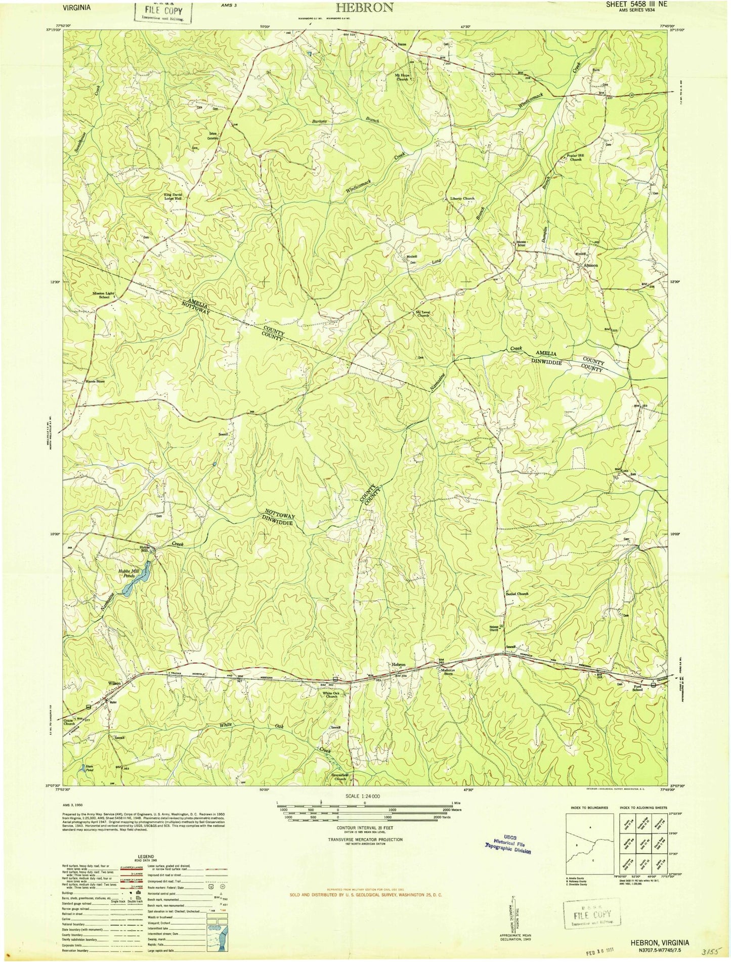
Historical USGS topographic quad map of Hebron in the state of Virginia. Map scale may vary for some years, but is generally around 1:24,000. Print size is approximately 24" x 27"
This quadrangle is in the following counties: Amelia, Dinwiddie, Nottoway.
The map contains contour lines, roads, rivers, towns, and lakes. Printed on high-quality waterproof paper with UV fade-resistant inks, and shipped rolled.
Contains the following named places: Ammon, Ammon School, Bethel Church, Bollins Cemetery, Broomfield Church, Burtons Branch, Coleman Cemetery, Craddock Cemetery, Dumplin Branch, Farley Cemetery, Ford School, Gills Cemetery, Grace Cemetery, Grace Church, Hamner Cemetery, Harris Store, Hebron, Hebron Cemetery, Hebron Church, Hobbs Dam, Hobbs Mill, Hobbs Millpond, King David Lodge Hall, Liberty Church, Long Branch, Mallorys Store, Mission Light School, Mount Hope Baptist Church, Mount Hope Cemetery, Mount Level Cemetery, Mount Level Church, Oliver Cemetery, Phillips Cemetery, Poplar Hill Church, Reames Cemetery, Salem Cemetery, Salem Methodist Episcopal Church, Stem Pond, Tucker Cemetery, Turner Cemetery, White Oak Cemetery, White Oak Church, Wilsons, Wilsons Post Office, ZIP Code: 23850