MyTopo
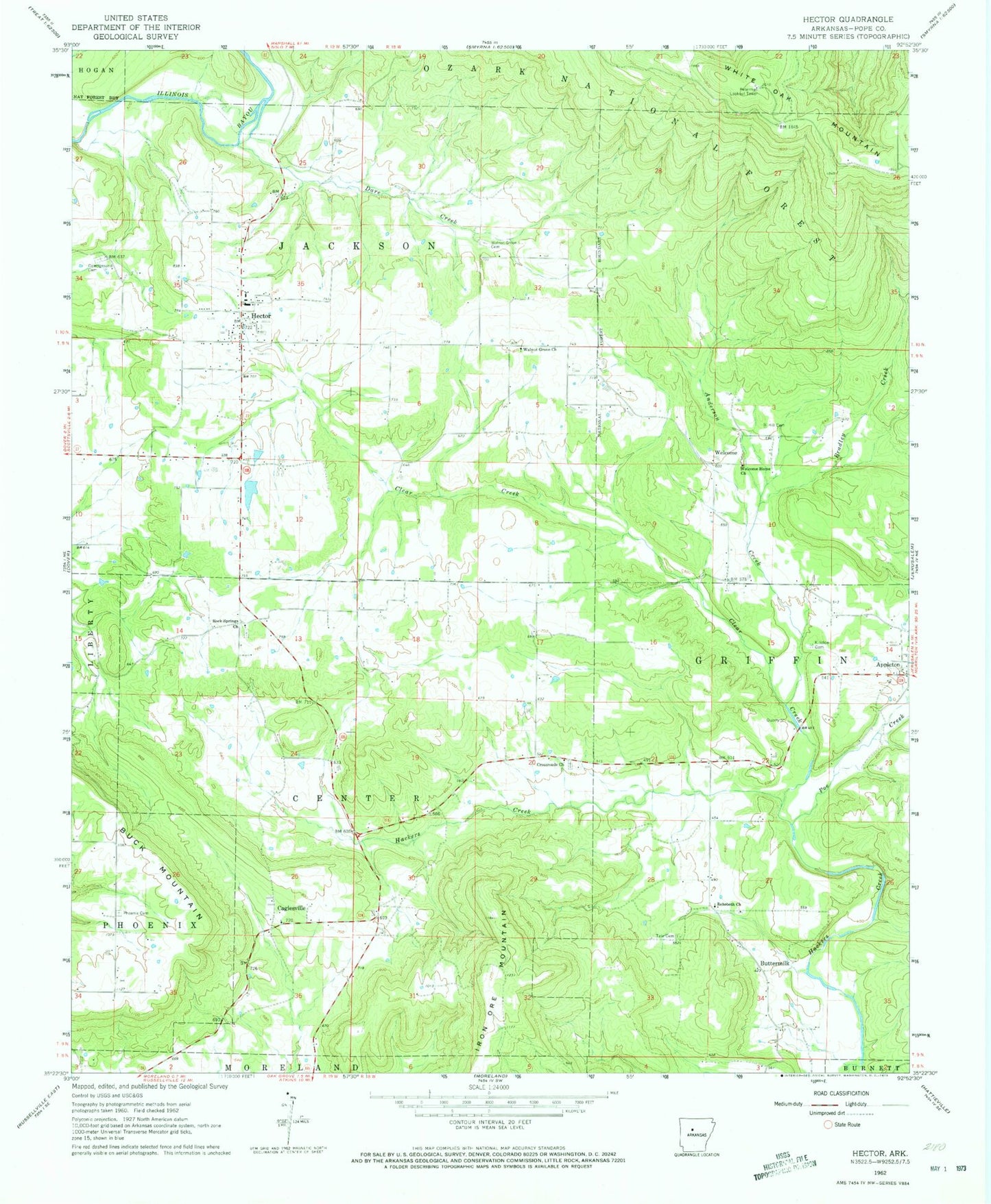
Classic USGS Hector Arkansas 7.5'x7.5' Topo Map
Couldn't load pickup availability
Historical USGS topographic quad map of Hector in the state of Arkansas. Map scale may vary for some years, but is generally around 1:24,000. Print size is approximately 24" x 27"
This quadrangle is in the following counties: Pope.
The map contains contour lines, roads, rivers, towns, and lakes. Printed on high-quality waterproof paper with UV fade-resistant inks, and shipped rolled.
Contains the following named places: Anderson Creek, Appleton Post Office, Bayou Ranger District Office and Work Center, Boiling Springs, Bradley Creek, Buck Mountain, Buttermilk, Caglesville, Caglesville Community Church, Campground Cemetery, Campground School, Clear Creek, Crossroads Cemetery, Crossroads Church, Dare Creek, Hall School, Hector, Hector Elementary School, Hector Fire Department, Hector High School, Hector Police Department, Hector Post Office, Hill Cemetery, Iron Ore Mountain, Kinslow Cemetery, Leta, Peterman Lookout Tower, Phoenix Cemetery, Pine Grove Church, Poe Creek, Rehoboth Church, Rock Springs, Rock Springs Cemetery, Rock Springs Cumberland Presbyterian Church, Rock Springs School, Tate Cemetery, Town of Hector, Township of Center, Township of Griffin, Walnut Grove, Walnut Grove Cemetery, Walnut Grove Freewill Baptist Church, Walnut Grove School, Welcome, Welcome Home Freewill Baptist Church, Welcome Home School, West Fork Point Remove Creek Site 10 Dam, West Fork Point Remove Creek Site 10 Reservoir, West Fork Point Remove Creek Site Nine Dam, West Fork Point Remove Creek Site Nine Reservoir, White Oak Mountain