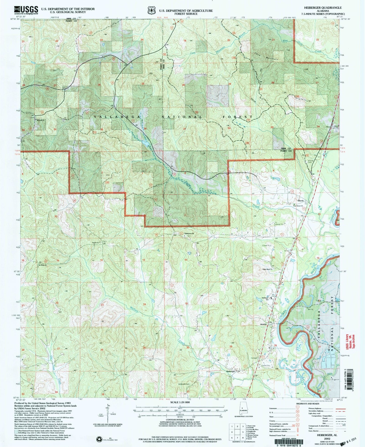
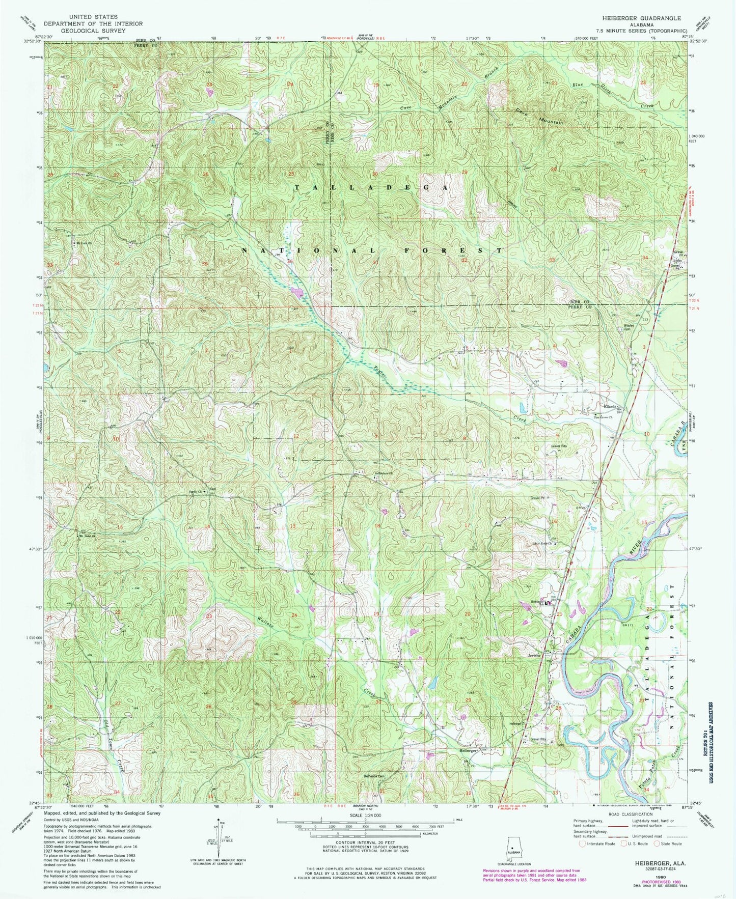
MyTopo
Classic USGS Heiberger Alabama 7.5'x7.5' Topo Map
Couldn't load pickup availability
Historical USGS topographic quad map of Heiberger in the state of Alabama. Map scale may vary for some years, but is generally around 1:24,000. Print size is approximately 24" x 27"
This quadrangle is in the following counties: Bibb, Perry.
The map contains contour lines, roads, rivers, towns, and lakes. Printed on high-quality waterproof paper with UV fade-resistant inks, and shipped rolled.
Contains the following named places: Bethesda Cemetery, Bethesda Presbyterian Church, Bethlehem Baptist Church, Cave Mountain, Cave Mountain Branch, Ellard School, Ellards, Heiberger, Heiberger Cemetery, Heiberger Division, Heiberger Elementary School, Heiberger Methodist Church, Heiberger Post Office, Heiberger Volunteer Fire Department, Ironville, Jericho, Little Rock Church, Mount Ivah Church, Mount Nebo Church, Nichols, Pine Grove Baptist Church, Potato Patch Creek, Sardis Baptist Church, Walter C Givhan Bridge, Williams Branch, Wooley Cemetery