MyTopo
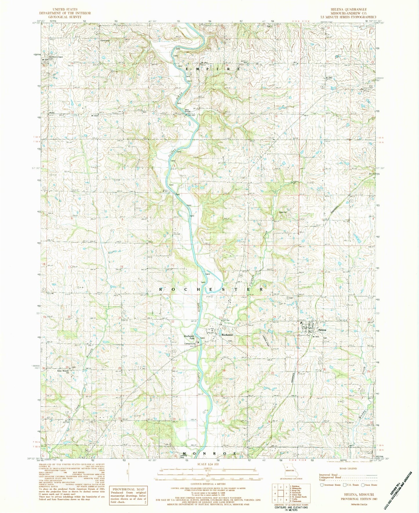
Classic USGS Helena Missouri 7.5'x7.5' Topo Map
Couldn't load pickup availability
Historical USGS topographic quad map of Helena in the state of Missouri. Map scale may vary for some years, but is generally around 1:24,000. Print size is approximately 24" x 27"
This quadrangle is in the following counties: Andrew.
The map contains contour lines, roads, rivers, towns, and lakes. Printed on high-quality waterproof paper with UV fade-resistant inks, and shipped rolled.
Contains the following named places: Bedford Chapel, Bedford Chapel Cemetery, Black Oak School, Cherry Grove School, Chestnut Grove School, Clanton School, Cosby - Helena Fire District, Dale School, Elm Grove School, Fountain Blue School, Fountainbleau, Helena, Helena Elementary School, Helena Post Office, Liberty School, Lillabridge Lake, Long Branch Church, Middle Lake, New Hope School, Niagara Creek, Platte Chapel, Pleasant Prairie School, Rochester, Rochester Falls, Rochester School, Taylor Lake, Township of Rochester, Van Meter Bridge, Wire Bridge, ZIP Code: 64459