MyTopo
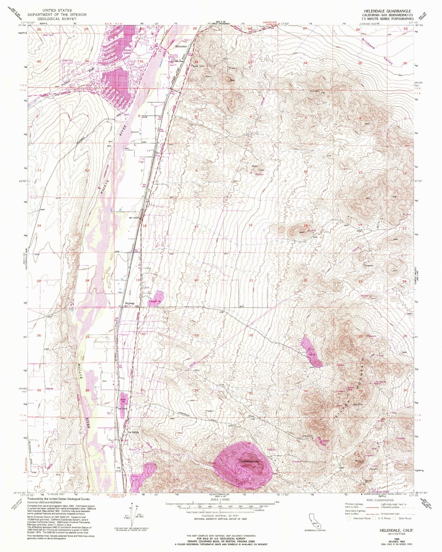
Classic USGS Helendale California 7.5'x7.5' Topo Map
Couldn't load pickup availability
Historical USGS topographic quad map of Helendale in the state of California. Map scale may vary for some years, but is generally around 1:24,000. Print size is approximately 24" x 27"
This quadrangle is in the following counties: San Bernardino.
The map contains contour lines, roads, rivers, towns, and lakes. Printed on high-quality waterproof paper with UV fade-resistant inks, and shipped rolled.
Contains the following named places: Airway Beacon 8, Apex Mine, Branch Mine, Bryman, Fremont Wash, Helendale, Helendale Elementary School, Helendale Post Office, La Delta, Las Cruces Ranch, North Lake, Oro Grande Mine, Palisades Ranch Airport, Riverview Middle School, San Bernardino County Fire Department Station 4 - Silver Lakes / Helendale, Silver Lakes, Silver Mountain, South Lake, Sparkhule Mountain, Western States Mine, ZIP Code: 92368