
MyTopo
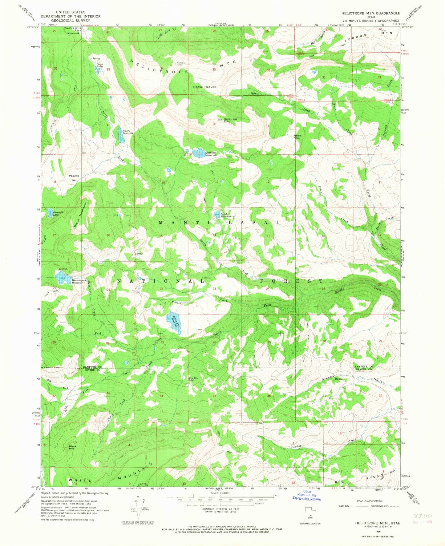
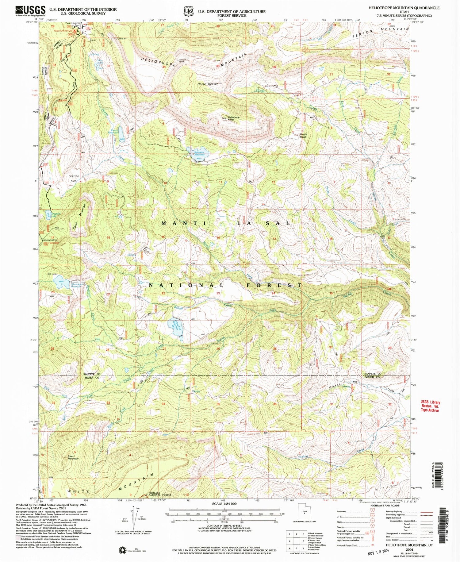
Classic USGS Heliotrope Mountain Utah 7.5'x7.5' Topo Map
Couldn't load pickup availability
Historical USGS topographic quad map of Heliotrope Mountain in the state of Utah. Typical map scale is 1:24,000, but may vary for certain years, if available. Print size: 24" x 27"
This quadrangle is in the following counties: Sanpete, Sevier.
The map contains contour lines, roads, rivers, towns, and lakes. Printed on high-quality waterproof paper with UV fade-resistant inks, and shipped rolled.
Contains the following named places: Beaver Creek, Black Fork Creek, Black Mountain, Block Mountain, Brush Reservoir, Currant Creek, Emerald Lake, Emery Reservoir, Enos Creek, Harris Knoll, Heliotrope Mountain, Heliotrope Point, Henningson Reservoir, Horse Heaven, Julius Flat Reservoir, North Fork Muddy Creek, Oleys Lakes, Peavine Flat, Petes Creek, Reservoir Creek, South Fork Muddy Creek, Spinners Reservoir, White Mountain Cabin, Julius Flat Dam, Henningson Dam, Brush Dam, Spinners Dam, Emery Dam, Ferron Mountain, Fish Creek, Jason Creek, Slide Fork, Twelve Mile Campground