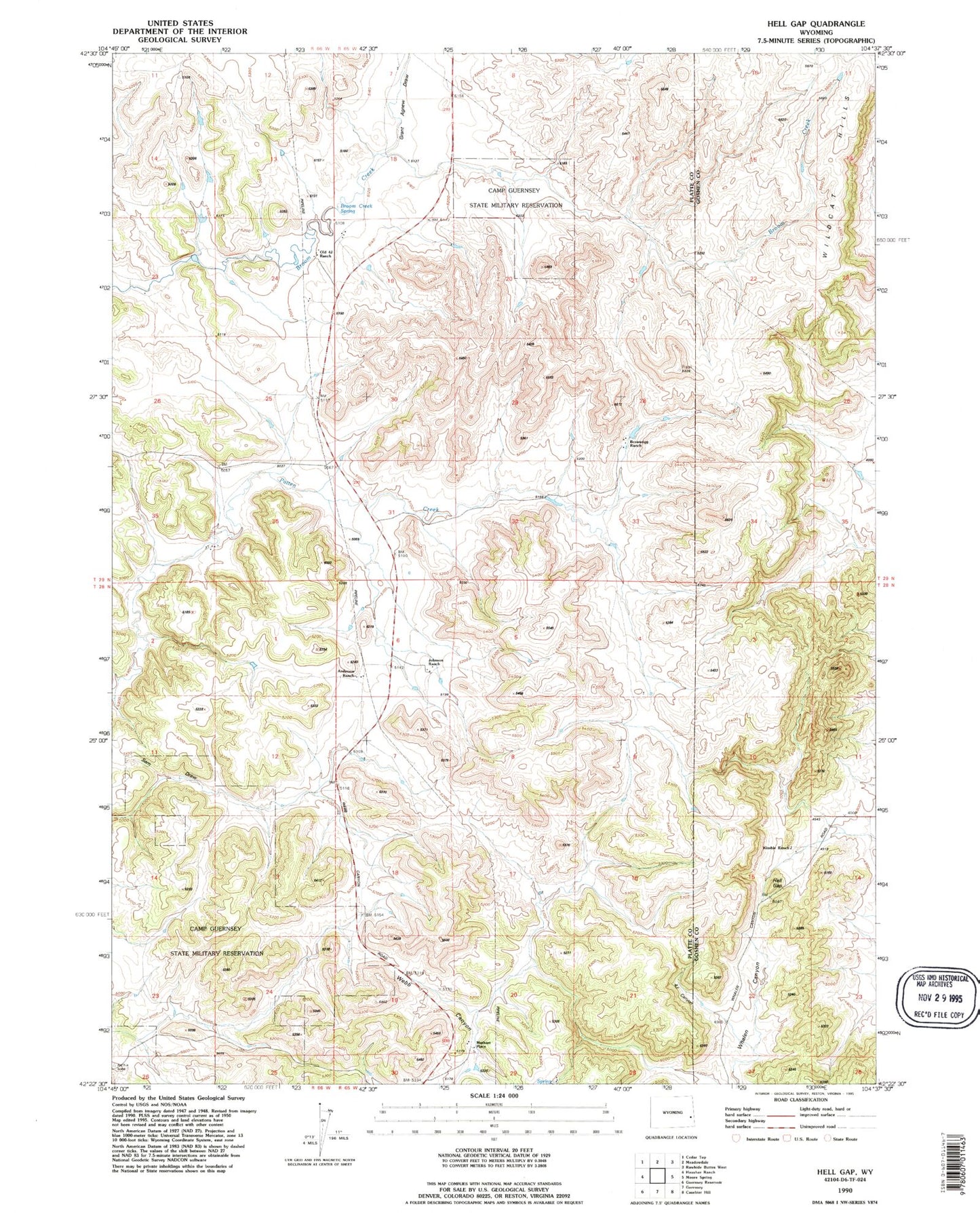
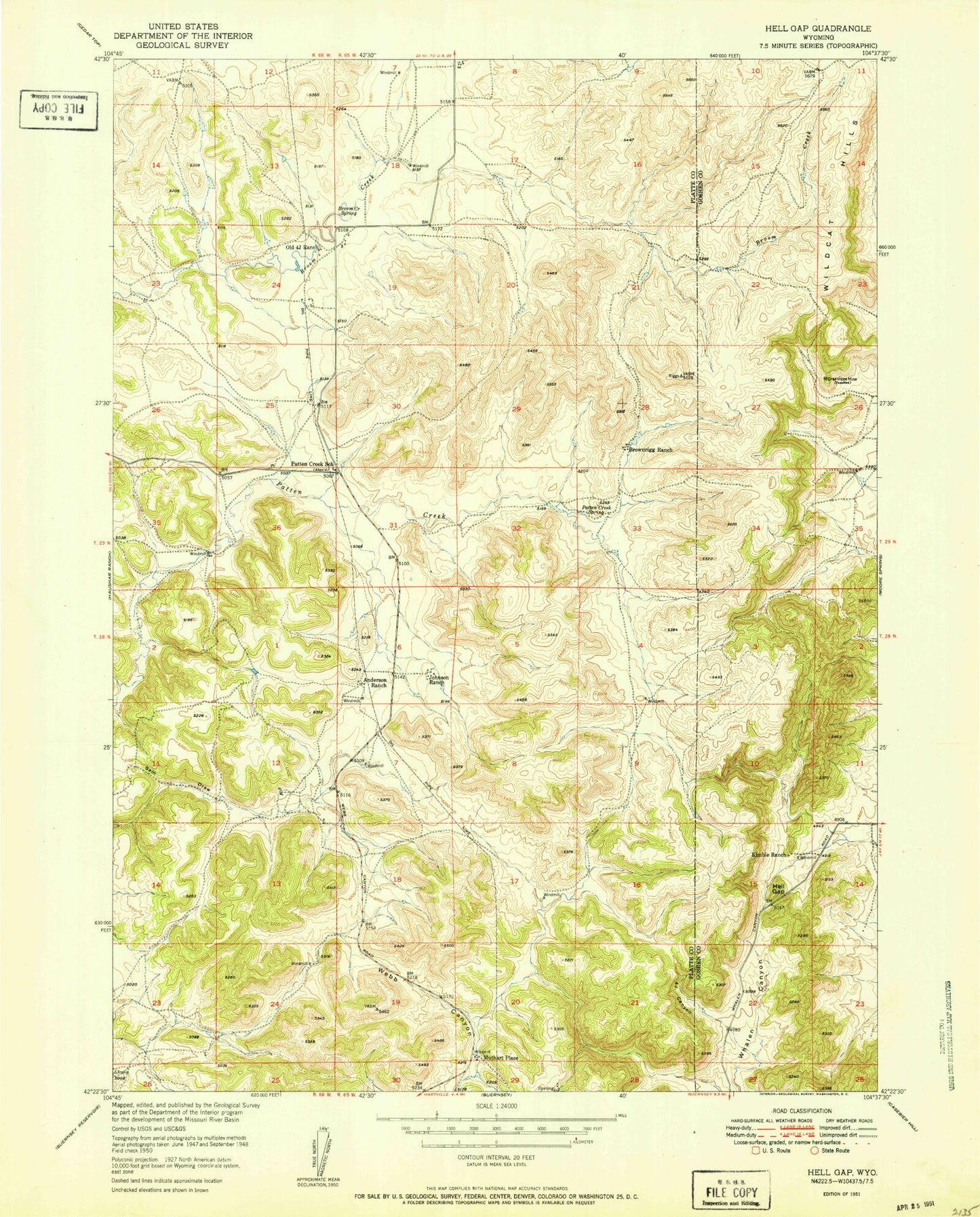
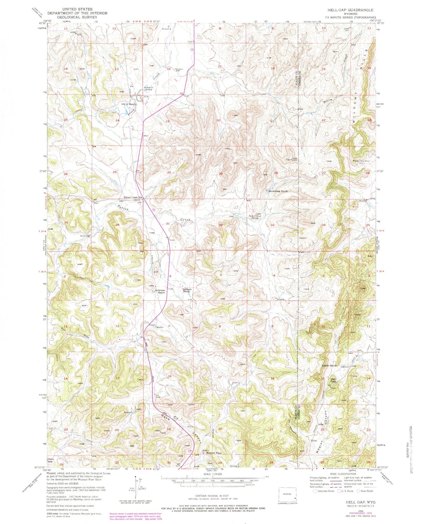
MyTopo
Classic USGS Hell Gap Wyoming 7.5'x7.5' Topo Map
Regular price
$16.95
Regular price
Sale price
$16.95
Unit price
per
Couldn't load pickup availability
Historical USGS topographic quad map of Hell Gap in the state of Wyoming. Map scale may vary for some years, but is generally around 1:24,000. Print size is approximately 24" x 27"
This quadrangle is in the following counties: Goshen, Platte.
The map contains contour lines, roads, rivers, towns, and lakes. Printed on high-quality waterproof paper with UV fade-resistant inks, and shipped rolled.
Contains the following named places: 4 J Canyon, Anderson Ranch, Broom Creek Spring, Brownrigg Ranch, Grant Agnew Draw, Greenhope Mine, Hell Gap, Johnson Ranch, Kimble Ranch, Muthart Place, Old 4 J Ranch, Patten Creek School, Patten Creek Spring, Sam Draw