
MyTopo
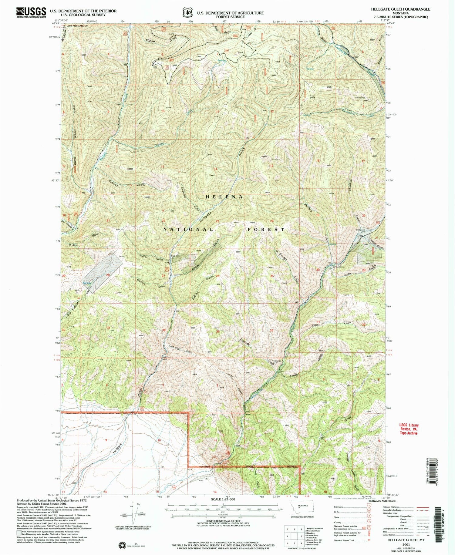
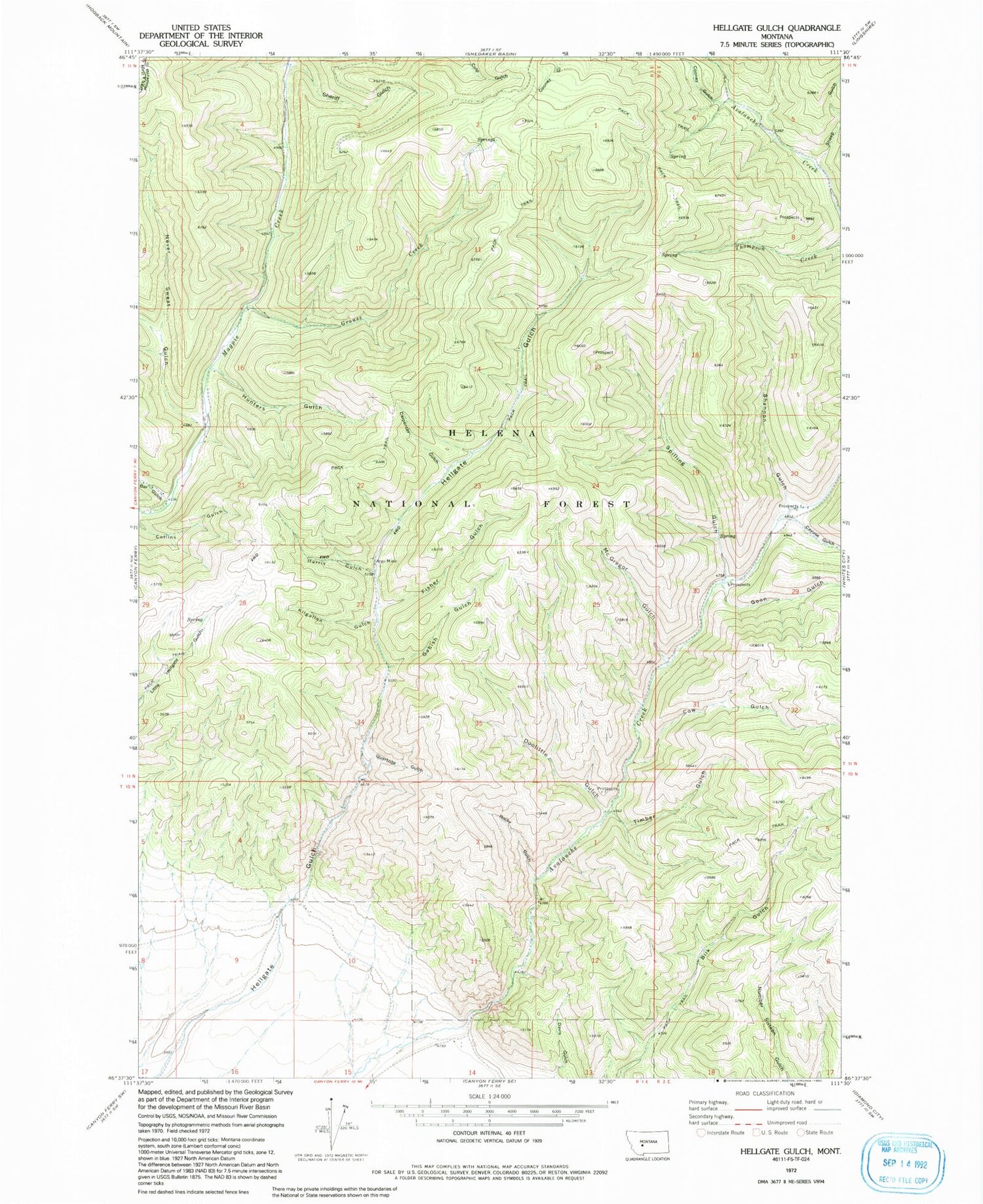
Classic USGS Hellgate Gulch Montana 7.5'x7.5' Topo Map
Couldn't load pickup availability
Historical USGS topographic quad map of Hellgate Gulch in the state of Montana. Map scale may vary for some years, but is generally around 1:24,000. Print size is approximately 24" x 27"
This quadrangle is in the following counties: Broadwater, Lewis and Clark.
The map contains contour lines, roads, rivers, towns, and lakes. Printed on high-quality waterproof paper with UV fade-resistant inks, and shipped rolled.
Contains the following named places: 10N01E14BACA01 Well, Argo Mine, Argo Post Office, Bar Gulch, Blackwells, Carpenter Gulch, Cayuse Creek, Cayuse Gulch, Cooney Gulch, Cow Gulch, Davis Gulch, Doolittle Gulch, Doolittle Gulch Mine, Fisher Gulch, Gabish Gulch, Goon Gulch, Grouse Creek, Harris Gulch, Hunters Gulch, Kilgallon Gulch, Mc Gregor Gulch, Never Sweat Gulch, Quartz Gulch, Rocky Gulch, Shannon Gulch, Sheep Gulch, Sheriff Gulch, Spilling Gulch, Thompson Creek Mine, Timber Gulch


