MyTopo
Classic USGS Helms West Well Texas 7.5'x7.5' Topo Map
Couldn't load pickup availability
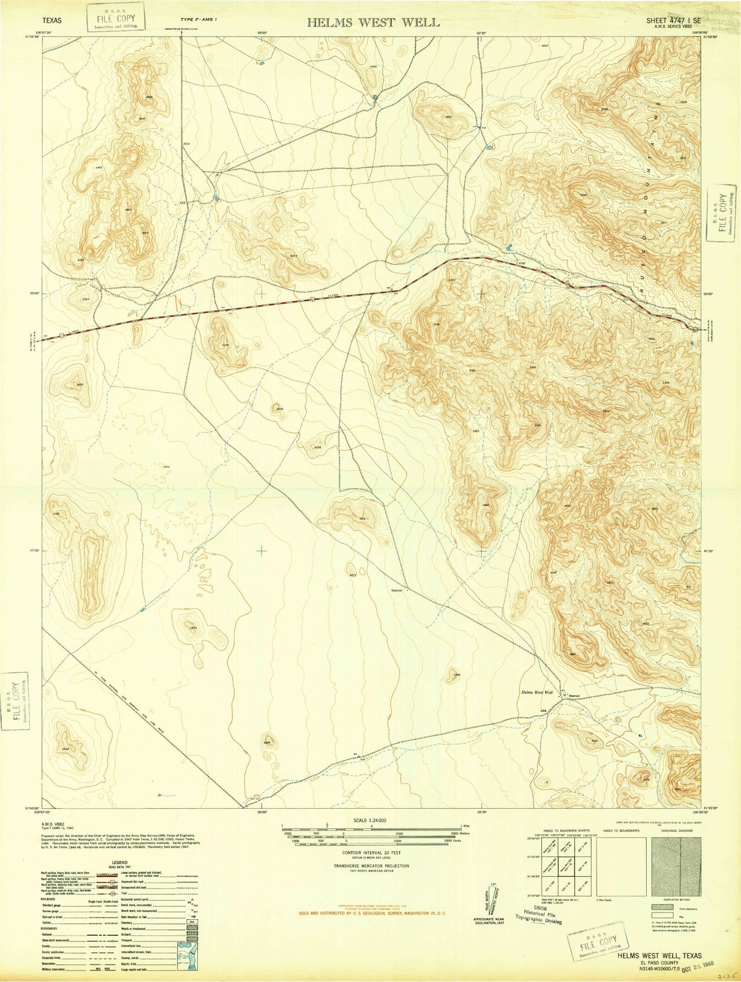
Historical USGS topographic quad map of Helms West Well in the state of Texas. Map scale may vary for some years, but is generally around 1:24,000. Print size is approximately 24" x 27"
This quadrangle is in the following counties: El Paso.
The map contains contour lines, roads, rivers, towns, and lakes. Printed on high-quality waterproof paper with UV fade-resistant inks, and shipped rolled.
Contains the following named places: Butterfield, Butterfield Census Designated Place, Butterfield City Number 1 Colonia, Butterfield City Number 2 Colonia, Butterfield City Number 3 Colonia, Butterfield City Number 4 Colonia, Dugout Tank, Fly Tank, Helms West Well, Hueco Mountain Estates Number 9 Colonia, Martin Canyon, Martin Tank, Middle Canyon, Middle Tank, Mikes Tank, Neals Tank, Phone Line Canyon, Pow Wow Canyon, Pow Wow Tank