
MyTopo
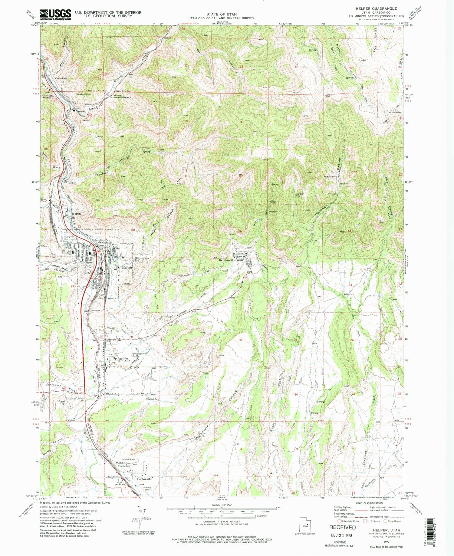
Classic USGS Helper Utah 7.5'x7.5' Topo Map
Couldn't load pickup availability
Historical USGS topographic quad map of Helper in the state of Utah. Map scale may vary for some years, but is generally around 1:24,000. Print size is approximately 24" x 27"
This quadrangle is in the following counties: Carbon.
The map contains contour lines, roads, rivers, towns, and lakes. Printed on high-quality waterproof paper with UV fade-resistant inks, and shipped rolled.
Contains the following named places: Aberdeen Mine, Alrad Canyon, Barn Canyon, Carbonville Cemetery, Carbonville Census Designated Place, Carbonville School, Castle Gate, Castle Gate Cemetery, Castle Gate Mine Number 1, Castle Gate Mine Number 2, Castle Gate Mine Number 4, Castle Gate Precinct, Central Cemetery / Slovenian Cemetery, City of Helper, Consumers Wash, Cordingly Canyon, Dry Canyon, Ewell Post Office, Garley Canyon, Gentile Wash, Glen Canal, Gorley Cemetery, Hardscrabble Canyon, Haycock Cemetery, Heiner, Helper, Helper Canyon, Helper Police Department, Helper Post Office, Helper Volunteer Fire Department, Kenilworth, Kenilworth Census Designated Place, Kenilworth Wash, Ketchum Mine, KOAL-AM (Price), Martin, Maxwell, Milburn Mine, Mountain View Cemetery, New Life Ministries Church, Panther Canyon, Panther Carbon Post Office, Price Canyon, Saint Anthony Catholic Church, Saint Anthony School, Sally Mauro Elementary School, Spring Canyon, Spring Glen, Spring Glen Cemetery, Spring Glen Census Designated Place, The Church of Jesus Christ of Latter Day Saints, Warehouse Canyon, Willow Creek, ZIP Code: 84529


