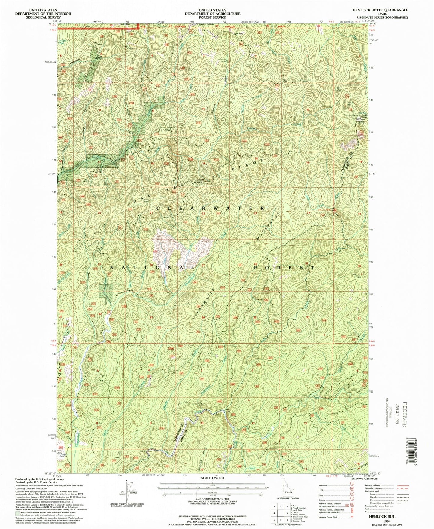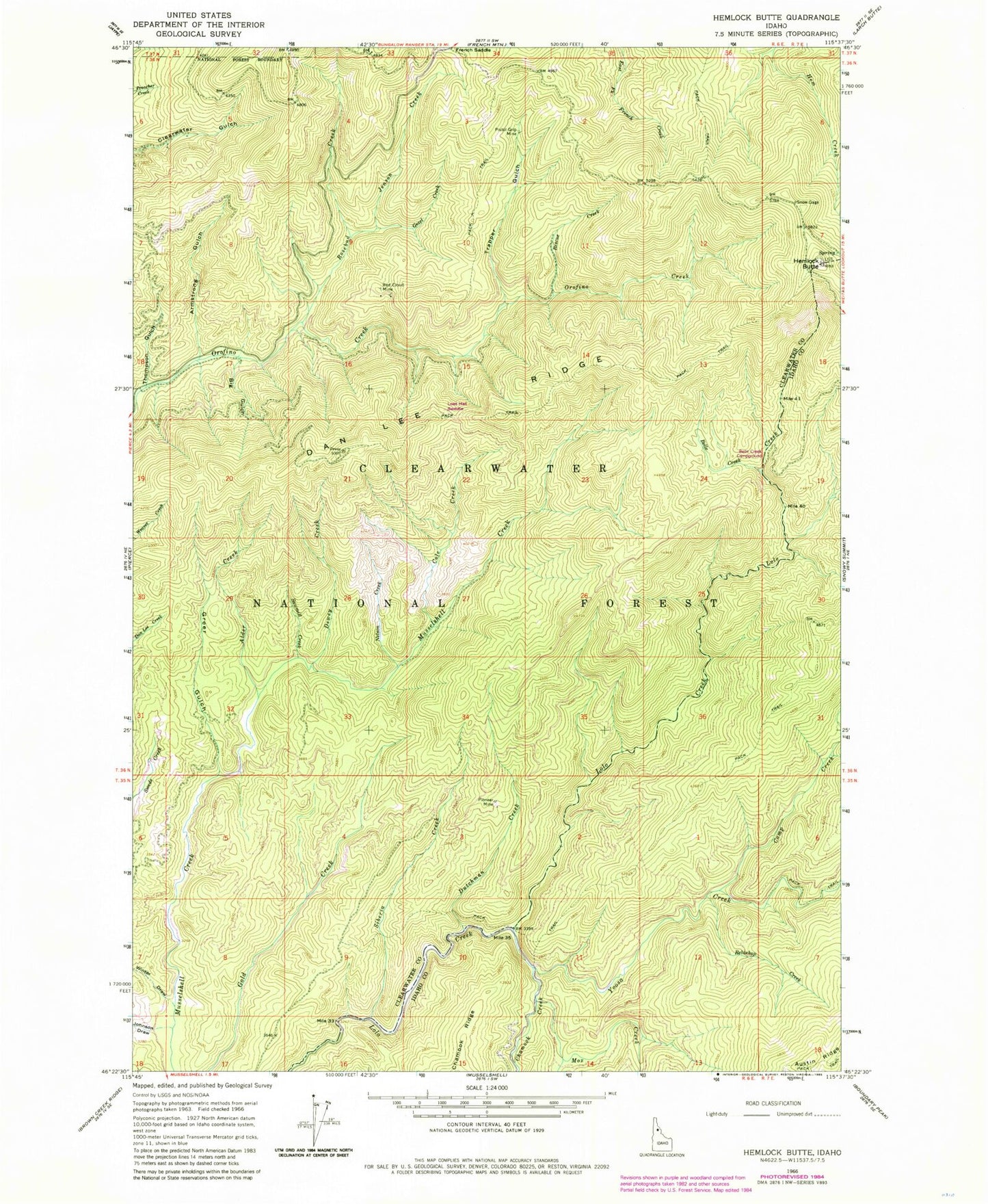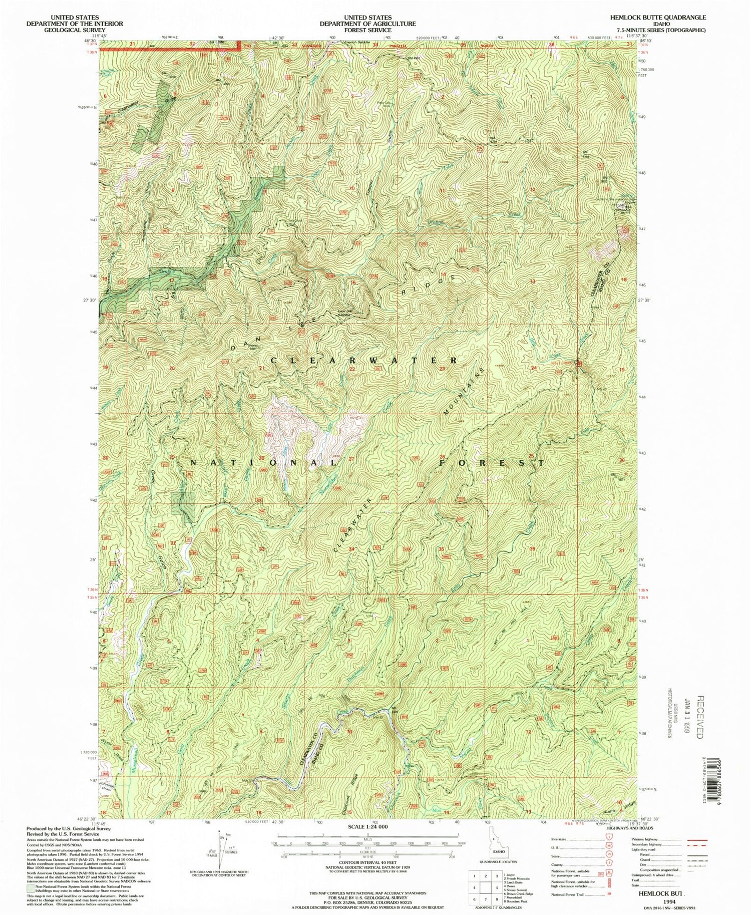

MyTopo
Classic USGS Hemlock Butte Idaho 7.5'x7.5' Topo Map
Couldn't load pickup availability
Historical USGS topographic quad map of Hemlock Butte in the state of Idaho. Map scale may vary for some years, but is generally around 1:24,000. Print size is approximately 24" x 27"
This quadrangle is in the following counties: Clearwater, Idaho.
The map contains contour lines, roads, rivers, towns, and lakes. Printed on high-quality waterproof paper with UV fade-resistant inks, and shipped rolled.
Contains the following named places: Alder Creek, Armstrong Gulch, Belle Creek, Belle Creek Campground, Big Gulch, Camp Creek, Chamook Creek, Cole Creek, Dan Lee Ridge, Dewey Creek, Dutchman Creek, French Saddle, Gezel Creek, Greer Gulch, Hemlock Butte, Jenson Creek, Johnson Draw, Lost Hat Saddle, Mox Creek, Nelson Creek, Pioneer Mine, Pistol Grip Mine, Red Cloud Mine, Relaskop Creek, Rescue Creek, Rosebud Creek, Sawmill Creek, Siberia Creek, Thompson Gulch, Trapper Gulch, Winter Draw, Yoosa Creek