

MyTopo
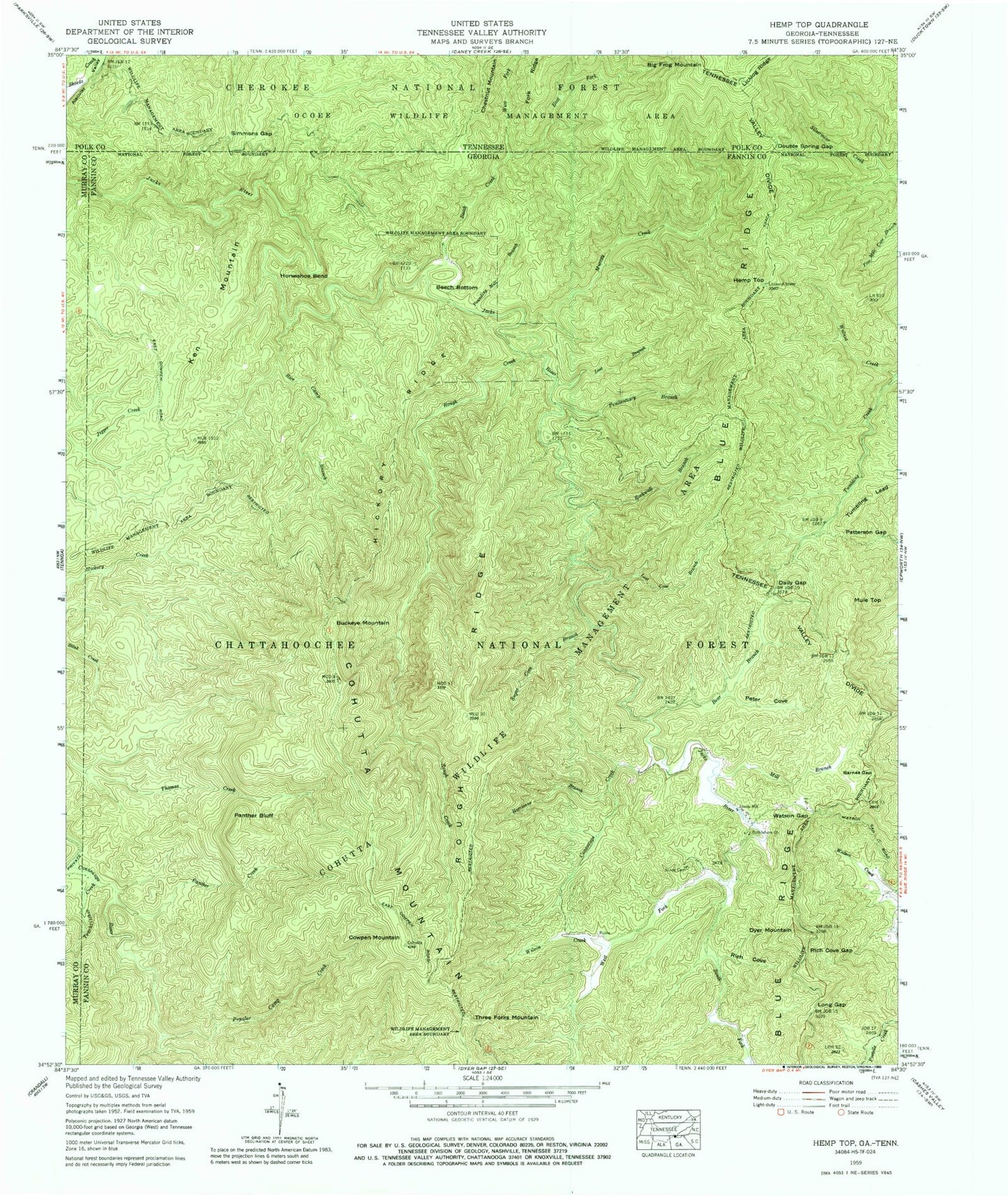
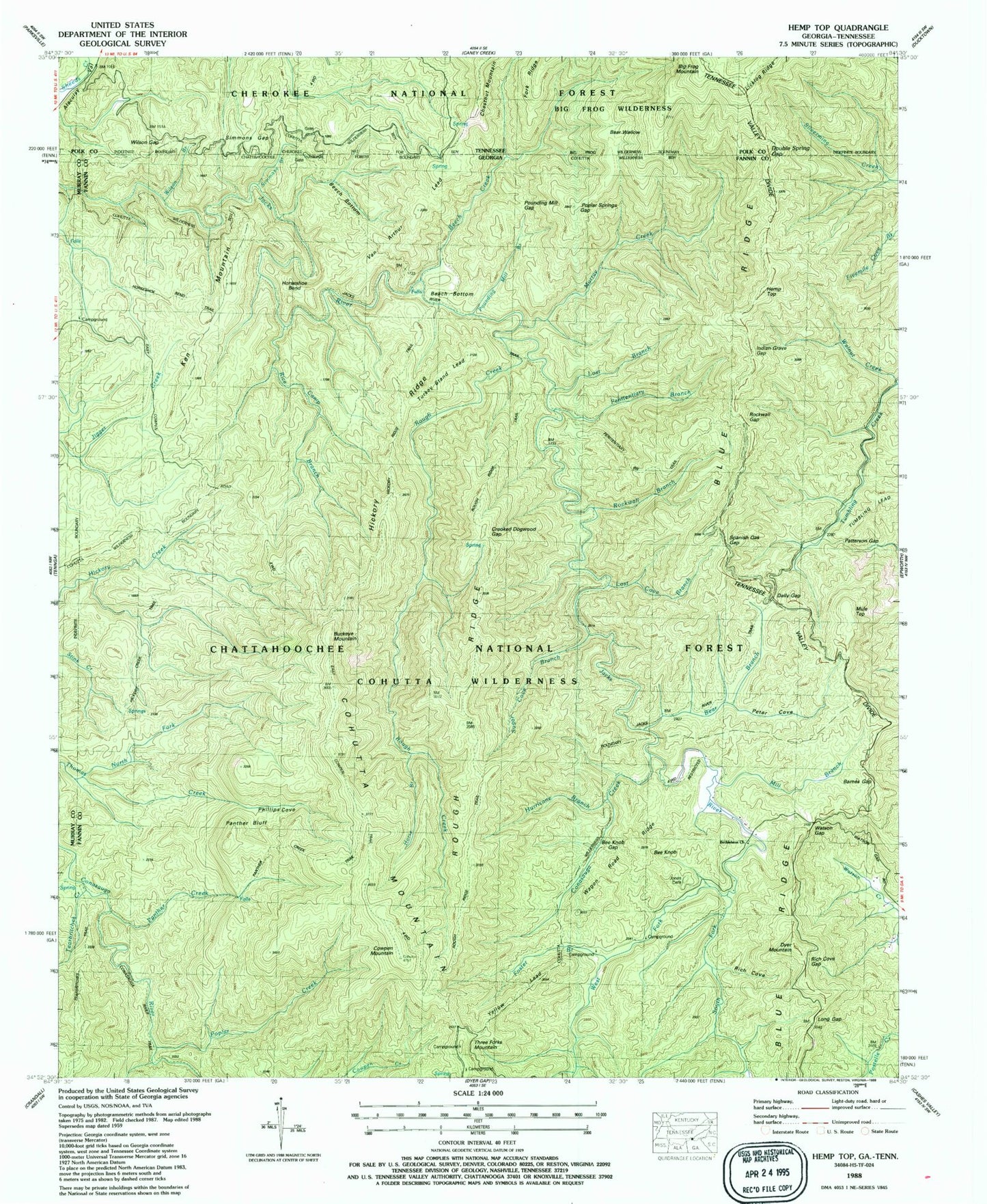
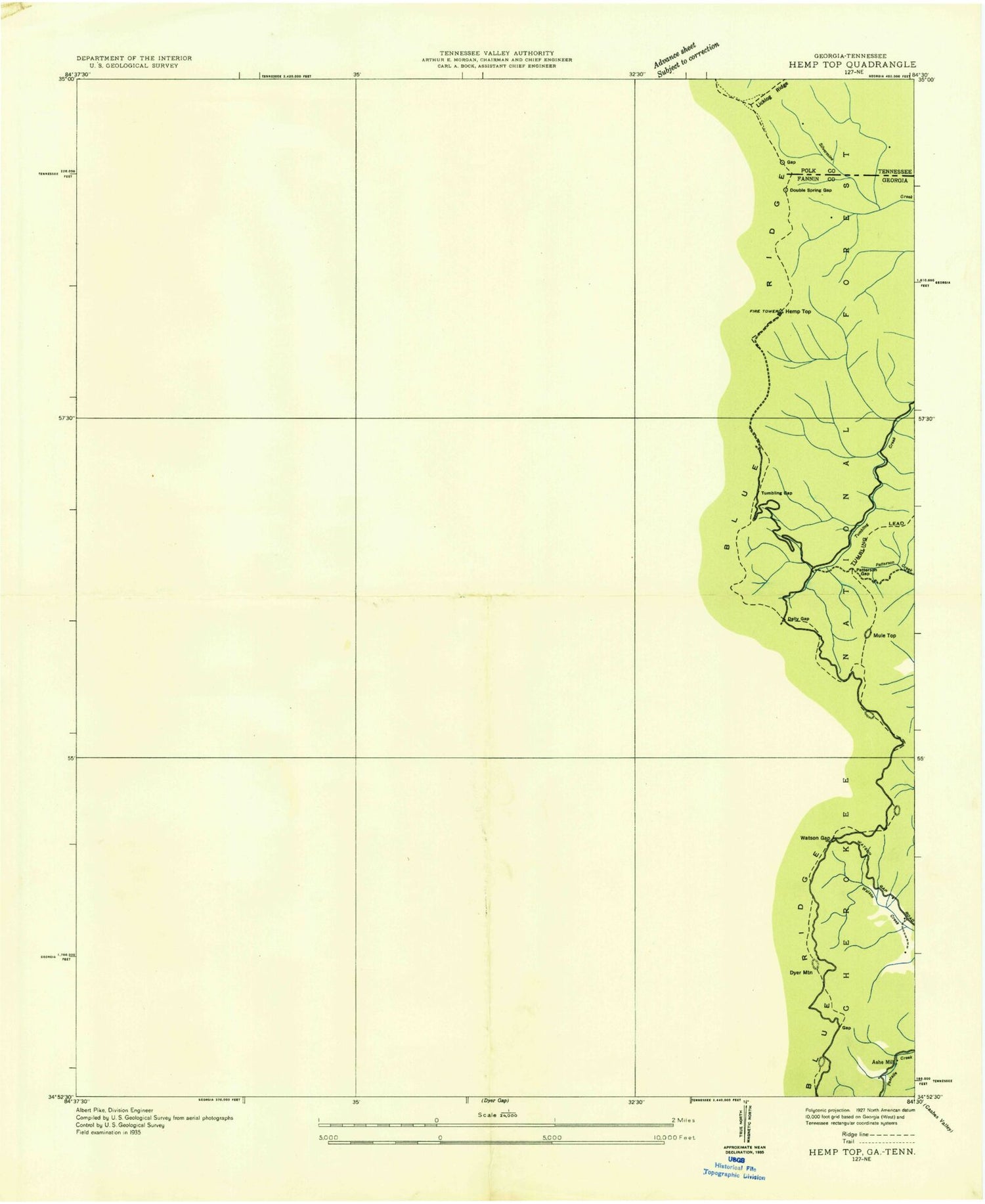
USGS Classic Hemp Top Georgia 7.5'x7.5' Topo Map
Couldn't load pickup availability
Historical USGS topographic quad map of Hemp Topin the states of Georgia, Tennessee. Scale: 1:24000. Print size: 24" x 27"
This quadrangle is in the following counties: Fannin, Murray, Polk.
The map contains contour lines, roads, rivers, towns, lakes, and grids including latitude / longitude and UTM / MGRS. Printed on high-quality waterproof paper with UV fade-resistant inks.
Contains the following named places: Barnes Gap, Bear Branch, Beech Bottom, Beech Creek, Bethlehem Church, Cowpen Mountain, Dally Gap, East Fork Beech Creek, Hemp Top, Hickory Ridge, Horseshoe Bend, Hurricane Branch, Jones Cemetery, Ken Mountain, Long Gap, Lost Branch, Lost Cove Branch, Mill Branch, Murray Creek, Panther Bluff, Panther Creek, Patterson Gap, Penitentiary Branch, Peter Cove, Poplar Camp Creek, Pounding Mill Branch, Rice Camp Branch, Rich Cove, Rich Cove Gap, Rockwall Branch, Rough Creek, Rough Ridge, South Fork Jacks River, Sugar Cove Branch, Tearbritches Creek, Walnut Creek, Watson Gap, West Fork Beech Creek, West Fork Jacks River, Foster Branch, Simmons Branch, Wilson Branch, Poplar Springs Gap, Indian Grave Gap, Rockwall Gap, Conasauga Creek, Pounding Mill Gap, Spanish Oak Gap, Crooked Dogwood Gap, Phillips Cove, Turkey Stand Lead, Bee Knob Gap, Van Arthur Lead, Wagon Road Ridge, Yellow Lead, Cohutta Wilderness, Beech Bottom Trail, Hemp Top Trail, Rice Camp Trail, Horseshoe Bend Trail, Cohutta Wildlife Management Area, Jacks River Trail, Hickory Creek Trail, Penitentiary Branch Trail, Hickory Ridge Trail, Sugar Cove Trail, Rough Ridge Trail, North Fork Thomas Creek, Horse Branch, East Cowpen Trail, Panther Creek Trail, Benton McKaye Trail, Conasauga River Trail, Tearbritches Trail, Buckeye Mountain, Dyer Mountain, Jones Mill (historical), Mule Top, Three Forks Mountain, South Fork Trail, Double Spring Gap, East Fork Beach Creek, Wilson Branch, Higdon-Mobile Division, Beech Bottom, East Fork Beech Creek, Murray Creek, West Fork Beech Creek, Wilson Gap, Bear Wallow, Cohutta Wilderness, Simmons Gap, Double Spring Gap, East Fork Beach Creek, Bear Wallow, Wilson Branch, Licklog Ridge, Hemp Top Trail