MyTopo
Classic USGS Henderson Bay New York 7.5'x7.5' Topo Map
Couldn't load pickup availability
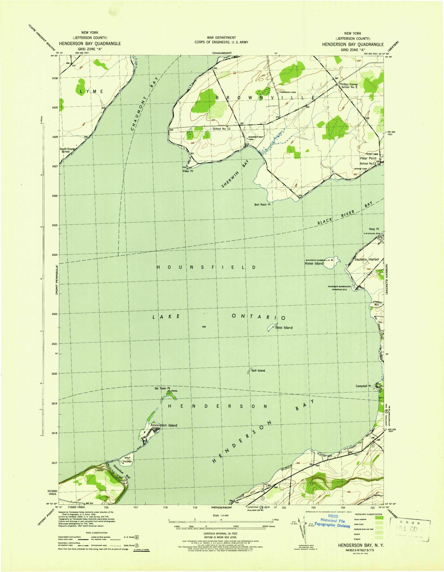
Historical USGS topographic quad map of Henderson Bay in the state of New York. Map scale may vary for some years, but is generally around 1:24,000. Print size is approximately 24" x 27"
This quadrangle is in the following counties: Jefferson.
The map contains contour lines, roads, rivers, towns, and lakes. Printed on high-quality waterproof paper with UV fade-resistant inks, and shipped rolled.
Contains the following named places: Association Island, Bass Island, Bedford Creek, Boultons Beach, Bull Rock Point, Campbell Point, Dexter Volunteer Fire Department Pillar Point Station 2, Everleigh Point, Ferry Cemetery, Gilmore Point, Gilmore Shore, Gull Island, Henderson Bay, Horse Island, Hoveys Island, Ingalls - Ingerson Cemetery, Lime Barrel Shoal, Madison Barracks Pumping Station, Marsh Point, Pillar Point, Reeds Bay, Sackets Harbor Battlefield State Park, Sackets Harbor Lighthouse, Sackets Harbor Police Department, Sackets Harbor Sewage Treatment Plant, School Number 11, School Number 12, School Number 5, Sherwin Bay, Sherwin Bay Cemetery, Sherwin Creek, Six Town Point, Snowshoe Bay, South Shore School, Stone Cemetery, The Willows Park, Town of Hounsfield, ZIP Code: 13693