MyTopo
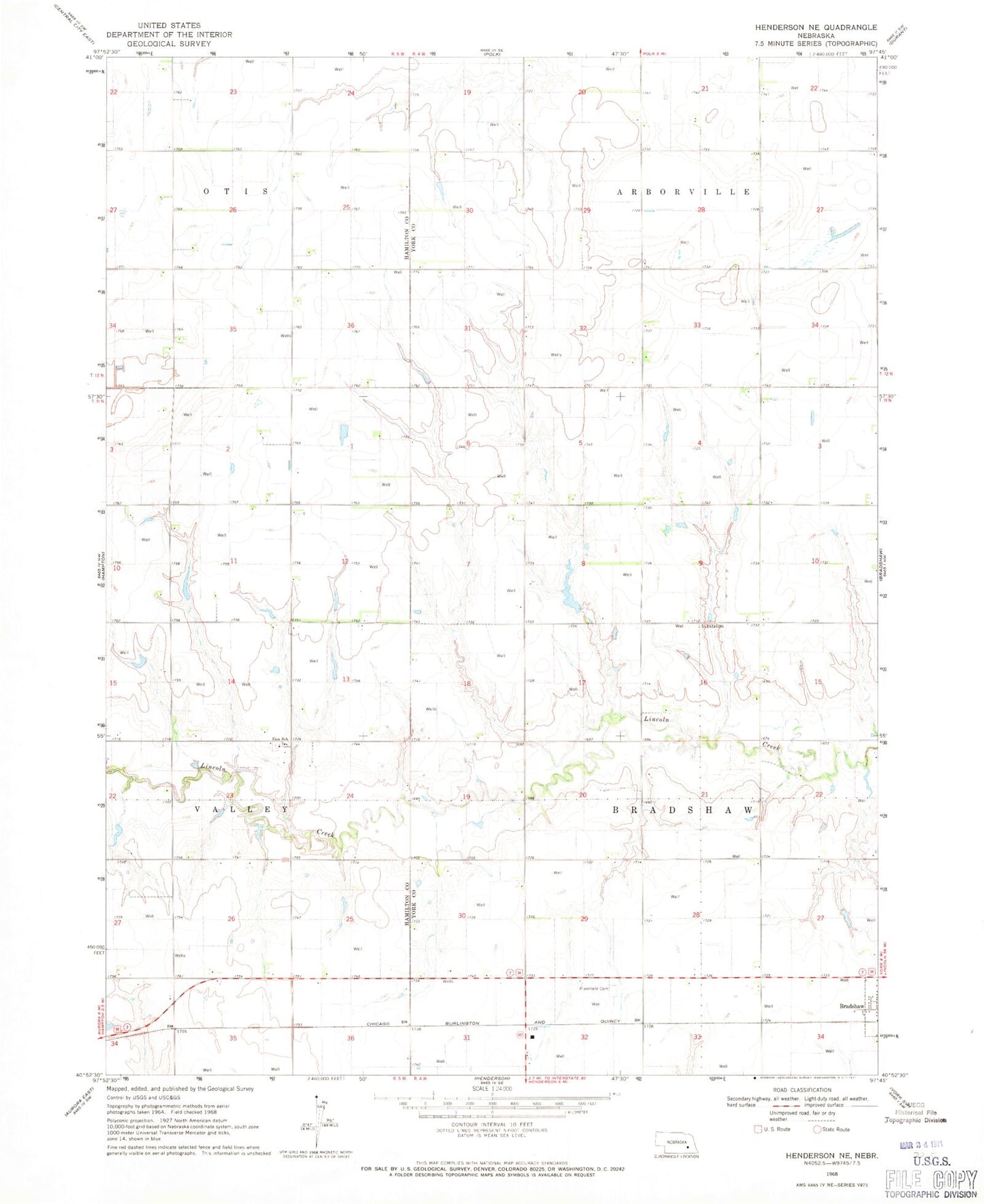
Classic USGS Henderson NE Nebraska 7.5'x7.5' Topo Map
Couldn't load pickup availability
Historical USGS topographic quad map of Henderson NE in the state of Nebraska. Map scale may vary for some years, but is generally around 1:24,000. Print size is approximately 24" x 27"
This quadrangle is in the following counties: Hamilton, York.
The map contains contour lines, roads, rivers, towns, and lakes. Printed on high-quality waterproof paper with UV fade-resistant inks, and shipped rolled.
Contains the following named places: Bradshaw Election Precinct, Driewer Reservoir, Driewer Reservoir Dam, Lundell Dam, Lundell Reservoir, Plainfield Cemetery, Rech-Smith Dam, Rech-Smith Reservoir, Stuhr Dam, Stuhr Reservoir, Township of Bradshaw, York County Waterfowl Production Area, Zion Lutheran Church, Zion School, ZIP Code: 68319