
MyTopo
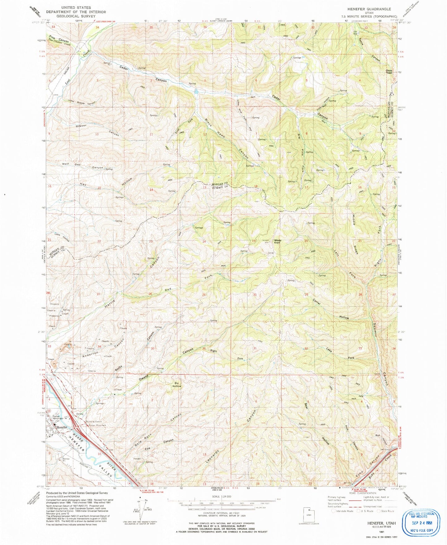
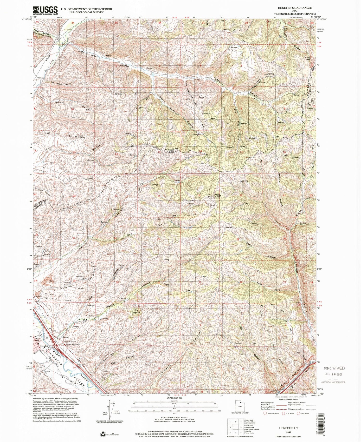
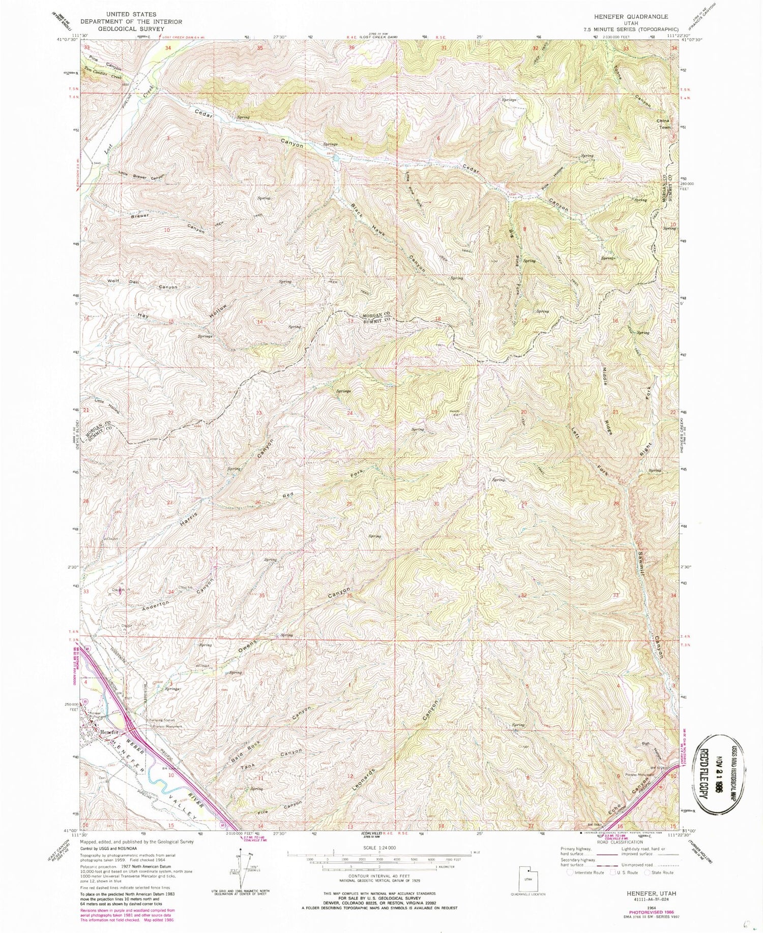
Classic USGS Henefer Utah 7.5'x7.5' Topo Map
Couldn't load pickup availability
Historical USGS topographic quad map of Henefer in the state of Utah. Map scale may vary for some years, but is generally around 1:24,000. Print size is approximately 24" x 27"
This quadrangle is in the following counties: Morgan, Summit.
The map contains contour lines, roads, rivers, towns, and lakes. Printed on high-quality waterproof paper with UV fade-resistant inks, and shipped rolled.
Contains the following named places: Anderton Canyon, Bald Rock Canyon, Bear Hollow, Big Pine Fork, Black Hawk Canyon, Brewer Canyon, Bull Hollow, Cedar Canyon, China Town, Fire Canyon, Henefer, Henefer Cemetery, Henefer Post Office, Henefer-Echo Wildlife Management Area, Left Fork Sawmill Canyon, Little Brewer Canyon, Little Pine Fork, Middle Ridge, North Summit EMS Ambulance, North Summit Fire District Station 22 Henefer, Owens Canyon, Pine Canyon, Pole Hollow, Red Fork, Right Fork Sawmill Canyon, The Church of Jesus Christ of Latter Day Saints, Tom Condies Creek, Town of Henefer, Windy Knoll, ZIP Code: 84024