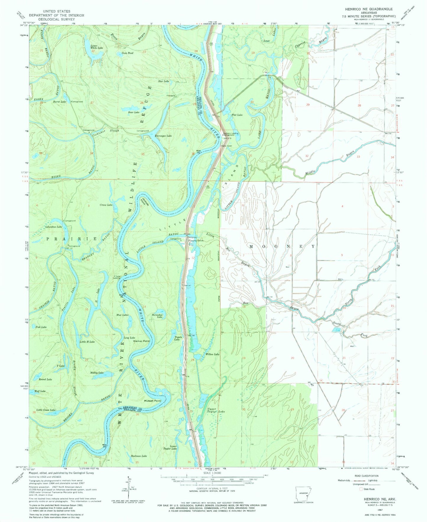
MyTopo
Classic USGS Henrico NE Arkansas 7.5'x7.5' Topo Map
Couldn't load pickup availability
Historical USGS topographic quad map of Henrico NE in the state of Arkansas. Map scale may vary for some years, but is generally around 1:24,000. Print size is approximately 24" x 27"
This quadrangle is in the following counties: Arkansas, Phillips.
The map contains contour lines, roads, rivers, towns, and lakes. Printed on high-quality waterproof paper with UV fade-resistant inks, and shipped rolled.
Contains the following named places: Bear Lake, Bee Bayou, Bradley Bayou, Brushy Slough, Burnt Lake, Cocklebur Slough, Columbus Lake, Crane Lake, Cypress Bayou, Escronges Lake, Fish Lake, Flat Lake, Girard Reach, Gum Pond, H Lake, H Lake Landing, Horseshoe Lake, Hudsons Landing Campground, Jackass Point, Lake Bayou, Little Bee Bayou, Little Goose Lake, Little H Lake, Little Island, Little Island Bayou, Long Lake, Lower White Lake, Middle Bayou, Mobley Lake, Mud Lakes, Mussell Point, North Fork Bee Bayou, Pennyson Lake, Prairie Lake, Round Lake, Scrubgrass Bayou, South Fork Bee Bayou, Star Lake, Steelman Lake, T Lake, Tupelo Lake, Upper Taylor Lake, Wamac Point, Willow Lake