MyTopo
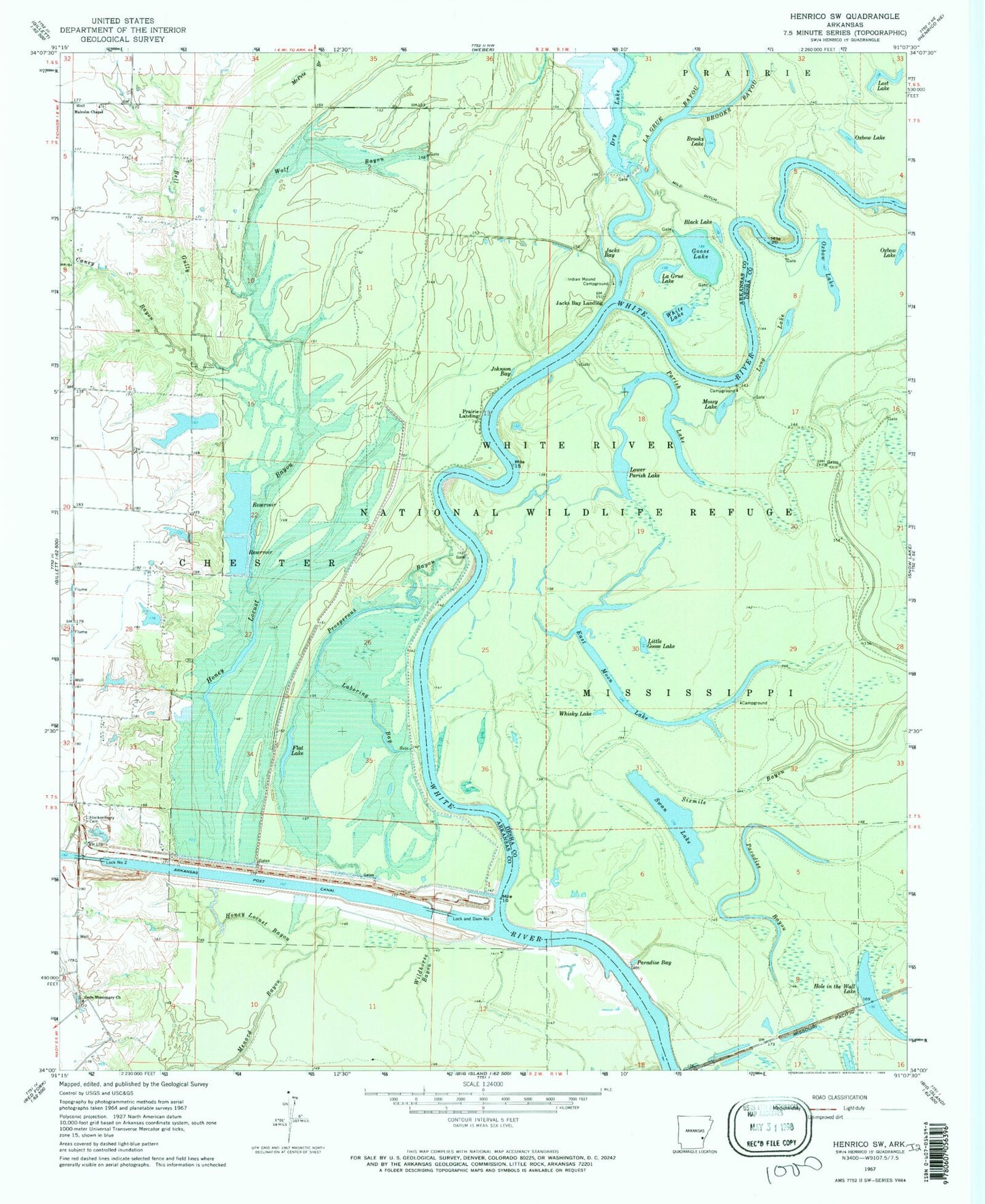
Classic USGS Henrico SW Arkansas 7.5'x7.5' Topo Map
Couldn't load pickup availability
Historical USGS topographic quad map of Henrico SW in the state of Arkansas. Typical map scale is 1:24,000, but may vary for certain years, if available. Print size: 24" x 27"
This quadrangle is in the following counties: Arkansas, Desha.
The map contains contour lines, roads, rivers, towns, and lakes. Printed on high-quality waterproof paper with UV fade-resistant inks, and shipped rolled.
Contains the following named places: Bell Gully, Caney Bayou, Gods Missionary Church, Hockenberry Cemetery, Honey Locust Bayou, Honey Locust Bayou, Jacks Bay, Johnson Bay, Laboring Bay, Malcolm Chapel, McPete Branch, Menard Bayou, Mild Ditch, Paradise Bay, Paradise Bayou, Prosperous Bayou, Wildhorse Bayou, Wolf Bayou, Prairie Landing, Buffalo Bend, Carolina Point, Cow Pen Bend, Fairview School (historical), Bonner Chapel Cemetery, Seventh Day Church (historical), Township of Chester, Black Lake, Brooks Lake, East Moon Lake, Flat Lake, Goose Lake, Hole in the Wall Lake, La Grue Lake, Little Goose Lake, Lock and Dam Number 1, Long Lake, Lower Parish Lake, Mossy Lake, Parish Lake, Swan Lake, Whisky Lake, White Lake, Jacks Bay Landing, La Grue Bayou, Lost Lake, Oxbow Lake, Oxbow Lake, Oxbow Lake, Norrell Lock and Dam, Arkansas Post Canal Reservoir, Dry Lake Dam, Dry Lake, Whiting Reservoir Dam, Whiting Lake, Lock Number 2