MyTopo
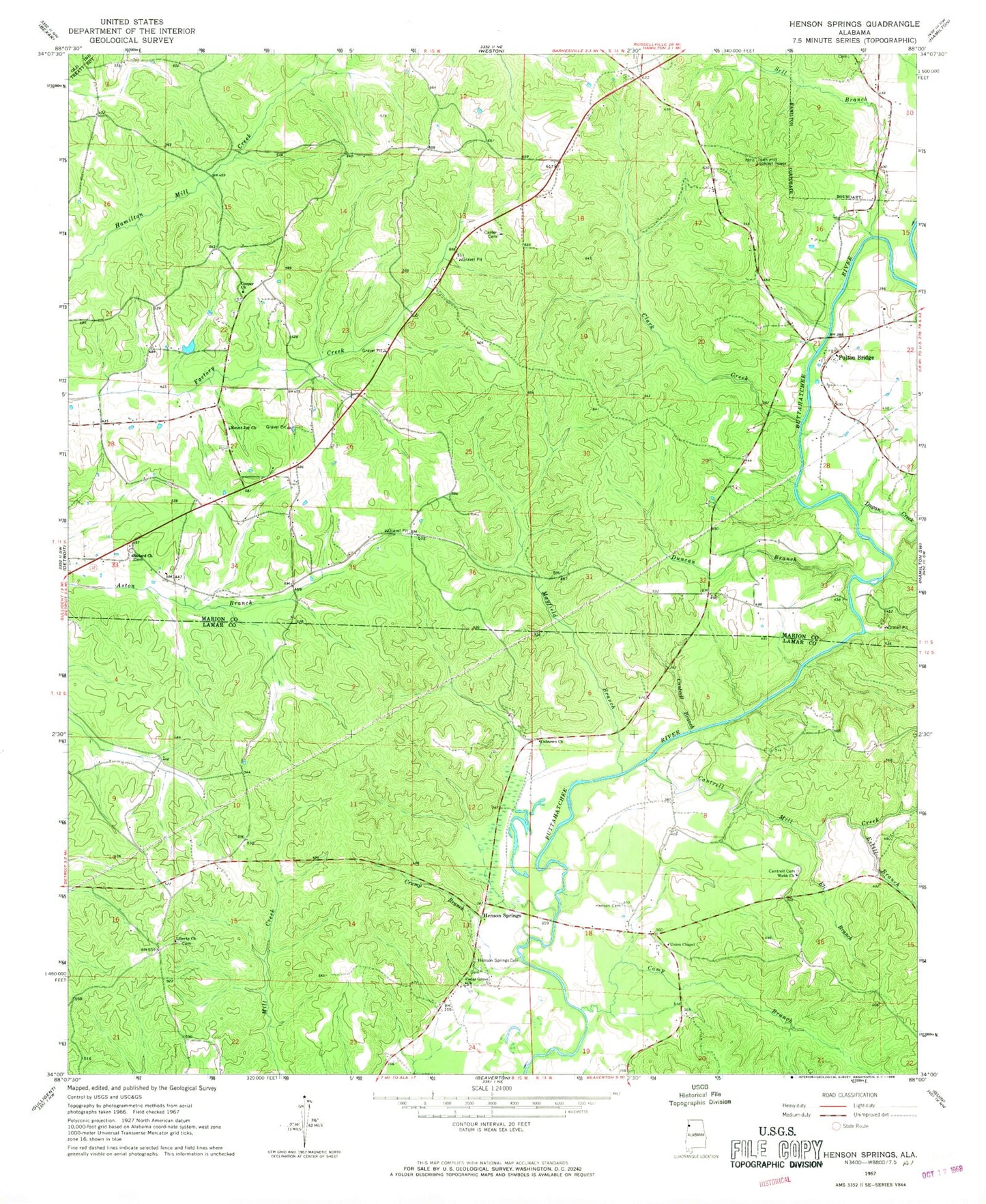
Classic USGS Henson Springs Alabama 7.5'x7.5' Topo Map
Couldn't load pickup availability
Historical USGS topographic quad map of Henson Springs in the state of Alabama. Map scale may vary for some years, but is generally around 1:24,000. Print size is approximately 24" x 27"
This quadrangle is in the following counties: Lamar, Marion.
The map contains contour lines, roads, rivers, towns, and lakes. Printed on high-quality waterproof paper with UV fade-resistant inks, and shipped rolled.
Contains the following named places: Ballard Cemetery, Ballard Freewill Baptist Church, Bishop Cemetery, Camp Branch, Cantrell Branch, Cantrell Cemetery, Cantrell Family Cemetery, Cantrell Mill Creek, Carter Cemetery, Carter Methodist Church, Cedar Grove Church, Clark Creek, Cobtown Church, Cooper Cemetery, Cooper Freewill Baptist Church, Crump Branch, Crump Cemetery, Dugan Creek, Duncan Branch, East Detroit Oil and Gas Field, Eli Branch, Estill Branch, Evins Ferry, Fulton Bridge, Fulton Bridge Cemetery, Fulton Bridge Missionary Baptist Church, Henson Cemetery, Henson Spring, Henson Springs, Henson Springs Cemetery, Henson Springs Fire Department, Henson Springs Oil Field, Liberty Cemetery, Liberty Church, Mayfield Branch, Metcalf Ferry, Mount Joy Church, Sell Branch, Town Hill Lookout Tower, Union Chapel, Webb Church