
MyTopo
Classic USGS Hentown Georgia 7.5'x7.5' Topo Map
Couldn't load pickup availability
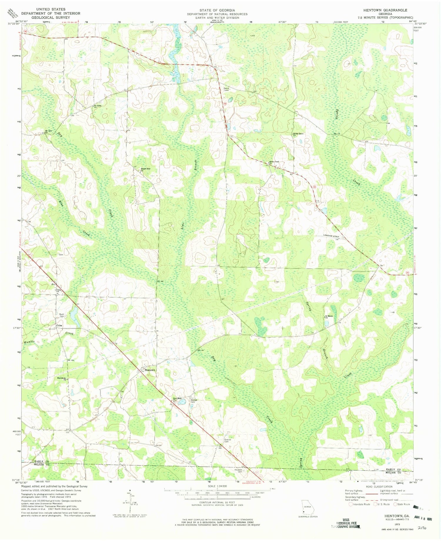
Historical USGS topographic quad map of Hentown in the state of Georgia. Map scale may vary for some years, but is generally around 1:24,000. Print size is approximately 24" x 27"
This quadrangle is in the following counties: Early, Miller.
The map contains contour lines, roads, rivers, towns, and lakes. Printed on high-quality waterproof paper with UV fade-resistant inks, and shipped rolled.
Contains the following named places: Blue Creek, Bright Star Church, Bush Cemetery, Cuba, Cuba Church, Dry Creek, Dubose Cemetery, Dubose Methodist Church, Early County Fire Department Cuba Station, Five Bridge, George Cemetery, Glendale School, Hentown, Hentown Church of Christ, Houston Cemetery, Liberty Hill Cemetery, Liberty Hill School, Lime Branch, Macedonia Church, Maddox Lake, Maddox Lake Dam, Mount Airy Church, New Hope, New Hope Church, New Hope School, Oak Grove School, Saint Johns Church, Saint Johns School, Saint Marys Church, Spring Branch, Wamble Creek, WDKZ-FM (Blakely), White Pond Church, Willis Grove Church


