MyTopo
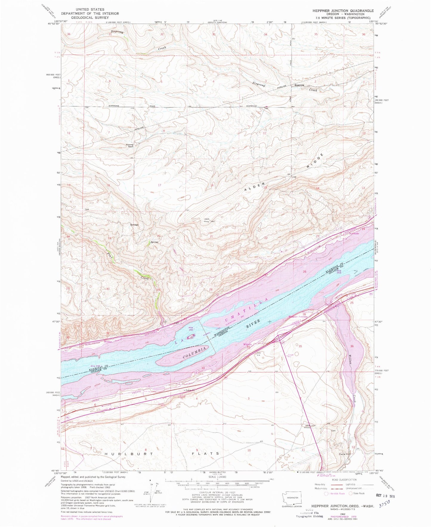
Classic USGS Heppner Junction Oregon 7.5'x7.5' Topo Map
Regular price
$16.95
Regular price
Sale price
$16.95
Unit price
per
Couldn't load pickup availability
Historical USGS topographic quad map of Heppner Junction in the states of Oregon, Washington. Map scale may vary for some years, but is generally around 1:24,000. Print size is approximately 24" x 27"
This quadrangle is in the following counties: Gilliam, Klickitat, Morrow.
The map contains contour lines, roads, rivers, towns, and lakes. Printed on high-quality waterproof paper with UV fade-resistant inks, and shipped rolled.
Contains the following named places: Coyote Creek, Harriet, Heppner Junction, McCredie, Moona, Moonax, Pine Creek, Pine Creek Treaty Fishing Access Site, Sixprong, Sixprong Ranch, Willow Creek, Willow Lake, Willows, Willows Post Office