MyTopo
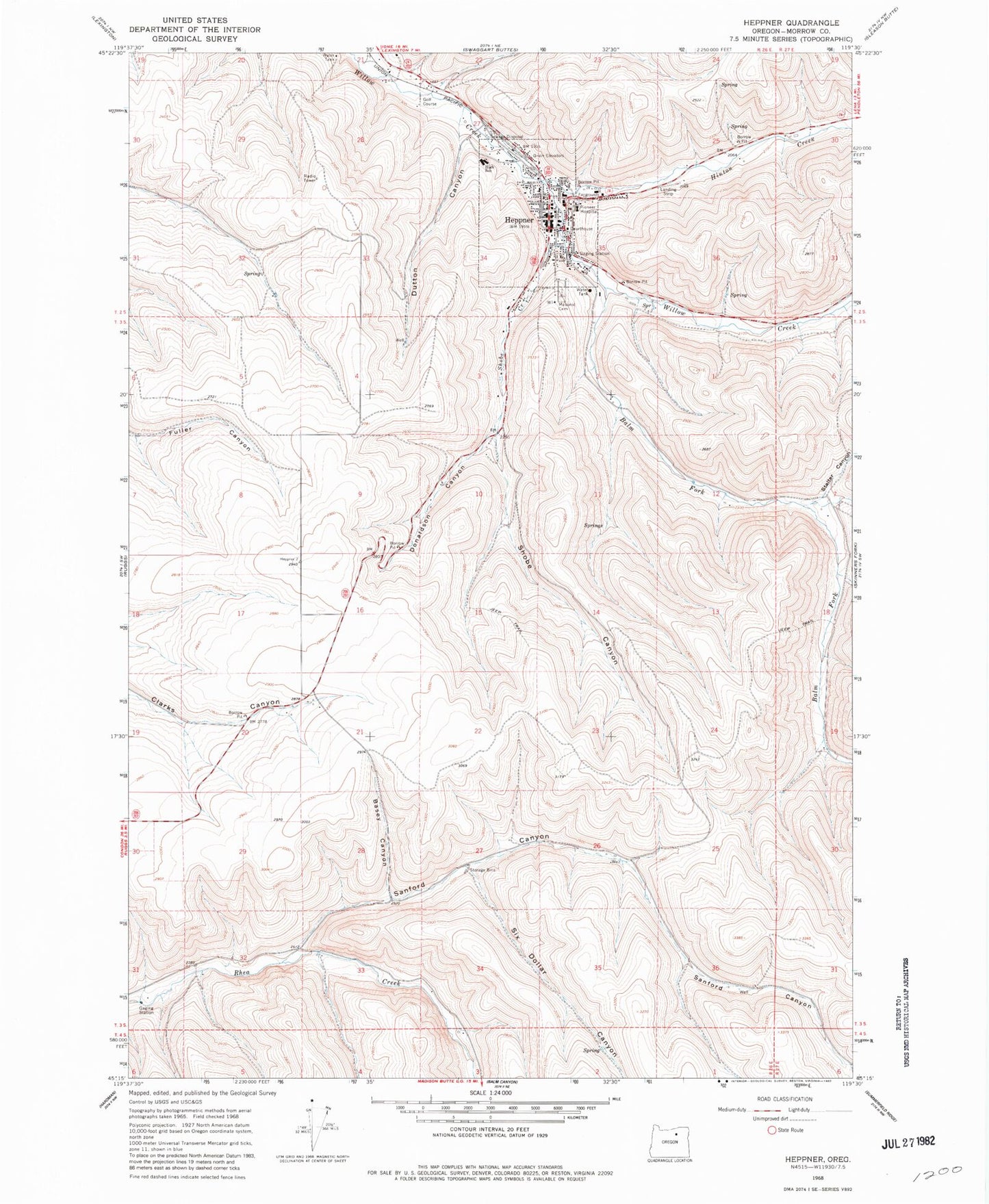
Classic USGS Heppner Oregon 7.5'x7.5' Topo Map
Couldn't load pickup availability
Historical USGS topographic quad map of Heppner in the state of Oregon. Map scale may vary for some years, but is generally around 1:24,000. Print size is approximately 24" x 27"
This quadrangle is in the following counties: Morrow.
The map contains contour lines, roads, rivers, towns, and lakes. Printed on high-quality waterproof paper with UV fade-resistant inks, and shipped rolled.
Contains the following named places: Balm Fork, Basey Canyon, City of Heppner, City of Heppner Fire Department, City Park, Department of Motor Vehicles Heppner, Donaldson Canyon, Dutton Canyon, Hager Park, Heppner, Heppner City Hall, Heppner Elementary School, Heppner Junior - Senior High School, Heppner Justice Court, Heppner Police Department, Heppner Post Office, Heppner Public Works Department, Heppner Ranger Station, Heppner Wastewater Treatment Plant, Heritage Park, Hinton Creek, Masonic Cemetery, Morrow County Agriculture Museum, Morrow County Courthouse, Morrow County Fairgrounds, Morrow County Fairgrounds Rodeo Arena, Morrow County Health Department Office, Morrow County Law Library, Morrow County Museum, Morrow County Sheriff's Office, Oregon Trail Library District Heppner Branch Library, Pioneer Memorial Hospital, Sanford Canyon, Shobe Canyon, Shobe Creek, Six Dollar Canyon, Soocup Canyon, Stalter Canyon, United States Forest Service Guard Station, Veterans Mini Park, Willow Creek Dam, Willow Creek Lake Boat Ramp, Willow Creek Reservoir