MyTopo
Classic USGS Herbine Arkansas 7.5'x7.5' Topo Map
Couldn't load pickup availability
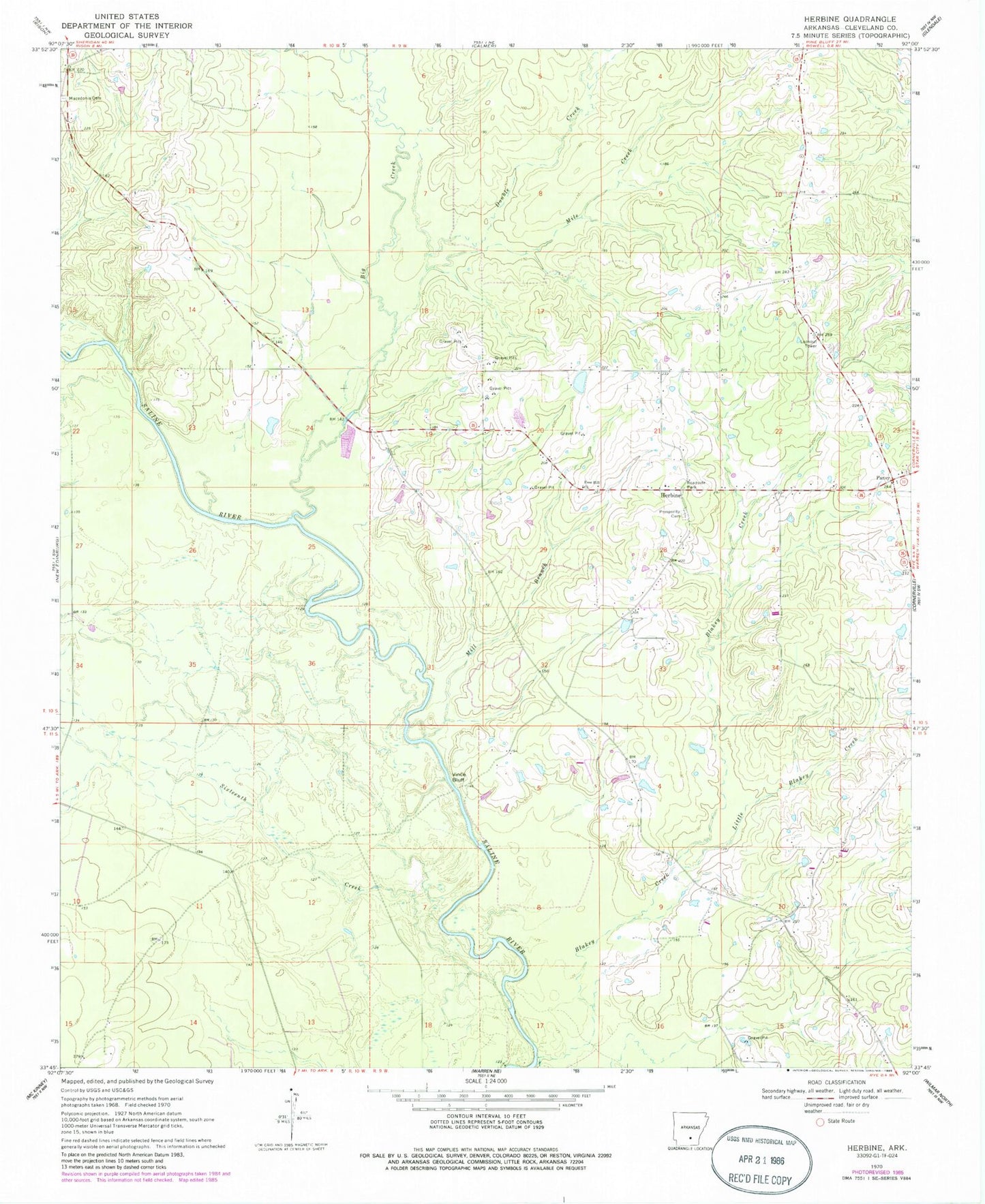
Historical USGS topographic quad map of Herbine in the state of Arkansas. Map scale may vary for some years, but is generally around 1:24,000. Print size is approximately 24" x 27"
This quadrangle is in the following counties: Cleveland.
The map contains contour lines, roads, rivers, towns, and lakes. Printed on high-quality waterproof paper with UV fade-resistant inks, and shipped rolled.
Contains the following named places: Big Creek, Blakey Creek, Bridge Creek, Double Creek, Free Hill Church, Herbine, Highway 35 Volunteer Fire Department, Little Blakey Creek, Macedonia Cemetery, McKinney, Mile Creek, Mill Branch, Pansy, Pansy Volunteer Fire Department, Prosperity Cemetery, Ripley, Schultz Lake, Schultz Lake Dam, Sixteenth Creek, Township of Harper, Township of Hurricane, Vince Bluff