
MyTopo
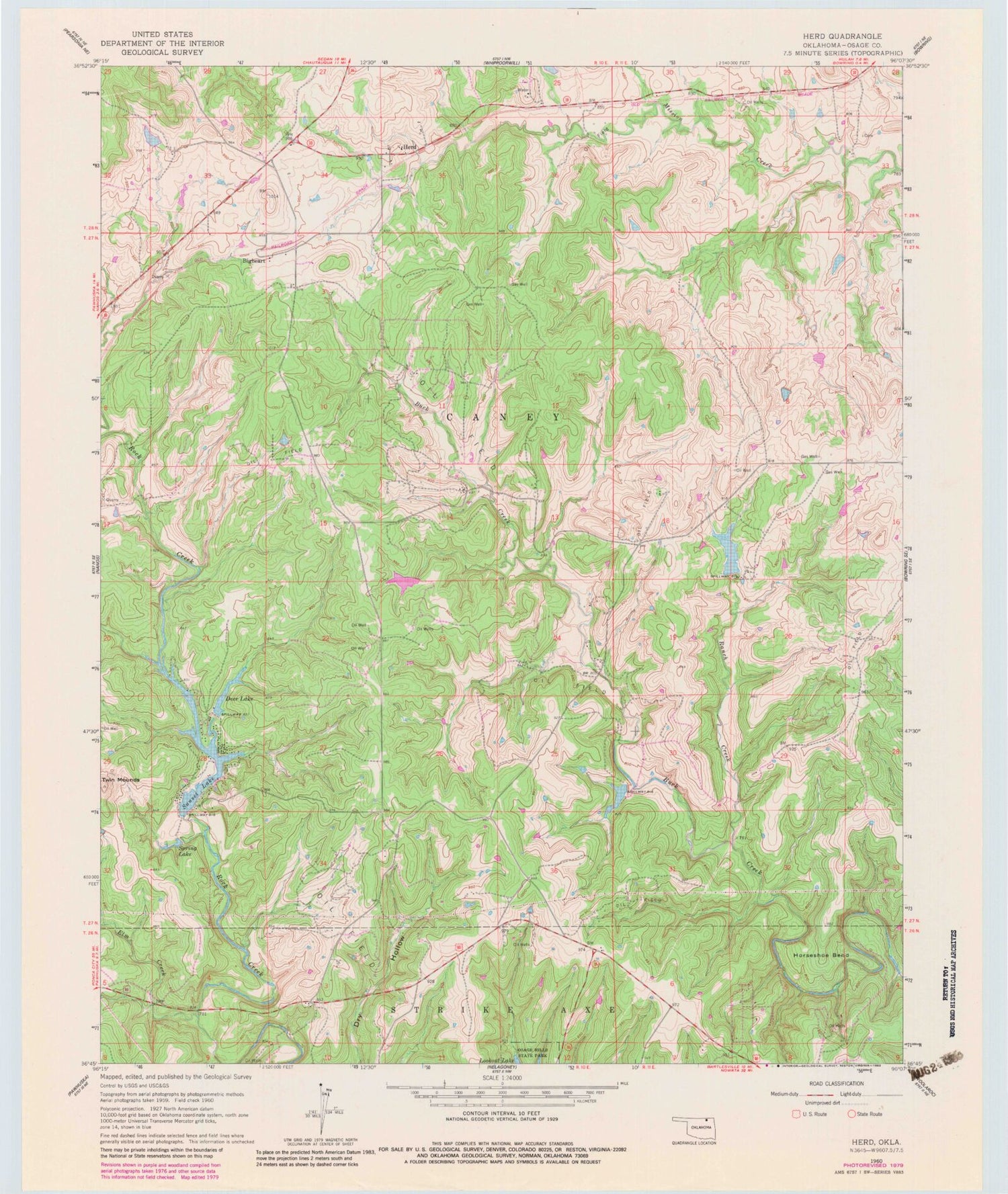
Classic USGS Herd Oklahoma 7.5'x7.5' Topo Map
Couldn't load pickup availability
Historical USGS topographic quad map of Herd in the state of Oklahoma. Map scale may vary for some years, but is generally around 1:24,000. Print size is approximately 24" x 27"
This quadrangle is in the following counties: Osage.
The map contains contour lines, roads, rivers, towns, and lakes. Printed on high-quality waterproof paper with UV fade-resistant inks, and shipped rolled.
Contains the following named places: Bigheart, Deer Lake, Deer Lake Dam, Elm Creek, Herd, Horseshoe Bend, Moore Cemetery, Oknoname 113032 Dam, Oknoname 113032 Reservoir, Oknoname 113094 Dam, Oknoname 113094 Reservoir, Oknoname 113095 Dam, Oknoname 113095 Reservoir, Oknoname 113096 Dam, Oknoname 113096 Reservoir, Oknoname 113097 Dam, Oknoname 113097 Reservoir, Oknoname 113098 Dam, Oknoname 113098 Reservoir, Oknoname 113099 Dam, Oknoname 113099 Reservoir, Pawhuska Division, Ranch Creek, Spring Lake, Sunset Lake, Sunset Lake Dam, Twin Mounds


