MyTopo
Classic USGS Hereford Arizona 7.5'x7.5' Topo Map
Couldn't load pickup availability
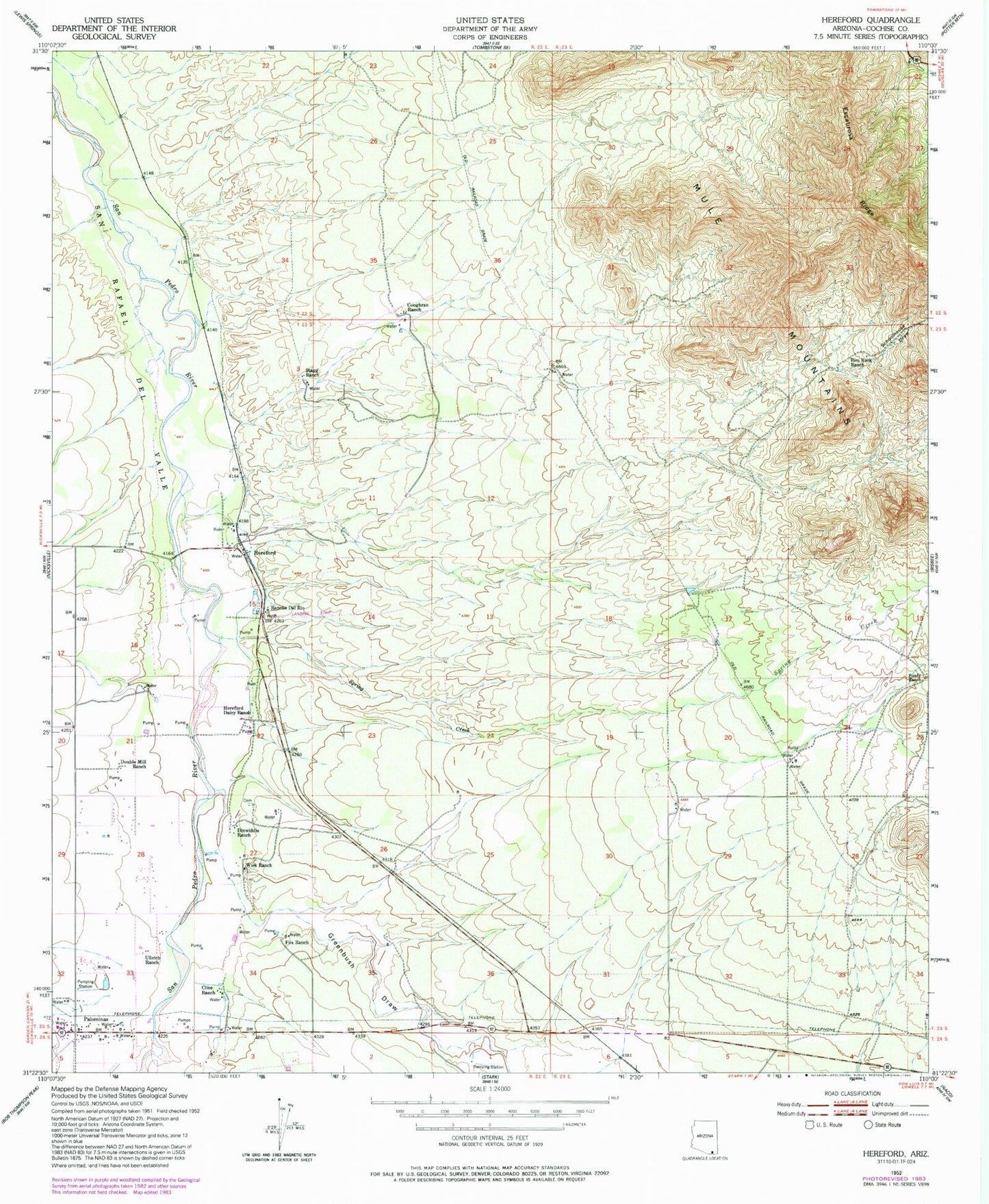
Historical USGS topographic quad map of Hereford in the state of Arizona. Map scale may vary for some years, but is generally around 1:24,000. Print size is approximately 24" x 27"
This quadrangle is in the following counties: Cochise.
The map contains contour lines, roads, rivers, towns, and lakes. Printed on high-quality waterproof paper with UV fade-resistant inks, and shipped rolled.
Contains the following named places: Banning Creek, Bisbee Division, Cline Ranch, Coughran Ranch, Dinwiddie Ranch, Double Mill Ranch, Foudy Ranch, Fox Ranch, Greenbush Draw, Hereford, Hereford Dairy Ranch, Hereford Road Bridge, Lehner Mammoth-Kill Site, Palominas, Palominas Census Designated Place, Palominas Elementary School, Palominas Fire District Station 191, Palominas Post Office, Rancho del Rio, Rim Rock Ranch, San Pedro, San Rafael del Valle, Schoolhouse Draw, Spring Creek, Stagg Ranch, Stark Overpass, Thompson International Aviation Airport, Ullrich Ranch, Wiek Ranch