MyTopo
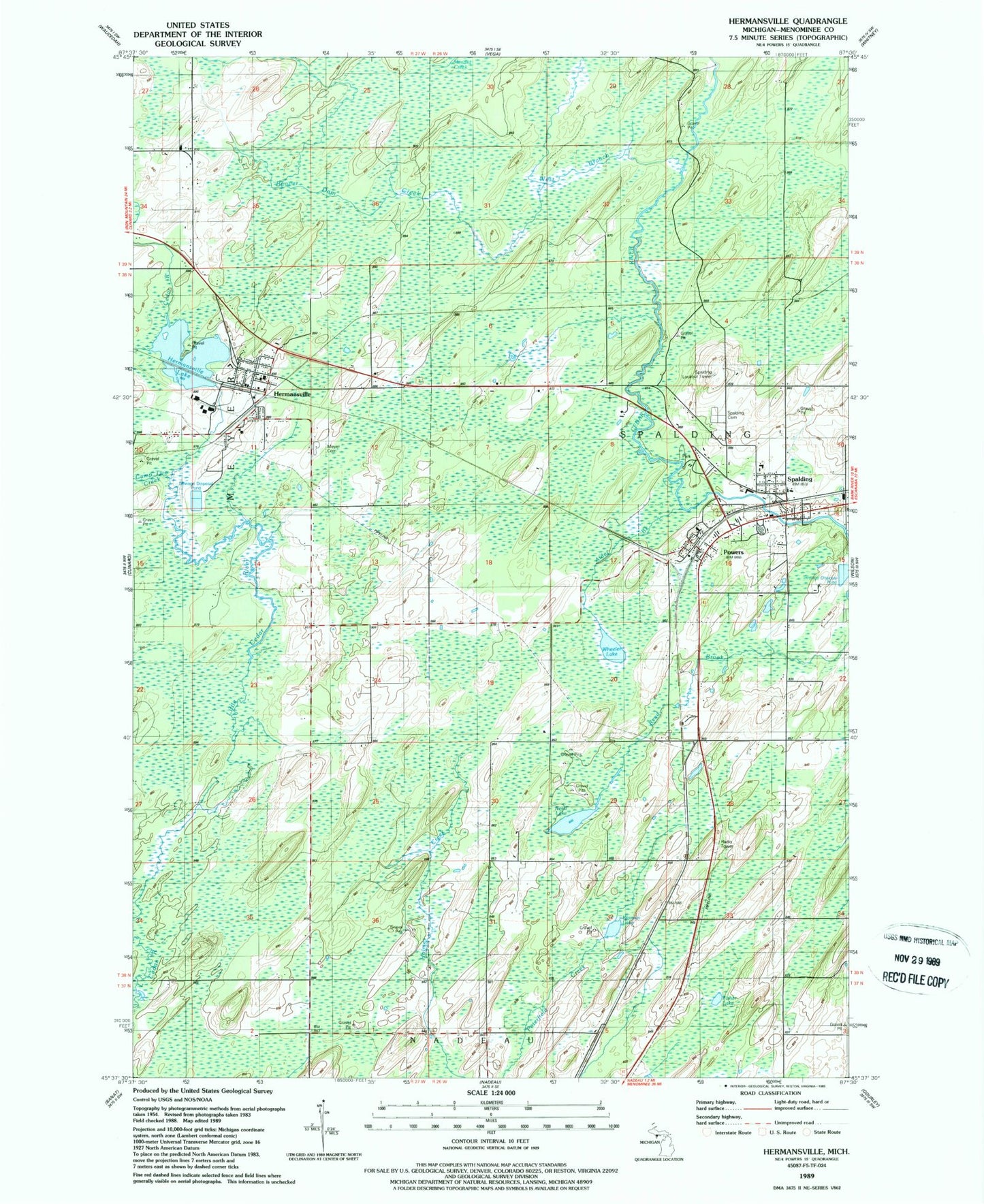
Classic USGS Hermansville Michigan 7.5'x7.5' Topo Map
Couldn't load pickup availability
Historical USGS topographic quad map of Hermansville in the state of Michigan. Map scale may vary for some years, but is generally around 1:24,000. Print size is approximately 24" x 27"
This quadrangle is in the following counties: Menominee.
The map contains contour lines, roads, rivers, towns, and lakes. Printed on high-quality waterproof paper with UV fade-resistant inks, and shipped rolled.
Contains the following named places: Alder Brook, Beaver Dam Creek, Camp Two Creek, English Post Office, English Station, First United Methodist Church, Fisher Lake, Grace Evangelical Lutheran Church, Hermansville, Hermansville Branch Library, Hermansville Census Designated Place, Hermansville Historical Marker, Hermansville Lake, Hermansville Post Office, Hermansville Rescue Squad and Ambulance Service, Hermansville Station, IXL Historical Museum, Kloman Lake, Meyer Cemetery, Meyer Township Volunteer Fire Department, Nadeau Mission, North Central Elementary School, North Central Junior/Senior High School, Northern Menominee Health Center, OSF Medical Group, Powers, Powers Police Department, Powers Post Office, Powers Station, Reed Lake, Saint John Neumann Church, Spalding, Spalding Cemetery, Spalding Lookout Tower, Spalding Post Office, Spalding Station, Spalding Township Volunteer Fire Department, Veterans Memorial Park, Village of Powers, West Branch Cedar River, Wheeler Lake, ZIP Code: 49886