MyTopo
Classic USGS Hermit Butte California 7.5'x7.5' Topo Map
Couldn't load pickup availability
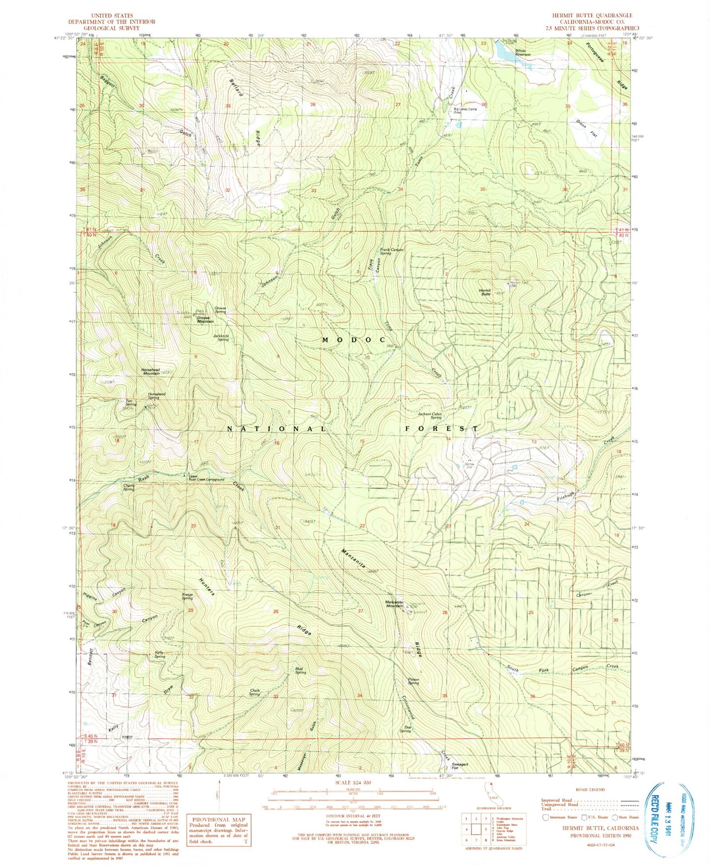
Historical USGS topographic quad map of Hermit Butte in the state of California. Map scale may vary for some years, but is generally around 1:24,000. Print size is approximately 24" x 27"
This quadrangle is in the following counties: Modoc.
The map contains contour lines, roads, rivers, towns, and lakes. Printed on high-quality waterproof paper with UV fade-resistant inks, and shipped rolled.
Contains the following named places: Ballard Ridge, Big Lakes Camp, California Department of Forestry and Fire Protection Lassen Modoc Unit Deer Springs, Chalk Spring, Cherry Spring, Deer Springs Fire Protection District, Dixon Flat, Doe Spring, Frank Canyon Spring, Grouse Mountain, Grouse Spring, Head of Rush Creek Campground, Hermit Butte, Horsehead Mountain, Horsehead Spring, Hunters Ridge, Jackknife Spring, Jackson Cabin Spring, Johnson Gulch, Kelly Spring, Kresge Spring, Manzanita Mountain, Manzanita Ridge, Mud Spring, Poison Spring, Two Spring, Upper Rush Creek Campground, White 151 Dam, White Reservoir