MyTopo
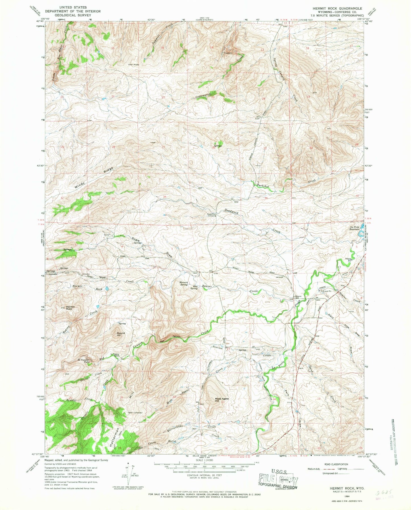
Classic USGS Hermit Rock Wyoming 7.5'x7.5' Topo Map
Couldn't load pickup availability
Historical USGS topographic quad map of Hermit Rock in the state of Wyoming. Map scale may vary for some years, but is generally around 1:24,000. Print size is approximately 24" x 27"
This quadrangle is in the following counties: Converse.
The map contains contour lines, roads, rivers, towns, and lakes. Printed on high-quality waterproof paper with UV fade-resistant inks, and shipped rolled.
Contains the following named places: Beaver Creek, Beaver School, Boulder Creek, Cottonwood Creek Prospect, Crazy Horse Creek, Crazy Horse Ditch, Cross Draw, Dead Man Crossing, Deadwood Creek, Dogie Draw, Elsie Dam, Elsie Reservoir, Granite Creek, Hart Draw, Hatterman Hill, Hermit Rock, Hermit Rock Creek, Hermit Rock Valley Ditch, Howard Spring, Le Vasseur Falls, Le Vasseur Ranch, Moss Agate Creek, Moss Agate Hill, Olin Brothers Property Mine, Park Draw, Rattlesnake Creek, Red Canyon, Red Canyon Creek, Rice Spring, Robert Curtis Dam, Robert Curtis Reservoir, Round Hill, Sand Creek, Sawmill Creek, Semino Creek, Spring Canyon Creek, Station Creek, William A Cross Ranch Mine