
MyTopo
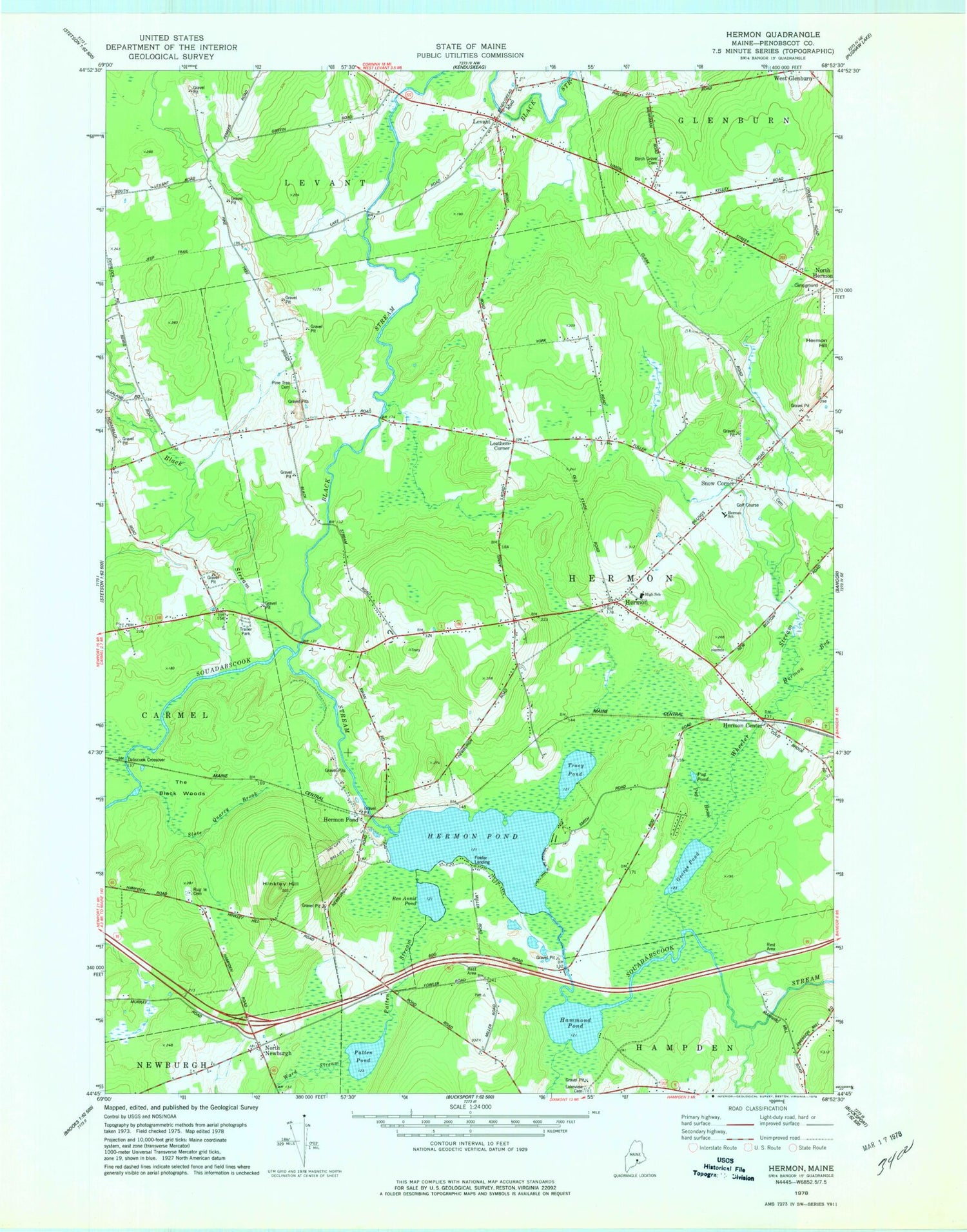
Classic USGS Hermon Maine 7.5'x7.5' Topo Map
Couldn't load pickup availability
Historical USGS topographic quad map of Hermon in the state of Maine. Map scale may vary for some years, but is generally around 1:24,000. Print size is approximately 24" x 27"
This quadrangle is in the following counties: Penobscot.
The map contains contour lines, roads, rivers, towns, and lakes. Printed on high-quality waterproof paper with UV fade-resistant inks, and shipped rolled.
Contains the following named places: Ben Annis Pond, Birch Grove Cemetery, Black Stream, Dabscook Crossover, Fowler Landing, George Pond, Griffin Field, Hammond Pond, Hermon, Hermon Baptist Church, Hermon Center, Hermon Creative Playground, Hermon Fire Department, Hermon High School, Hermon Meadows Golf Club, Hermon Middle School, Hermon Pond, Hermon Pond Cemetery, Hermon Volunteer Rescue Ambulance, Hinkley Hill, Lakeview Cemetery, Leathers Corner, Levant, Levant Consolidated School, Levant Heritage Library, Levant Post Office, Levant Village Baptist Church, Miller's Field, North Carmel Cemetery, North Hermon, North Newburgh, North Star Christian School, Patricia A Duran School, Patten Pond, Patten Stream, Pine Tree Cemetery, Pleasant Hill Campground, Pug Brook, Pug Pond, Ruggles Cemetery, Slate Quarry Brook, Snow Corner, Snows Corner Cemetery, Suzanne Smith Elementary School, The Black Woods, Town of Hermon, Tracy Pond, Ward Stream, West Branch Souadabscook Stream, Wheeler Stream, Wheeler Stream Camping Area


