MyTopo
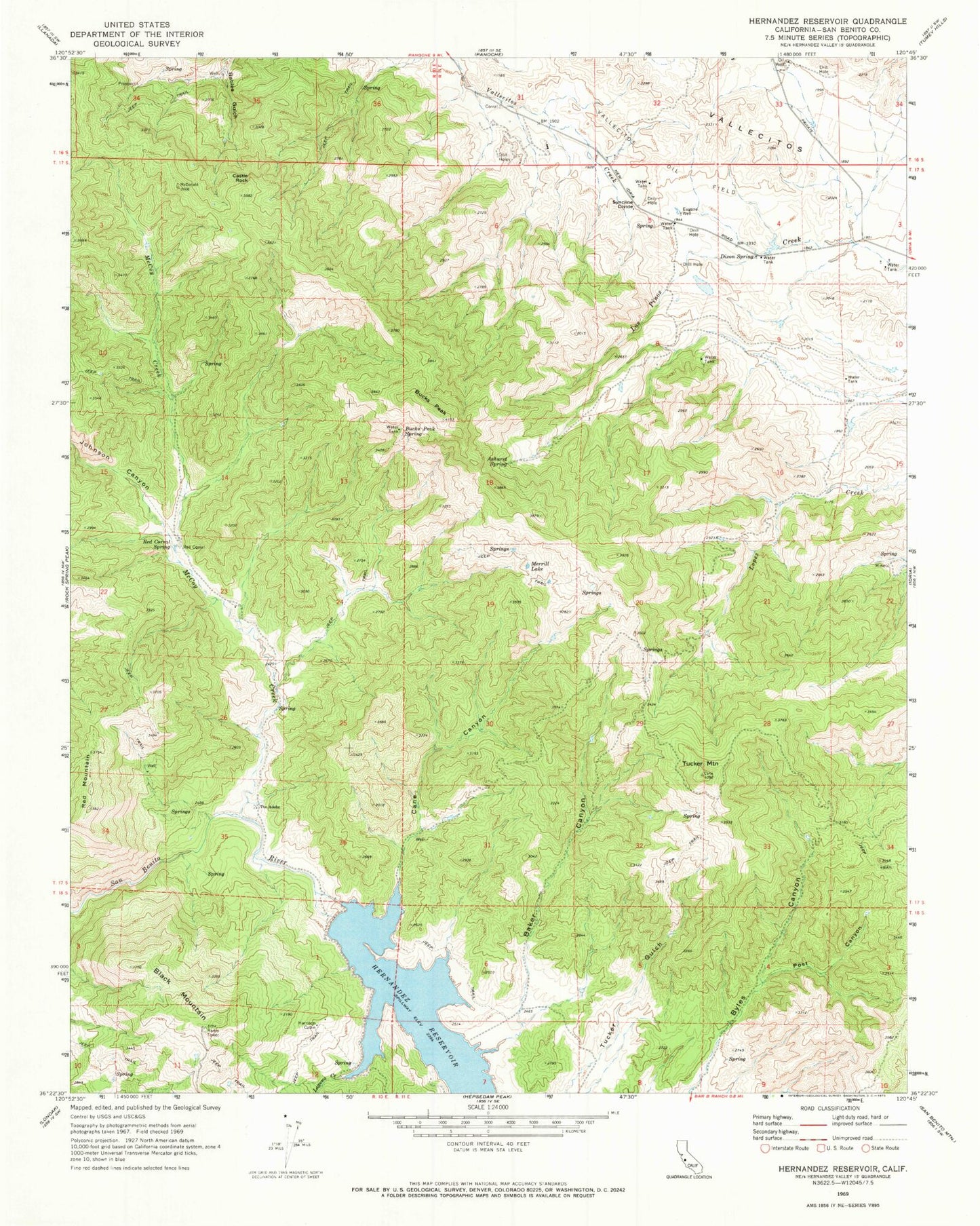
Classic USGS Hernandez Reservoir California 7.5'x7.5' Topo Map
Couldn't load pickup availability
Historical USGS topographic quad map of Hernandez Reservoir in the state of California. Map scale may vary for some years, but is generally around 1:24,000. Print size is approximately 24" x 27"
This quadrangle is in the following counties: San Benito.
The map contains contour lines, roads, rivers, towns, and lakes. Printed on high-quality waterproof paper with UV fade-resistant inks, and shipped rolled.
Contains the following named places: Ashurst Spring, Baker Canyon, Black Mountain, Bucks Peak, Bucks Peak Spring, Cane Canyon, Castle Rock, Dogwood Lateral Six, Eugene Well, Harrison Cabin, Hernandez 1025-002 Dam, Hernandez Reservoir, Johnson Canyon, Laguna Creek, McCoy Creek, Merrill Lake, Post Canyon, Red Corral, Red Corral Spring, Red Mountain, Syncline Divide, The Adobe, Tucker Mountain