MyTopo
Classic USGS Herndon California 7.5'x7.5' Topo Map
Couldn't load pickup availability
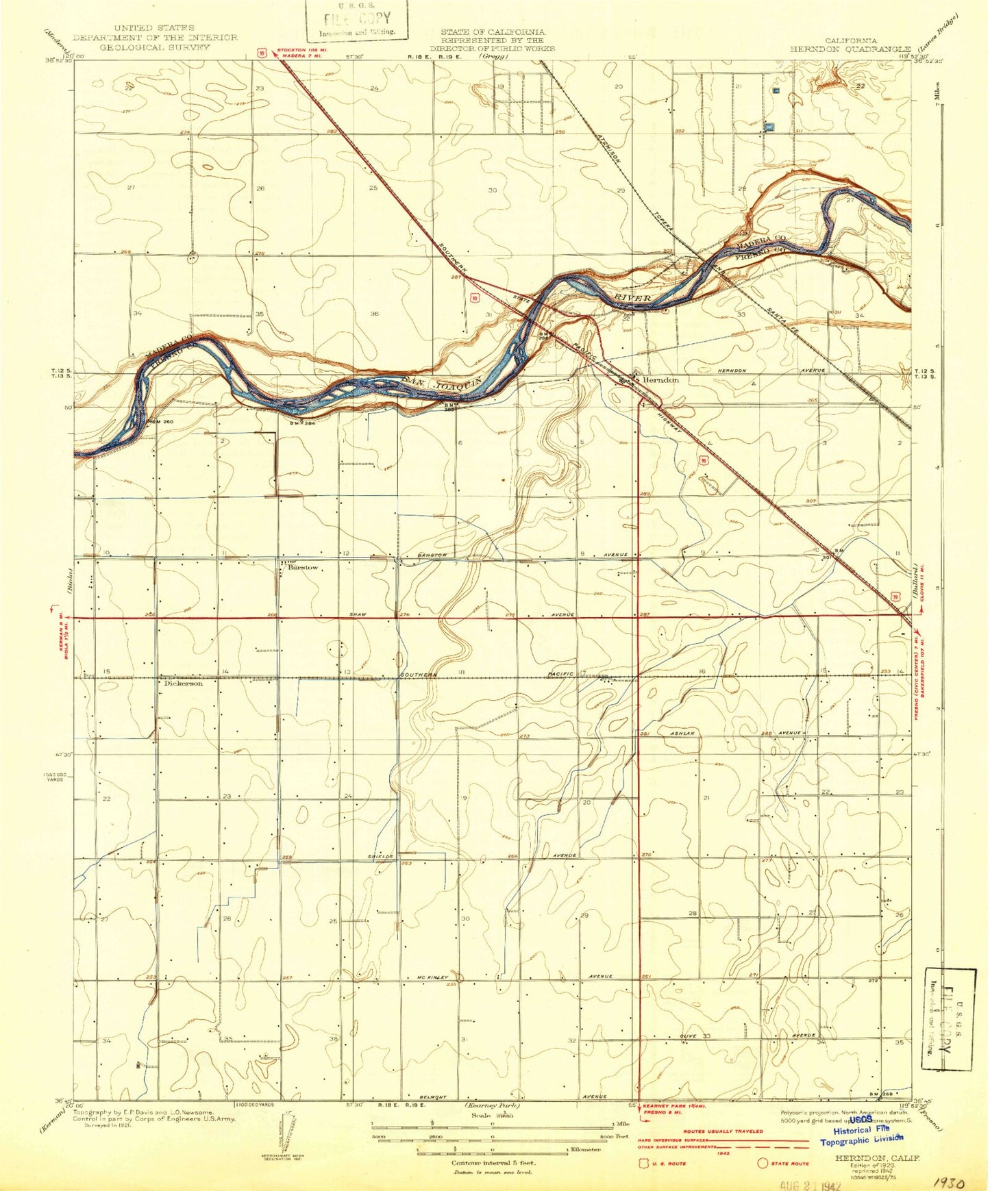
Historical USGS topographic quad map of Herndon in the state of California. Map scale may vary for some years, but is generally around 1:24,000. Print size is approximately 24" x 27"
This quadrangle is in the following counties: Fresno, Madera.
The map contains contour lines, roads, rivers, towns, and lakes. Printed on high-quality waterproof paper with UV fade-resistant inks, and shipped rolled.
Contains the following named places: Ambassador Baptist Church, Austin Ditch, Barcus Ditch, Barstow, Calvary Missionary Baptist Church, Central High School, Dickerson, Divine Master Convent, Epstein Canal, First Spanish Baptist Church, Flum Ditch, Forestiere Underground Gardens, Fresno City Fire Department Station 14, Fresno City Fire Department Station 16, Fresno City Fire Department Station 18, Herndon, Herndon - Barstow Elementary School, Herndon Canal, Herndon Substation, Highway City, Highway City Ministries, Humphrey Ditch, Kennedy Owens Canal, KXEX-AM (Fresno), Minor Thornton Ditch, North Central Fire Protection District Station 45, North Gate Assembly of God Church, Northwest Church of Christ, Raco, Radin Kamp Ditch, Resurrection Lutheran Church, Riverside Municipal Golf Course, Roosevelt Elementary School, Santa Maria School, Silvia Ditch, Teague Elementary School, Teague School Canal, Thompson Canal, Tracy Ditch, Victory Life Center, Westwood Baptist Church, Wheaton Ditch, ZIP Code: 93723