MyTopo
Classic USGS Heron Reservoir New Mexico 7.5'x7.5' Topo Map
Regular price
$16.95
Regular price
Sale price
$16.95
Unit price
per
Couldn't load pickup availability
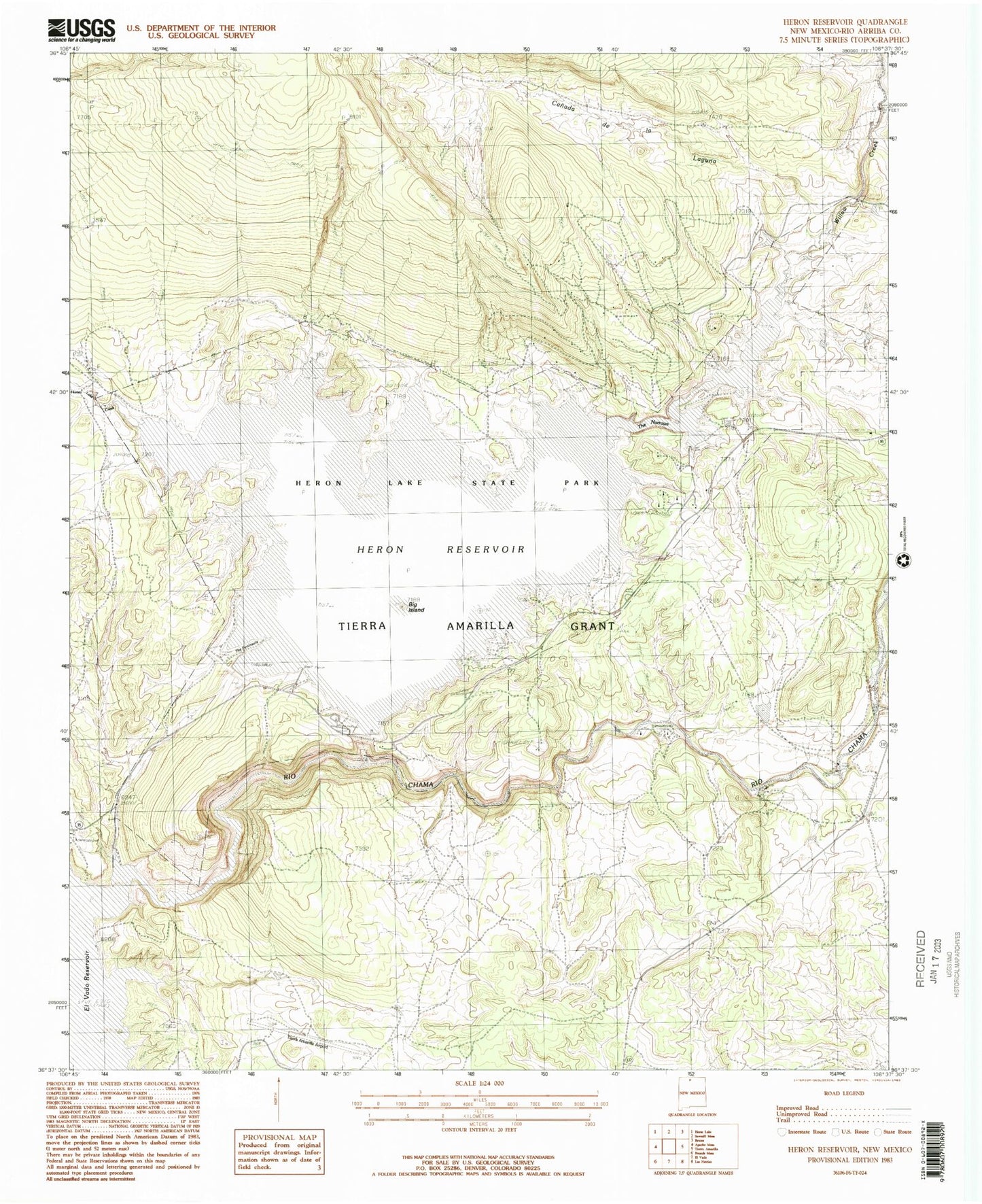
Historical USGS topographic quad map of Heron Reservoir in the state of New Mexico. Map scale may vary for some years, but is generally around 1:24,000. Print size is approximately 24" x 27"
This quadrangle is in the following counties: Rio Arriba.
The map contains contour lines, roads, rivers, towns, and lakes. Printed on high-quality waterproof paper with UV fade-resistant inks, and shipped rolled.
Contains the following named places: Canada de la Laguna, El Poso Ranch, El Vado State Park Airport, Heron Dam, Heron Dike, Heron Lake State Park, Heron Reservoir, Horse Lake Creek, Laguna Vista Estates Volunteer Fire Department, Rito de Tierra Amarilla, Willow Creek, ZIP Code: 87551