MyTopo
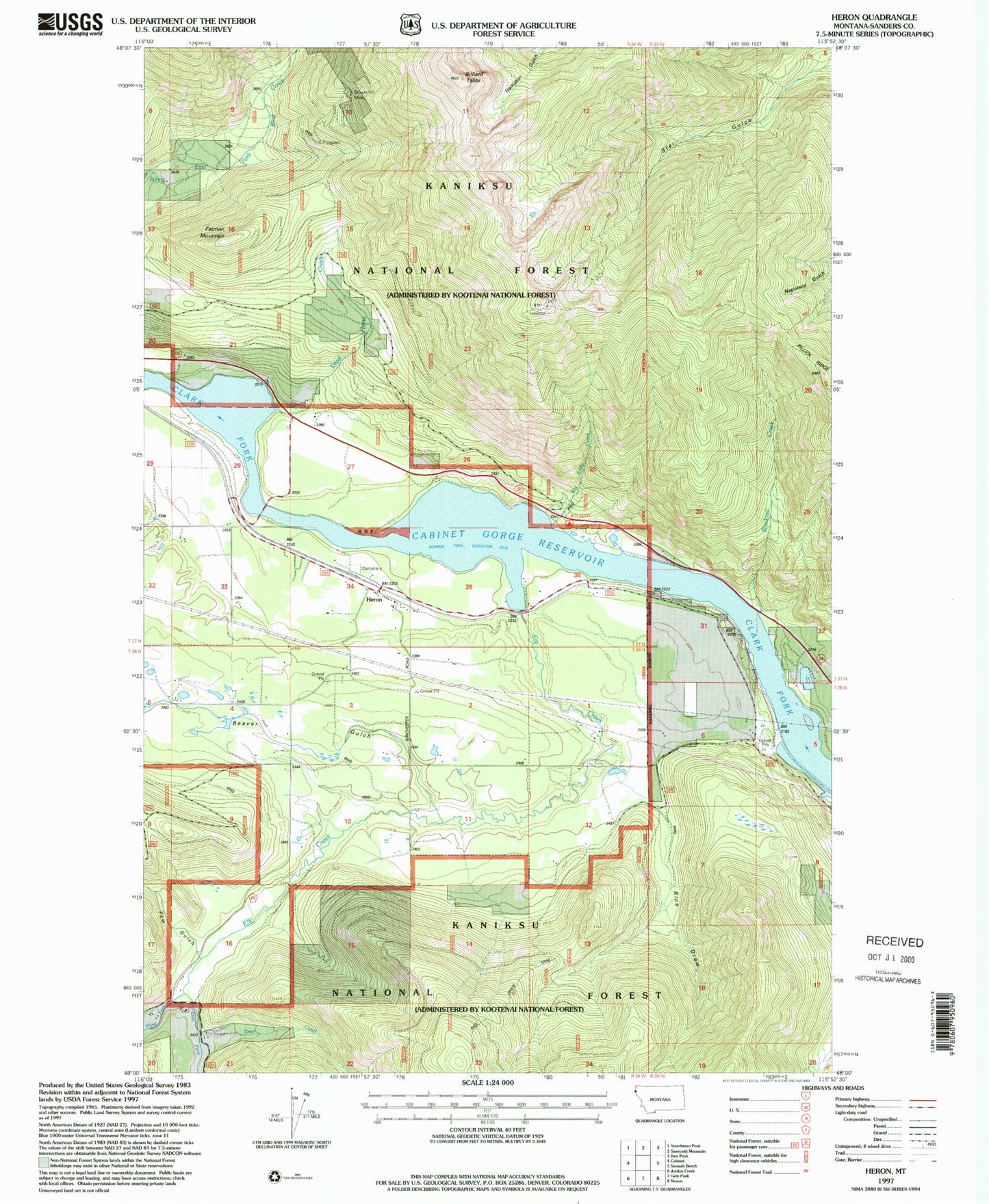
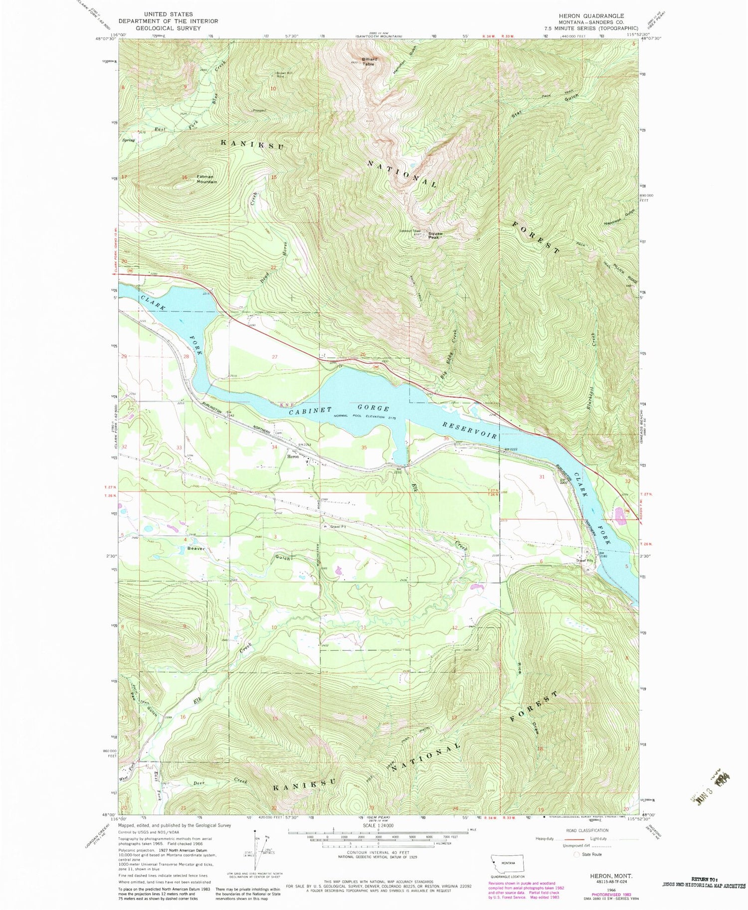
Classic USGS Heron Montana 7.5'x7.5' Topo Map
Couldn't load pickup availability
Historical USGS topographic quad map of Heron in the states of Montana, Idaho. Typical map scale is 1:24,000, but may vary for certain years, if available. Print size: 24" x 27"
This quadrangle is in the following counties: Sanders.
The map contains contour lines, roads, rivers, towns, and lakes. Printed on high-quality waterproof paper with UV fade-resistant inks, and shipped rolled.
Contains the following named places: Beaver Gulch, Big Eddy Creek, Billiard Table, Blacktail Creek, Brown Hill Mine, Cabinet Gorge Reservoir, Dead Horse Creek, Deer Creek, East Fork Elk Creek, Elk Creek, Fatman Mountain, Heron, Pew Gulch, Rice Draw, Rice Draw Trail, Star Peak, Star Peak Lookout Station, Broken Hill Mine, Fredrick and Wind Mine, Gopher Hole Mine, Red Fir/Amazon Mine, Blue Creek Mine, Lucky Star Mine, 26N34W03CDBC01 Well, 27N34W35DABA01 Well, 27N34W28DCDA01 Well, Heron Methodist Church (historical), Heron School (historical), First Baptist Church of Heron, Heron Community Clinic, Laurie Hill Library, Heron Cemetery, Heron, Heron Post Office, Caseys (historical), Russelville (historical), Proctor (historical), Knott (historical), Heron Census Designated Place, Heron Rural Fire District, West Fork Elk Creek