MyTopo
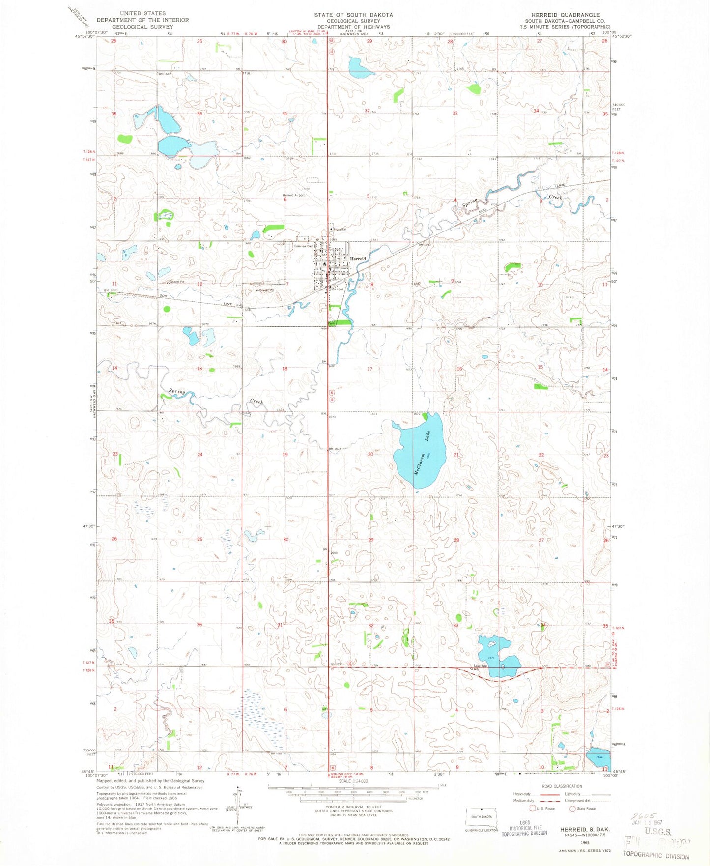
Classic USGS Herreid South Dakota 7.5'x7.5' Topo Map
Couldn't load pickup availability
Historical USGS topographic quad map of Herreid in the state of South Dakota. Map scale may vary for some years, but is generally around 1:24,000. Print size is approximately 24" x 27"
This quadrangle is in the following counties: Campbell.
The map contains contour lines, roads, rivers, towns, and lakes. Printed on high-quality waterproof paper with UV fade-resistant inks, and shipped rolled.
Contains the following named places: Campbell County, Campbell County Ambulance Service, City of Herreid, Fairview Cemetery, German Catholic Church, Herreid, Herreid City Hall, Herreid City Library, Herreid Elementary School, Herreid High School, Herreid Middle School, Herreid Municipal Airport, Herreid Post Office, Herreid Volunteer Fire Department, Lake Side School, McClarem Lake, Saint Michaels Catholic Cemetery, Township of Herreid, Township of McKinley, Unorganized Territory of North Campbell, ZIP Code: 57632