MyTopo
Classic USGS Herrera New Mexico 7.5'x7.5' Topo Map
Regular price
$16.95
Regular price
Sale price
$16.95
Unit price
per
Couldn't load pickup availability
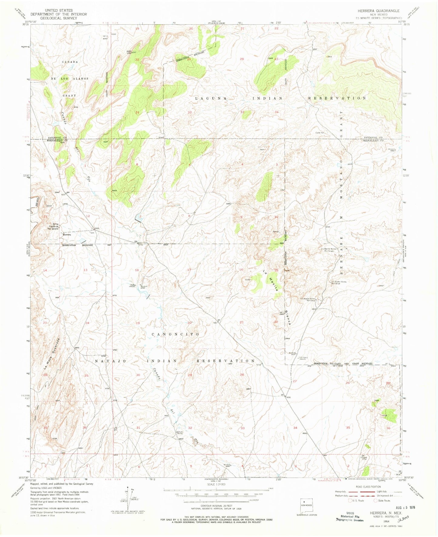
Historical USGS topographic quad map of Herrera in the state of New Mexico. Map scale may vary for some years, but is generally around 1:24,000. Print size is approximately 24" x 27"
This quadrangle is in the following counties: Bernalillo, Sandoval.
The map contains contour lines, roads, rivers, towns, and lakes. Printed on high-quality waterproof paper with UV fade-resistant inks, and shipped rolled.
Contains the following named places: Canada De Los Alamos Grant, Capilla de San Ignacio, Herrera, Herrera Post Office, La Mesa Quebrada, La Mesita Blanca, RWP10 Water Well, RWP-10 Water Well, RWP11 Water Well, RWP13 Water Well, RWP6 Water Well